












Suggested Searches

1 min read

Tropical Cyclone Grace

Instruments:
Tropical Cyclone Grace
March 22, 2004

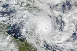
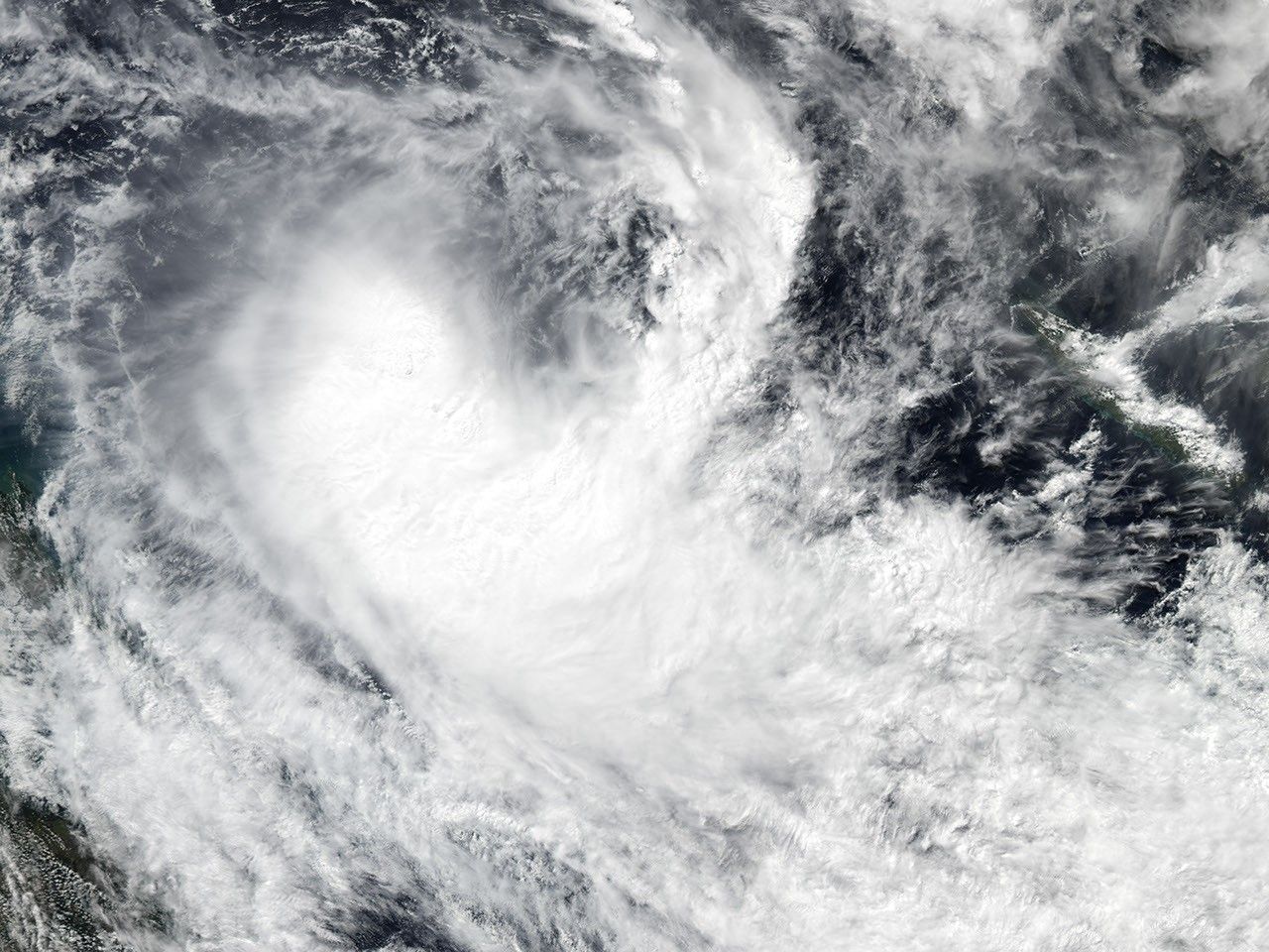
The MODIS instrument onboard NASA's Aqua spacecraft captured this true-color image of Tropical Cyclone Grace 500 miles east of Mackay and moving to the southeast. According to the Brisbane Weather Bureau, Graces's low pressure was acting alongside a high pressure system over Tasmania resulting in a steep pressure gradient causing gale force winds and high seas along the Queensland coast.

References & Resources

Image courtesy Jesse Allen, Earth Observatory Team at NASA GSFC.
You may also be interested in:

Stay up-to-date with the latest content from NASA as we explore the universe and discover more about our home planet.

Tropical Cyclone Narelle Crosses Australia
3 min read

The powerful storm lashed the northern edge of the continent with damaging winds and drenching rain as it made landfall…

Article
June 2026 Satellite Puzzler
2 min read

Your challenge is to tell us the location of the satellite image and why it is interesting.

Article
Tropical Storm Arthur
2 min read

The first named storm of the 2026 Atlantic hurricane season brought intense rainfall and the threat of flash flooding to…

Article