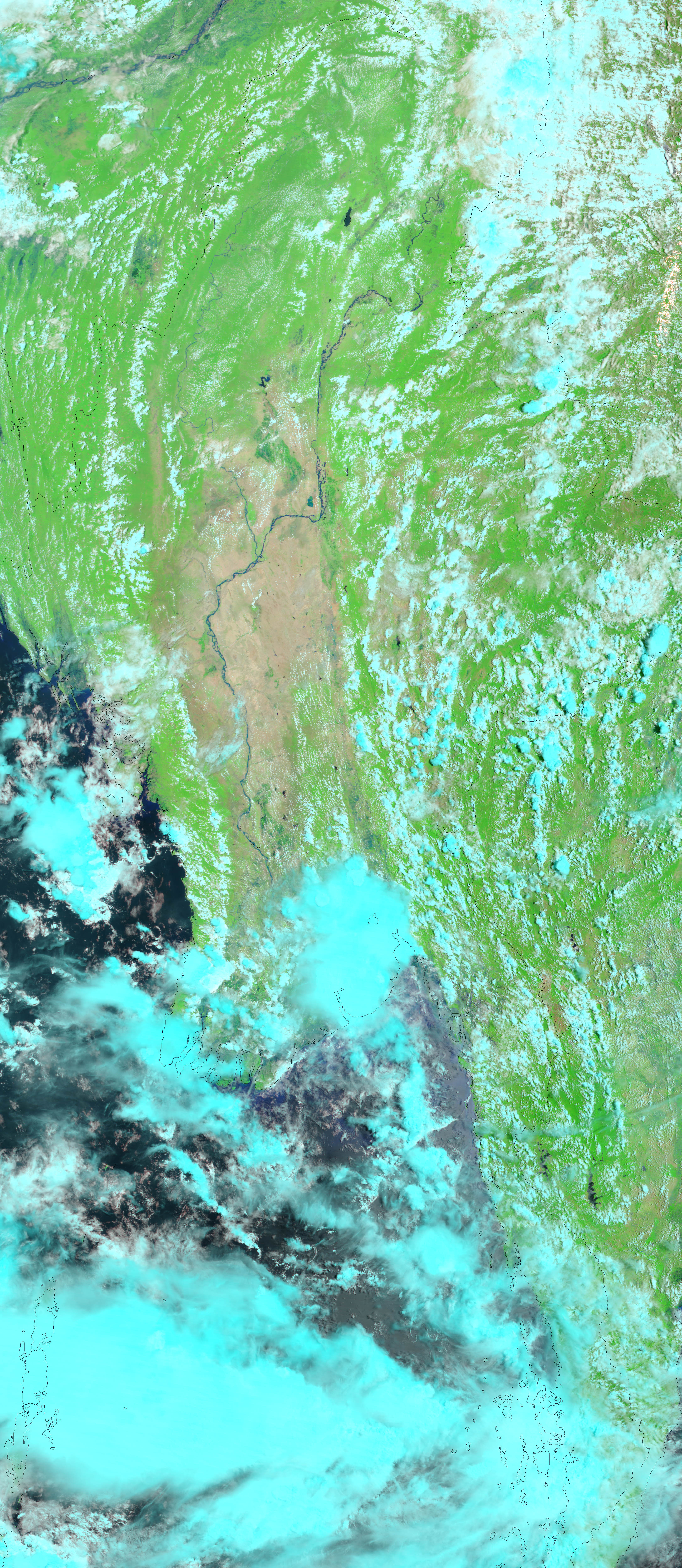
































- May 26, 2004 (3.8 Mb JPEG)
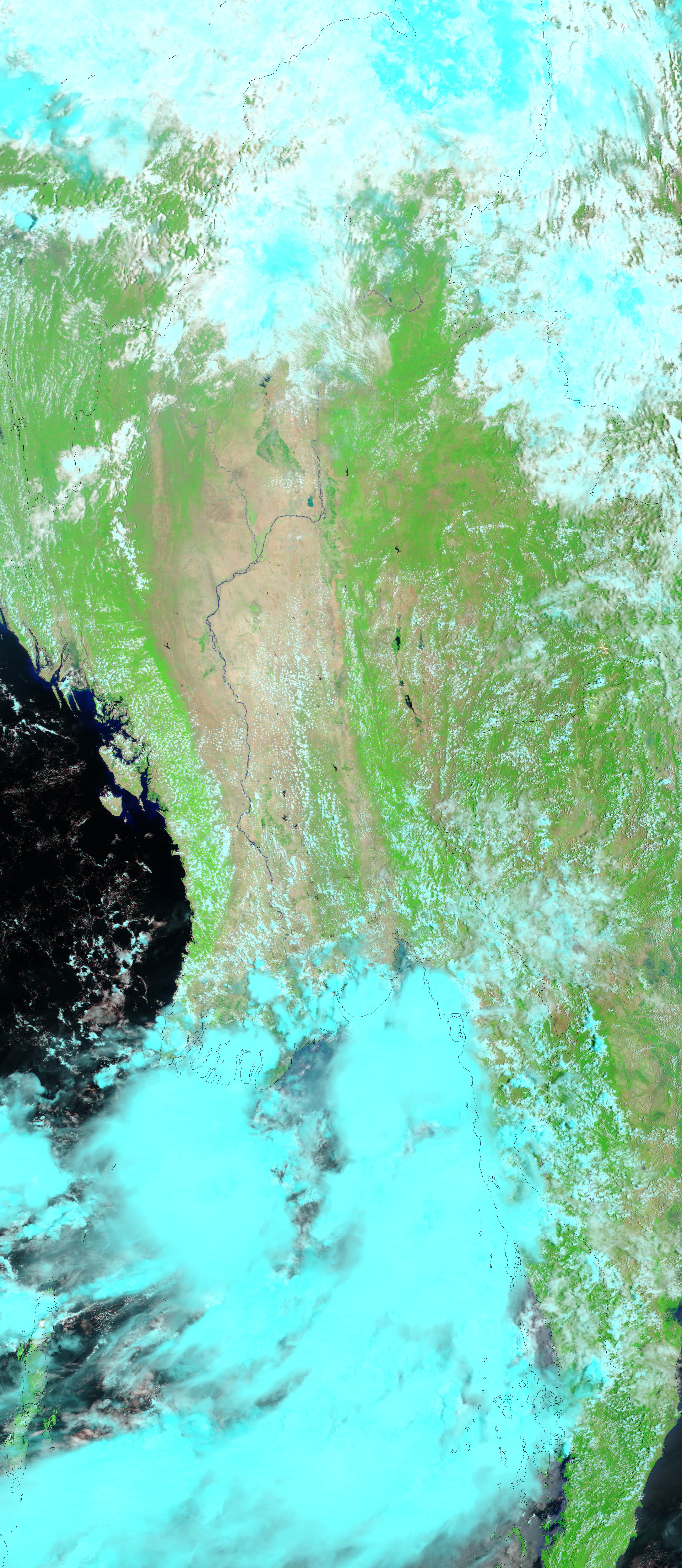
- May 10, 2004 (3.2 Mb JPEG)
On May 19, 2004, a tropical cyclone moved ashore over northern Myanmar bringing strong tidal surges and coastal flooding. As of June 4, the government estimated that 220 people had died and others are still missing. Over 18,000 were left homeless. On May 26, one week after the storm moved ashore, the Moderate Resolution Imaging Spectroradiometer (MODIS) on NASA’s Terra satellite detected ongoing flooding near the Bay of Bengal. In the false-color image, left, the flooded area is blue. By comparison, a MODIS image taken on May 10 shows dry land (tan pixels) where the blue flood waters are in the flooded scene. In both images, clouds are light blue.
References & Resources
NASA image courtesy Jesse Allen, based on data from the MODIS Rapid Response Team at Goddard Space Flight Center.