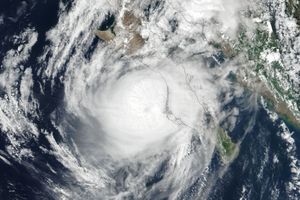
























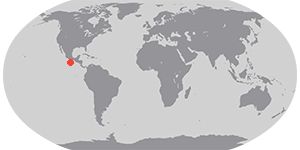

On June 24, 2010, the U.S. National Hurricane Center reported that Darby had strengthened to a hurricane. Located roughly 235 miles (375 kilometers) south-southwest of Puerto Escondido, Darby had maximum sustained winds of 75 miles (120 kilometers) per hour. The storm was headed to the west-northwest at roughly 9 miles (15 kilometers) per hour. Darby was headed away from land, and no coastal watches or warnings were in effect.
The Moderate Resolution Imaging Spectroradiometer (MODIS) on NASA’s Terra satellite captured this true-color image of Darby on June 23, 2010. The storm narrowly misses the southern coast of Mexico, but one spiral arm extends inland, not far from Puerto Escondido.
References & Resources
- National Hurricane Center. (2010, June 24). Hurricane Darby Public Advisory. Accessed June 24, 2010.
NASA image by Jeff Schmaltz, MODIS Rapid Response Team at NASA GSFC. Caption by Michon Scott.