- September 21, 2004 (3.3 Mb)
- July 5, 2004 (3.7 Mb)
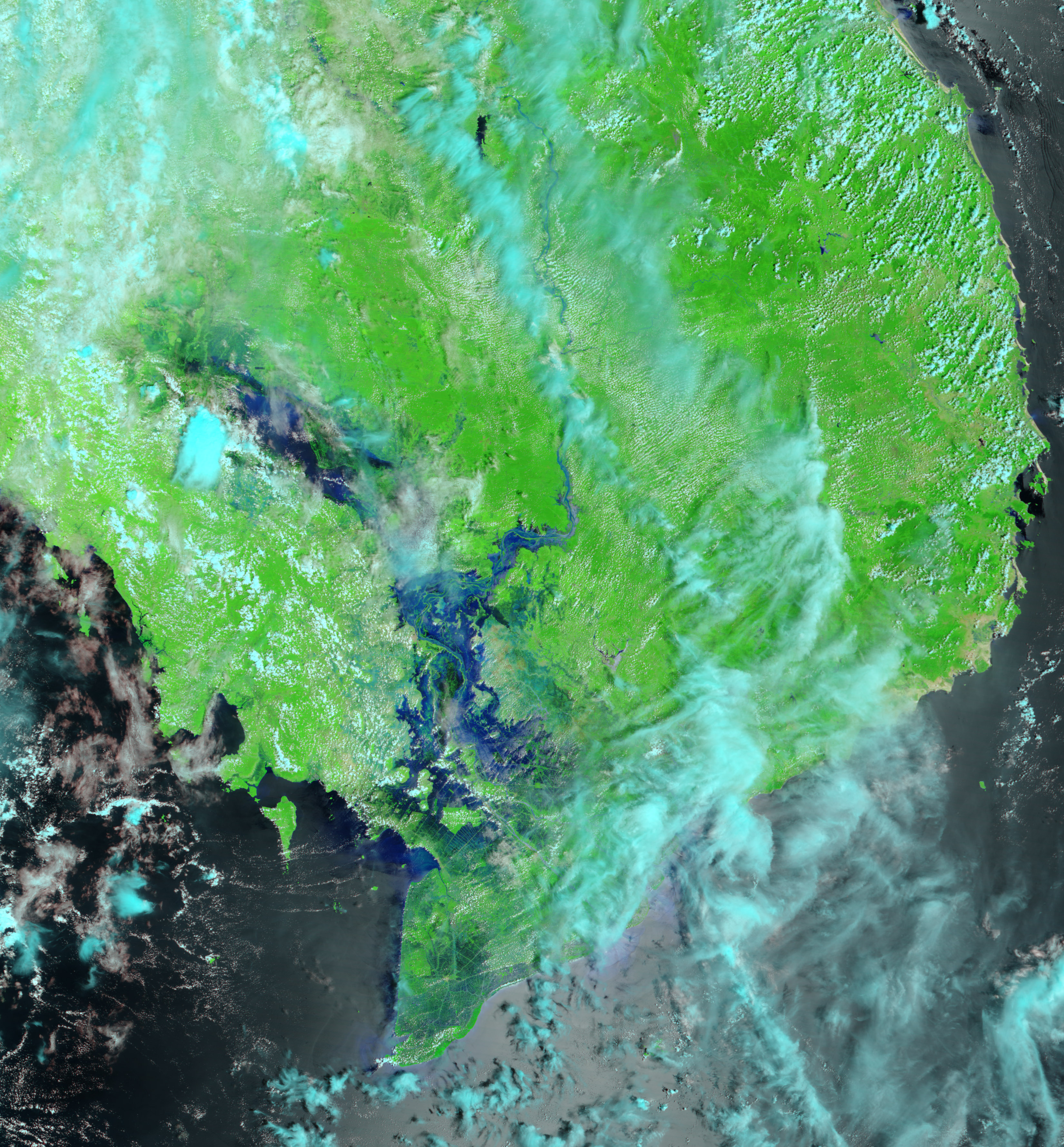
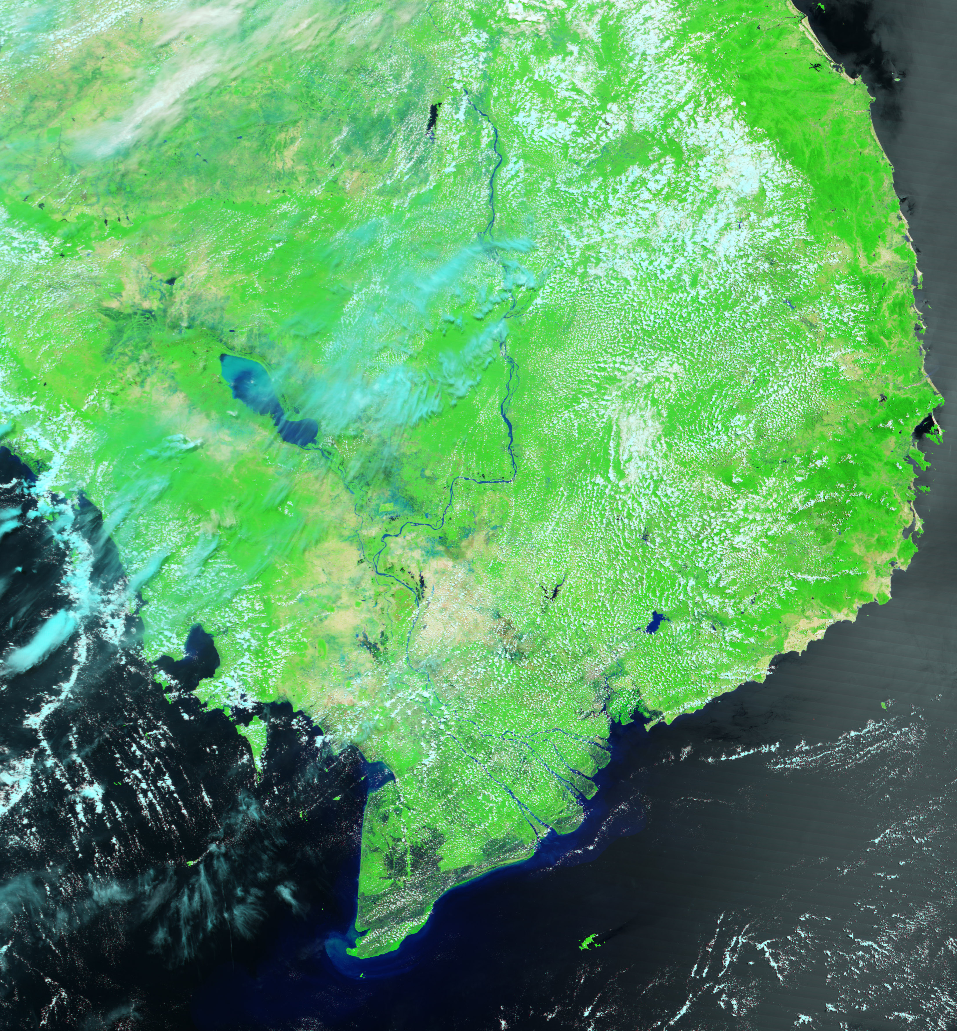
Flooding is a way of life along the lower Mekong River in Vietnam and Cambodia. Every year between August and November, monsoon rains fill the rivers of Southeast Asia, and the Mekong River Delta broadens well past its dry season levels. The annual floods carry nutrient-rich silt to farmland around the river and provide the moisture needed to grow vast fields of rice. Vietnam is the second largest exporter of rice in the world behind Thailand, and the Mekong River Delta is one of two primary rice-growing areas in the country. The second is the Red River Delta in the north.
The above false-color images contrast the Lower Mekong River at its flood stage and immediately before the monsoon rains started. Both images were acquired by the Moderate Resolution Imaging Spectroradiometer (MODIS). In false color, vegetation is bright green, water is blue and black, and clouds are light blue. The flood waters hide the river’s normal channel and even obscure the Tonle Sap, the vast lake seen in the pre-flood image.
References & Resources
NASA image created by Jesse Allen, Earth Observatory using data obtained from the MODIS Rapid Response team.