The southern part of Madagascar, the island nation off the southeast coast of Africa, is facing its worst drought in 40 years. The lack of rainfall and other environmental factors have taken a toll on the region’s vegetation and agricultural production, leaving many in the region facing severe hunger.
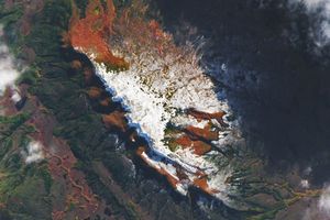
One way to detect healthy or stressed vegetation is with the Normalized Difference Vegetation Index (NDVI). The index, which uses data collected by the Moderate Resolution Imaging Spectroradiometer (MODIS) on NASA’s Terra satellite, provides a measure of the health of vegetation based on how much red and near-infrared light it reflects. Healthy vegetation with lots of chlorophyll reflects more near-infrared light and less visible light.
This map shows NDVI anomalies; that is, how the health or “greenness” of vegetation compared to the long-term average. The map compares the past year—July 25, 2020, to July 24, 2021—to the annual average from 2000–2015. Brown areas show where plants were more stressed than normal, and greens indicate vegetation that was healthier than normal.
Southern Madagascar is now in its fourth consecutive year of drought, which has “wiped out harvests and cut off access to food,” according to a United Nations news article. In a typical year, the rainy season lasts from November through March. But recent years have brought below-average rainfall during this period, drying up water used for the irrigation of agriculture. Over the past five years, southern Madagascar has had only one good harvest.
The persistent drought and devastation to farms has left more than a million people in southern Madagascar lacking reliable access to food. The Famine Early Warning Systems Network (FEWS NET) reported that much of the region is currently at crisis level for food insecurity (the third level on a five-level scale). Forecasters expect below-average rainfall from October through the end of 2021, which could elevate some areas, particularly around Ambovombe and Ampanihy, to emergency-level food insecurity (just below famine).
A phenomenon known locally as “tiomena” (red wind) is exacerbating the situation. Migrating sand dunes and windblown sand can blanket farmland, crops, forests, and infrastructure. According to the United Nations, a series of strong dust storms this year left some crops buried under sand.
References & Resources
- FEWS NET (2021, June) Without large-scale aid, area-level Emergency (IPC Phase 4) likely during 2021/22 lean season. Accessed July 30, 2021.
- Mongabay (2021, January 29) Dusty winds exacerbate looming famine in Madagascarâs deep south. Accessed July 30, 2021.
- NASA Applied Sciences (2019) Food Security from Space. Accessed July 30, 2021.
- TIME (2021, July 20) Climate, Not Conflict. Madagascarâs Famine is the First in Modern History to be Solely Caused by Global Warming. Accessed July 30, 2021.
- UN News (2021, July 26) Child malnutrition expected to quadruple in Southern Madagascar . Accessed July 30, 2021.
- UN News (2021, June 23) Madagascarâs hungry âholding on for dear lifeâ, WFP chief warns. Accessed July 30, 2021.
- UN World Food Programme (2021, July 8) Donât look the other way: Madagascar in the grip of drought and famine. Accessed July 30, 2021.
- The Washington Post (2021, July 1) Madagascar is headed toward a climate change-linked famine it did not create. Accessed July 30, 2021.
NASA Earth Observatory image by Lauren Dauphin, using MODIS data from NASA EOSDIS LANCE and GIBS/Worldview . Text by Kathryn Hansen .