August 31, 2021
Satellite Observes Power Outages in New Orleans
Three days after Hurricane Ida brought fierce wind, rain, and storm surges to Louisiana, large swaths of the state are enduring electric power blackouts due to downed lines and damaged transmission towers. According to news sources, many people are also going without access to running water and gasoline due to damaged infrastructure.
A team of scientists from NASA’s Goddard Space Flight Center and the Universities Space Research Association (USRA) has mapped the outages using satellite data. The images above show nighttime lights data acquired on August 9 and 31 by the Suomi NPP satellite. The base maps make use of data collected by the Landsat 8 satellite.
“The imagery is surprisingly cloud-free. It usually would take at least 48 hours for skies to clear up enough after an event like this,” added Miguel Román, a USRA scientist and leader of the Black Marble Project. “At this aftermath stage, Black Marble imagery is capturing a lot of diesel-power/backup generation, which utilities do not monitor.”
By the morning of September 1, 2021, more than 985,000 customers were reported without power in Louisiana according to data compiled by PowerOutage.US from publicly accessible sources. (The total counts homes and businesses, not people.) Another 33,000 customers were without power in Mississippi.
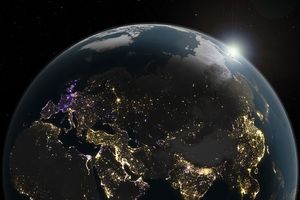
VIIRS has a low-light sensor—the day/night band—that measures light emissions and reflections. This capability has made it possible to distinguish the intensity, types, and sources of lights and to observe how they change. The data are then processed by the Black Marble team to account for changes in the landscape (such as flooding), the atmosphere, and the Moon phase, and to filter out stray light from sources that are not electric lights.
Precision is critical for studies with night lights. Raw, unprocessed images can be misleading because moonlight, clouds, pollution, seasonal vegetation—even the position of the satellite—can change how light is reflected and can distort observations.
References & Resources
- Associated Press (2021, September 1) Idaâs sweltering aftermath: No power, no water, no gasoline. Accessed September 1, 2021.
- NASA (2021) The Black Marble Project. Accessed September 1, 2021.
- NASA Earth Observatory (2021) Earth at Night.
- NASA Earth Observatory (2017, April 13) Night Light Maps Open Up New Applications.
- Nola.com (2021) 2021 Hurricane Season. Accessed September 1, 2021.
- Stokes, E.C., and K.C. Seto (2019) Characterizing urban infrastructural transitions for the Sustainable Development Goals using multi-temporal land, population, and nighttime light data. Remote Sensing of Environment, 234: 111430.
- Román, M.O., et al. (2019) Satellite-based assessment of electricity restoration efforts in Puerto Rico after Hurricane Maria. PLoS One, 14 (6).
- Román, M.O., et al. (2018) NASAâÂÂs Black Marble nighttime lights product suite. Remote Sensing of Environment, 210: 113â143.
NASA Earth Observatory images by Joshua Stevens , using Black Marble data courtesy of Ranjay Shrestha/NASA Goddard Space Flight Center and Landsat data from the U.S. Geological Survey . Story by Michael Carlowicz .