


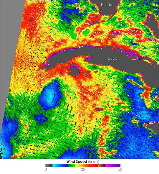
Tropical Storm Arlene spins off the southwestern tip of Cuba in this QuikSCAT image captured on June 9, 2005. The vibrant colors in this image depict relative wind speed, with the highest wind speeds in red. Although it is the first tropical cyclone of the 2005 Atlantic hurricane season, Arlene is not a powerful storm. Its strongest winds were maintained around 35 knots about the time this image was acquired. Arlene strengthened slightly the following day, but was not predicted to become an intense hurricane before making landfall.
The barbs indicate wind direction. The winds spiral around a calm center in a structure that is typical for a tropical storm, but the most powerful winds do not surround the center of the storm. Represented by red, these winds are north of the center.
References & Resources
NASA image courtesy the QuikSCAT Science Team at the Jet Propulsion Laboratory.


