
Cavum are among the most eye-catching cloud formations spotted by sky watchers. Seen from below, they can look like a large circle or ellipse has been cut neatly from a bank of cirrocumulus or atlocumulus clouds, with just feathery wisps of cloud left in middle of the hole.
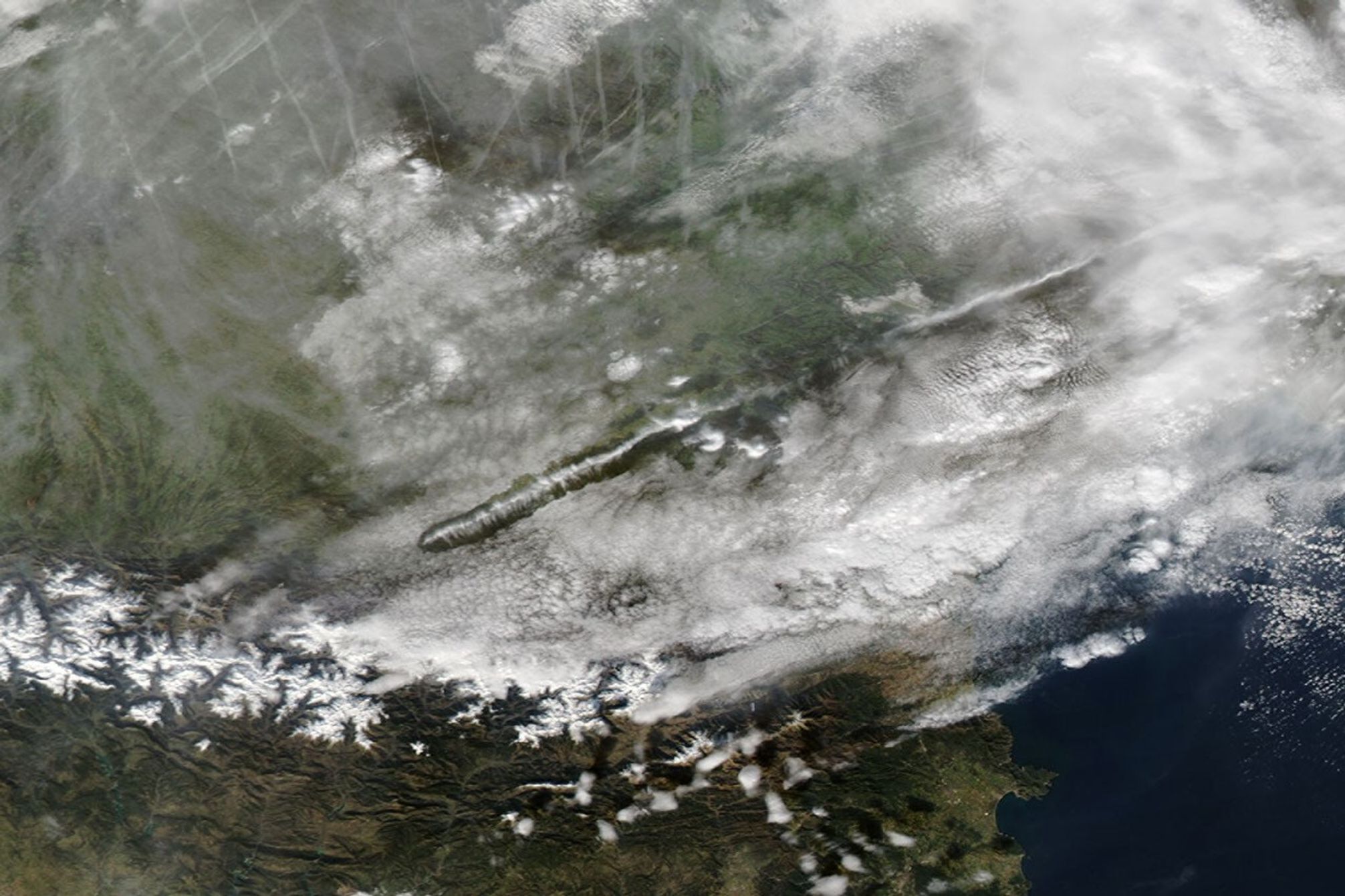
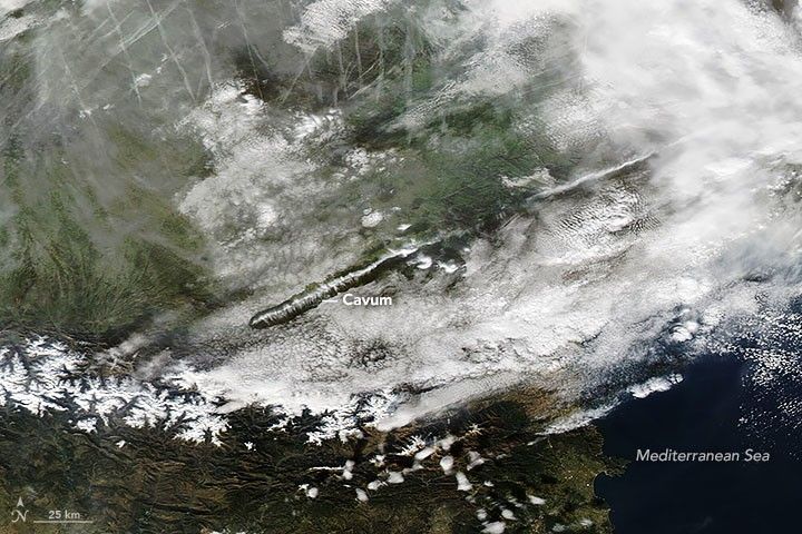
They are equally impressive when seen from above. This satellite image shows a lengthy cavum spanning part of southeastern France on January 14, 2023. The natural-color image was acquired by the Moderate Resolution Imaging Spectroradiometer (MODIS) on NASA’s Aqua satellite.
Cavum, also called hole-punch clouds and fallstreak clouds, are the result of cold air temperatures and atmospheric instability triggered by an aircraft moving through a layer of cloud. Viewed from below, it can appear as if part of the cloud is falling out of the sky. As it turns out, that is actually what is happening.
The phenomenon occurs in mid-level clouds composed of liquid water droplets that are super-cooled; that is, the droplets remain liquid even when temperatures are below the typical freezing point of water (32°F, or 0°C). But even super-cooled droplets have their limits. The additional cooling that occurs over the wings of aircraft, for example, can push the droplets to the point of freezing as an airplane passes through the cloud layer. Ice crystals beget more ice crystals as the liquid droplets continue to freeze. They eventually grow heavy enough that the ice crystals begin to fall out of the sky, leaving a void in the cloud layer.
The falling ice crystals are often visible in the center of the holes as wispy trails of precipitation—features called virga. When planes pass through clouds at a fairly sharp angle, they produce small, circular cavum. If they pass through the clouds at a shallow angle, they can produce long “canal clouds” with lengthy virga trails, as was the case for this cloud. Other factors that can affect the length of this cloud type include the thickness of the cloud layer, the air temperature, and the degree of horizontal wind shear.
References & Resources
- American Meteorological Society (2017, April 24) Cavum. Accessed January 17, 2023.
- Diedenhoven, B. via Twitter (2023, January 16) Some 200 km “punch hole” clouds.... Accessed January 17, 2023.
- Cloud Appreciation Society About Cavum. Accessed January 17, 2023.
- Earth Science Picture of the Day (2008, August 18) Feather Fall Streak Over Snowflake, Arizona. Accessed January 17, 2023.
- Heymsfield, A. et al. (2010) Aircraft-Induced Hole Punch and Canal Clouds. Bulletin of the American Meteorological Society, 91(6), 733-766.
- NASA Earth Observatory (2016, December 20) A Celebration of Clouds From Space, Earth Has an Elegant Atmosphere. Accessed January 17, 203.
- What’s This Cloud Cavum Cloud Feature: Fallstreak Hole, Hole Punch. Accessed January 17, 2023.
- World Meteorological Organization Cavum. Accessed January 17, 2023.
NASA Earth Observatory images by Adam Voiland , using MODIS data from NASA EOSDIS LANCE and GIBS/Worldview. Story by Adam Voiland.