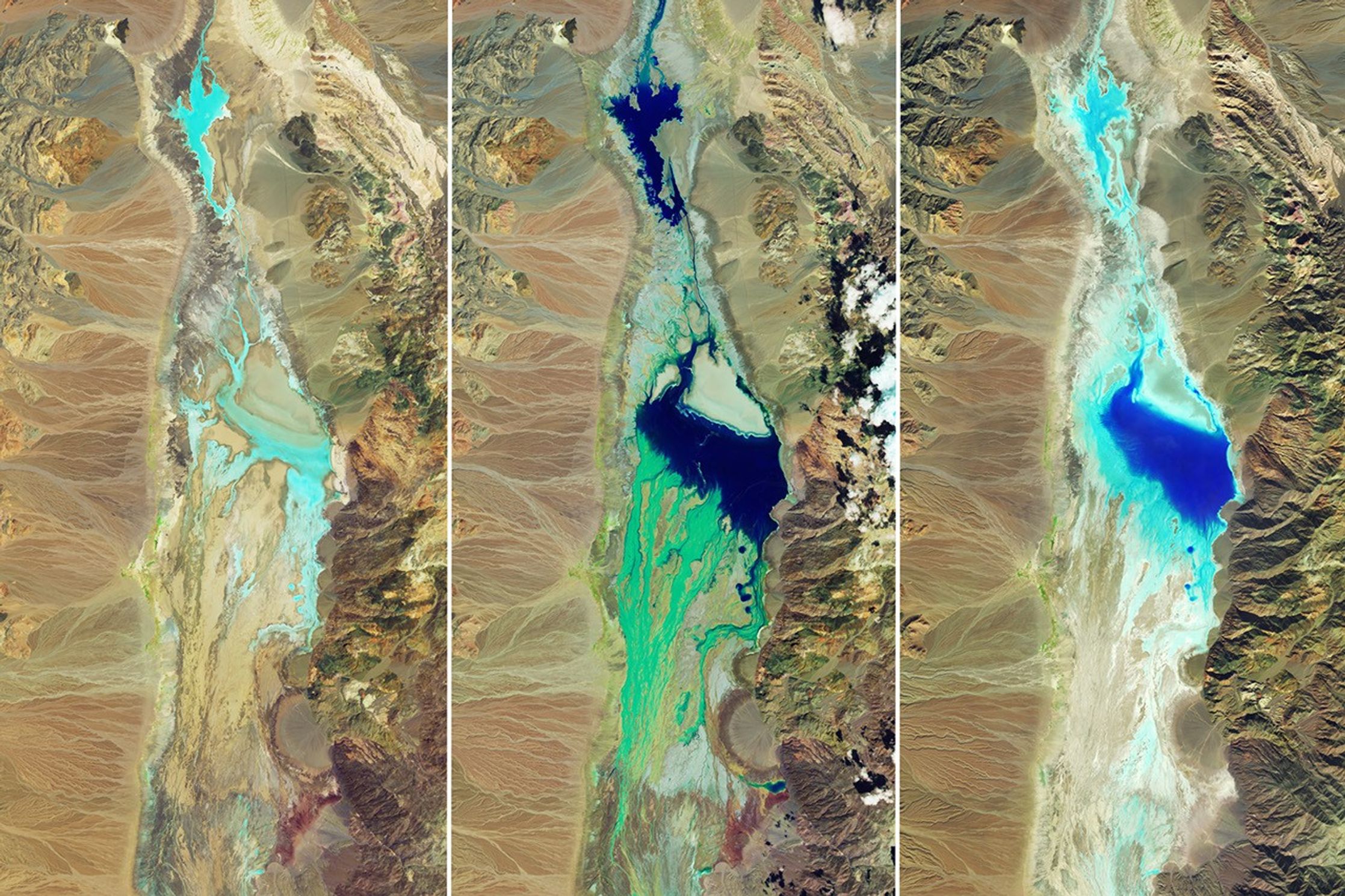
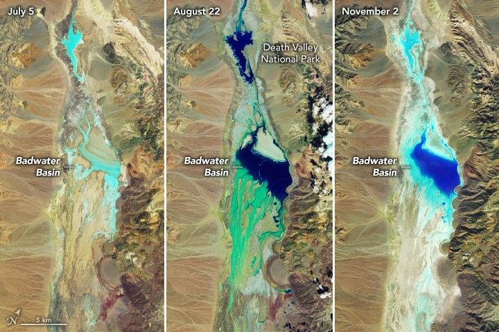
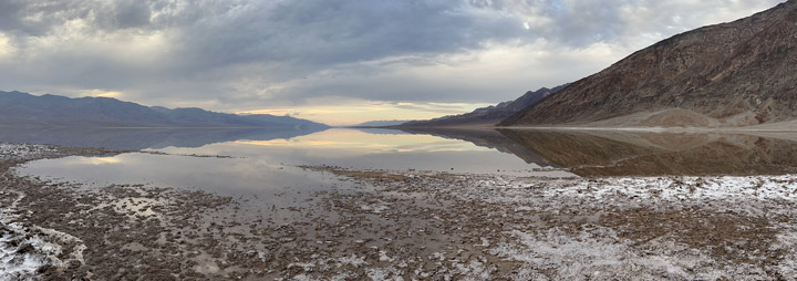
In August 2023, Hurricane Hilary made landfall in northern Mexico and soaked the Baja California peninsula, Southern California, and Nevada with rain. In California’s Death Valley, flash floods damaged roads and other infrastructure, causing the national park to close for nearly two months. When visitors returned in mid-October, they witnessed an infrequent sight in this notoriously hot and dry place: a shallow ephemeral lake stretching for miles in Badwater Basin.
This series of images reveals hydrologic changes in the desert basin relative to August’s heavy rain. The images are false color to emphasize the presence of water, which appears in shades of blue. On July 5, 2023 (left), the basin contains relatively little moisture prior to flooding. In contrast, the August 22 image (middle) shows the aftermath of a record-setting rainy day. Both were acquired by the OLI (Operational Land Imager) sensor on Landsat 8 using a band combination of 6-5-3.
On August 20, a weather station at Furnace Creek (north of this scene) recorded 2.2 inches (56 millimeters) of rain. The amount exceeds the area’s average annual rainfall total of 2.15 inches (55 millimeters), according to the National Park Service, and it breaks Death Valley’s previous single-day rainfall record of 1.7 inches (43 millimeters) set in August 2022.
The image from November 2 (right), acquired by the OLI-2 on Landsat 9, shows the extent of water present in the basin after more than two months. Around this time, national park officials said the lake measured approximately 2 miles by 4 miles (3 kilometers by 6 kilometers) and was only a couple inches deep. Observers on the ground reported springs flowing, bighorn sheep feeding on new greenery, and even some wildflowers blooming—a rarity outside of springtime.
Under more typical conditions, Badwater Basin is a vast and mostly dry salt flat—an expanse of approximately 200 square miles (520 square kilometers) lined with sodium chloride, calcite, gypsum, and borax. It is the lowest point in North America at 282 feet (86 meters) below sea level. The basin was once submerged by the much larger Lake Manly, one of several Great Basin lakes that existed during the cooler, wetter Pleistocene Epoch.
Today, it is uncommon but not unheard of for lakes to form in Badwater Basin. For example, storms and exceptionally rainy seasons filled in part of the basin in 2005, 2015, and 2019. There is no outflow from the basin, but evaporation rates far outpace precipitation rates, rendering the lakes ephemeral. While park officials cannot be sure, they speculate the current lake may dry up as soon as mid-November.
References & Resources
- NASA Earth Observatory (2023, August 22) Hilary Soaks the Southwest. Accessed November 8, 2023.
- National Park Service (2023) Badwater Basin. Accessed November 8, 2023.
- National Park Service (2023, August 23) Death Valley National Park remains closed, all visitors evacuated. Accessed November 8, 2023.
- NPR (2023, November 2) A stunning — but fleeting — lake has formed in California’s Death Valley. Accessed November 8, 2023.
NASA Earth Observatory images by Wanmei Liang , using Landsat data from the U.S. Geological Survey . Photograph by K. Bott/NPS. Story by Lindsey Doermann .