![Request for Information – Potential [Placeholder for Prize]](https://assets.science.nasa.gov/dynamicimage/assets/science/missions/a-step/FFR_Earth_Background_20251120%20.png?w=1024)


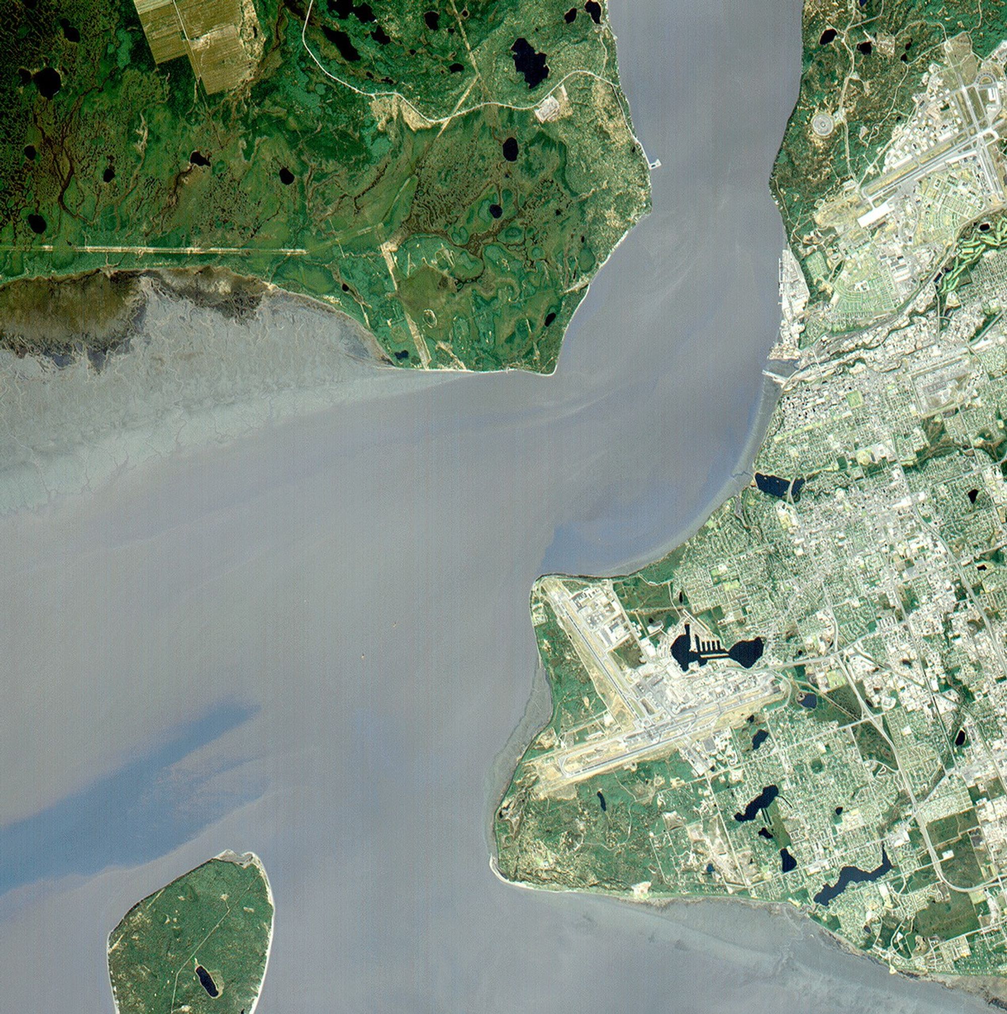
Anchorage and Cook Inlet, Alaska, are seen in this 30 by 30 km (19 by 19 miles) sub-image, acquired May 12, 2000, by the Advanced Spaceborne Thermal Emission and Reflection Radiometer (ASTER). Orbiting at an altitude of 705 km (430 miles) on board NASA’s Terra satellite, ASTER provides data at a resolution of 15 m (47 feet) and allows creation of this simulated natural color image.
There are dark green coniferous forests in the northwest (upper left) part of the image. Scanning eastward across the Knik Arm is Elmendorf Air Force Base in the upper right corner. A golf course, with its lush green fairways, is just south of the Air Force Base.
At the center of the image is the Ted Stevens Anchorage International Airport. Just south of the airport is Kincaid/Point Campbell Park. Due west of the park and across the Turnagain Arm, Fire Island sits in the lower lefthand corner of this scene.
ASTER is the only high-resolution imaging sensor on Terra. The primary goal of the ASTER mission is to obtain high-resolution image data in 14 channels over the Earth's entire land surface, as well as black and white stereo images. With revisit times of between 4 and 16 days, ASTER provides the capability for repeat coverage of changing areas on Earth’s surface.
The broad spectral coverage and high spectral resolution of ASTER provides scientists in numerous disciplines with critical information for surface mapping and monitoring dynamic conditions and temporal change. Examples of applications include monitoring glacial advances and retreats, potentially active volcanoes, thermal pollution, and coral reef degradation; identifying crop stress; determining cloud morphology and physical properties; evaluating wetlands; mapping surface temperature of soils and geology; and measuring surface heat balance.
References & Resources
Image courtesy NASA/GSFC/MITI/ERSDAC/JAROS, and U.S./Japan ASTER Science Team