


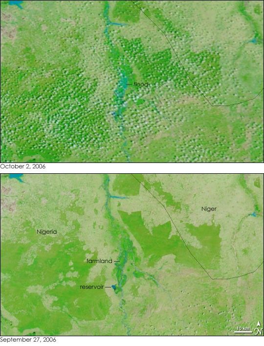
- October 2, 2006 (1.18 MB)
- September 27, 2006 (1.08 MB)
Wet-season rains triggered floods across Africa’s Sahel in August and September 2006. On September 30, a downpour overwhelmed a dam in northwest Nigeria, causing the floods seen in the top image. The deluge of water flowing from the burst dam flooded farmland and villages around the regional capital, Gusau. According to a United Nations report, the floods washed away 500 houses. As of October 2, more than 98 people were missing, but none were confirmed dead, said the UN.
The Moderate Resolution Imaging Spectroradiometer (MODIS) on NASA’s Terra satellite captured the top image of the flood on October 2, 2006. In this image, made with both infrared and visible light, blue flood water bulges in the river flowing south to north. Though partly hidden by a scattering of popcorn-like clouds, the floods are covering what had been bright green farmland a few days earlier (lower image). Clouds also obscure the reservoir, making it difficult to tell how much water drained through the dam.
Daily images of Nigeria are available from the MODIS Rapid Response Team.
References & Resources
NASA image courtesy the MODIS Rapid Response Team at NASA GSFC.


