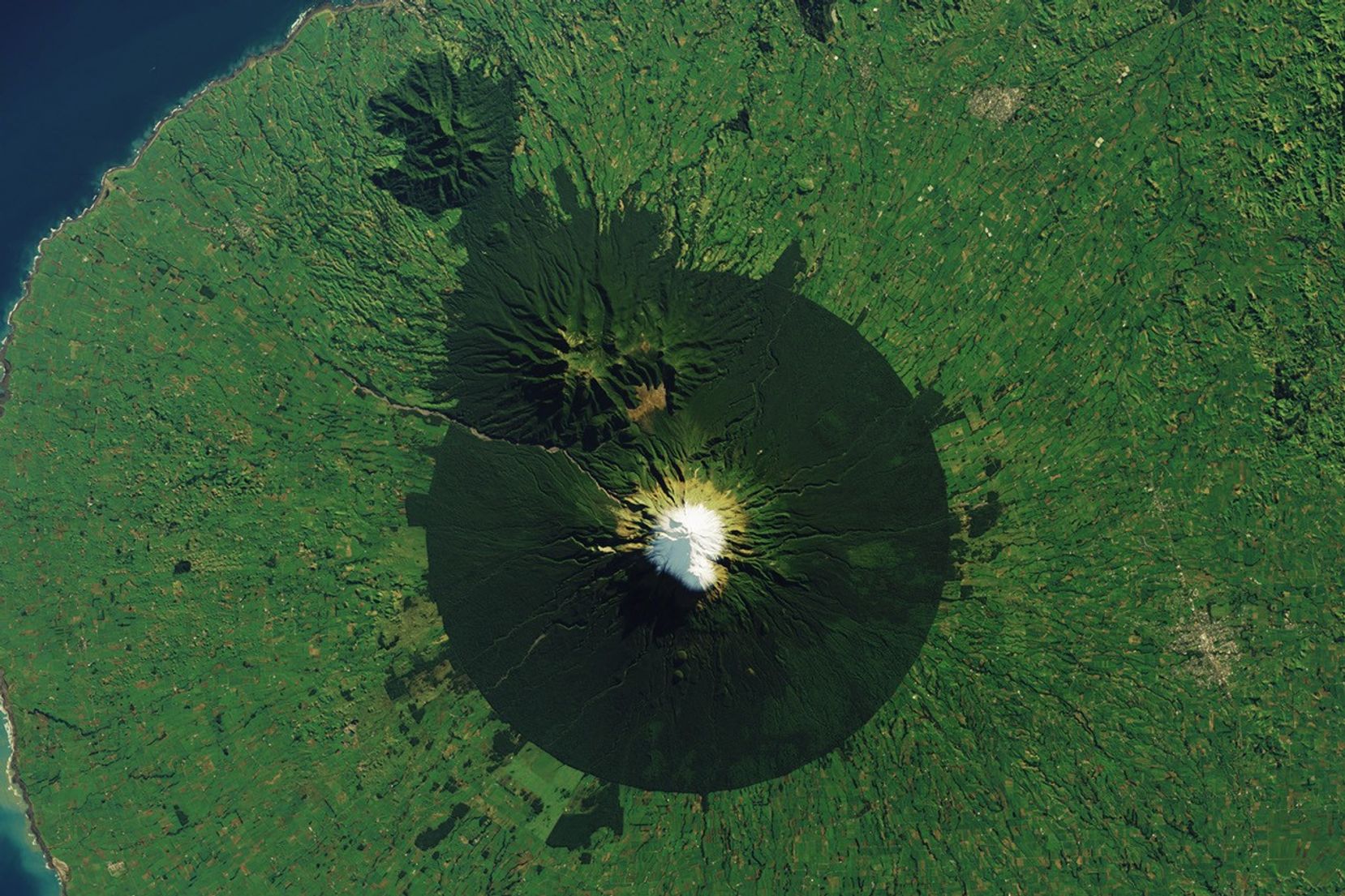


On New Zealand’s North Island, a conical snow-capped volcano ringed by dark green forest rises above dairy pasture. The often-snowcapped peak of Mount Taranaki (dubbed Mount Egmont by Captain Cook) is the centerpiece of Egmont National Park. A circular piece of land—with a 9.6-kilometer (6-mile) radius from the volcano’s summit—was first formally protected as a forest reserve in 1881. With some subsequent additions, it became New Zealand’s second national park in 1900.
The OLI (Operational Land Imager) on Landsat 8 acquired this image of Mount Taranaki in June 2023. Two older and extinct volcanoes, Kaitake and Pouakai, lie to the northwest of its peak. At 2,518 meters (8,261 feet) tall, Taranaki is the second-highest peak on New Zealand’s North Island after Ruapehu.
At the widest part of the ring around the mountain, forests of rimu and kāmahi, tall evergreen trees native to New Zealand, dominate. Stands of kāmahi have also found a niche at higher elevations in what’s known as the “Goblin Forest.” Here, they grow gnarled and twisted around trees that have been destroyed in volcanic eruptions. Moving higher, forests give way to progressively smaller bands of subalpine and alpine habitat.
Despite its neat appearance from above, the volcano has a history of dramatic change. By one count, the mountain’s edifice has collapsed and rebuilt 16 times, with each cycle sending large debris avalanches down its flanks. Steep slopes, loose sediments, high rainfall rates, and buried faults all contribute to its tendency to collapse. Avalanche deposits have accumulated to form the peninsula on which the mountain sits, and debris has even been found to extend up to 8 kilometers (5 miles) offshore.
Mount Taranaki’s last volcanic eruption was over 200 years ago, and scientists give it a 30 to 50 percent chance of erupting in the next 50 years. Hazards such as mudflows, or lahars, are still present and have occurred occasionally in the past several decades. A present-day eruption could have serious and costly consequences, researchers say, as the region is home to more than 110,000 people and economic activities such as farming, manufacturing, and energy production.
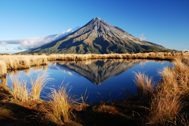
Despite its inherent threats, the towering, symmetrical cone has become iconic in New Zealand culture. It has served not only as an inspiration for artwork but also as a symbol depicted on product labels, postage stamps, and even the country’s currency. In 2017, the mountain attained a new level of protection when it was granted the same legal rights as a person, according to news reports. The status is an acknowledgment of the Indigenous Māori people’s relationship to the mountain and means that harming the mountain has the same legal implications as harming the tribe.
References & Resources
- Cronin, S.J., et al., (2021) The geological history and hazards of a long-lived stratovolcano, Mt. Taranaki, New Zealand. New Zealand Journal of Geology and Geophysics, 64(2–3), 456–478.
- Davies, R.B., and Lambert, R.E. (2015) Under the Mountain - how a volcanic peak has influenced the culture, ecology and landscape history of Taranaki, New Zealand. International Federation of Landscape Architects Asia Pacific Congress (Ed.), Lombok, Indonesia (pp.107 - 117).
- The Guardian (2017, December 22) New Zealand gives Mount Taranaki same legal rights as a person. Accessed September 16, 2024.
- New Zealand Department of Conservation Egmont National Park. Accessed September 16, 2024.
- Smithsonian Institution Global Volcanism Program Taranaki. Accessed September 16, 2024.
- Taranaki Emergency Management Volcanic Activity. Accessed September 16, 2024.
NASA Earth Observatory image by Wanmei Liang , using Landsat data from the U.S. Geological Survey . Photo by Kathrin & Stefan Marks, used under the Creative Commons Attribution-Noncommercial-Noderivs 2.0 Generic . Story by Lindsey Doermann .