.png?w=1024)


September 4-20, 2024
Rivers in Europe Burst Their Banks
A slow-moving storm triggered days of intense rainfall across central and eastern Europe in September 2024. The deluge submerged entire neighborhoods and forced tens of thousands to evacuate flooded towns and cities.
Between September 11 and 18, a low-pressure storm system battered parts of Austria, Poland, Slovakia, and the Czech Republic (Czechia) with torrential rainfall. The storm formed when a wave of cold Arctic air plunged into southern Europe and met with warm, moist air from the Mediterranean. The low-pressure system became cut off from the prevailing jet stream (known as a cut-off low), allowing it to linger in the region for several days.
Named Storm Boris by the UK Met Office, the system hit hardest in the Czech Republic and Austria, which in one week saw up to three times the amount of rainfall typical for the entire month of September, according to the European Centre for Medium-Range Weather Forecasts. In eastern Austria, near Vienna, 215 millimeters (8.5 inches) of rain fell during that week. All of this rainfall, however, had consequences beyond the hardest-hit areas.
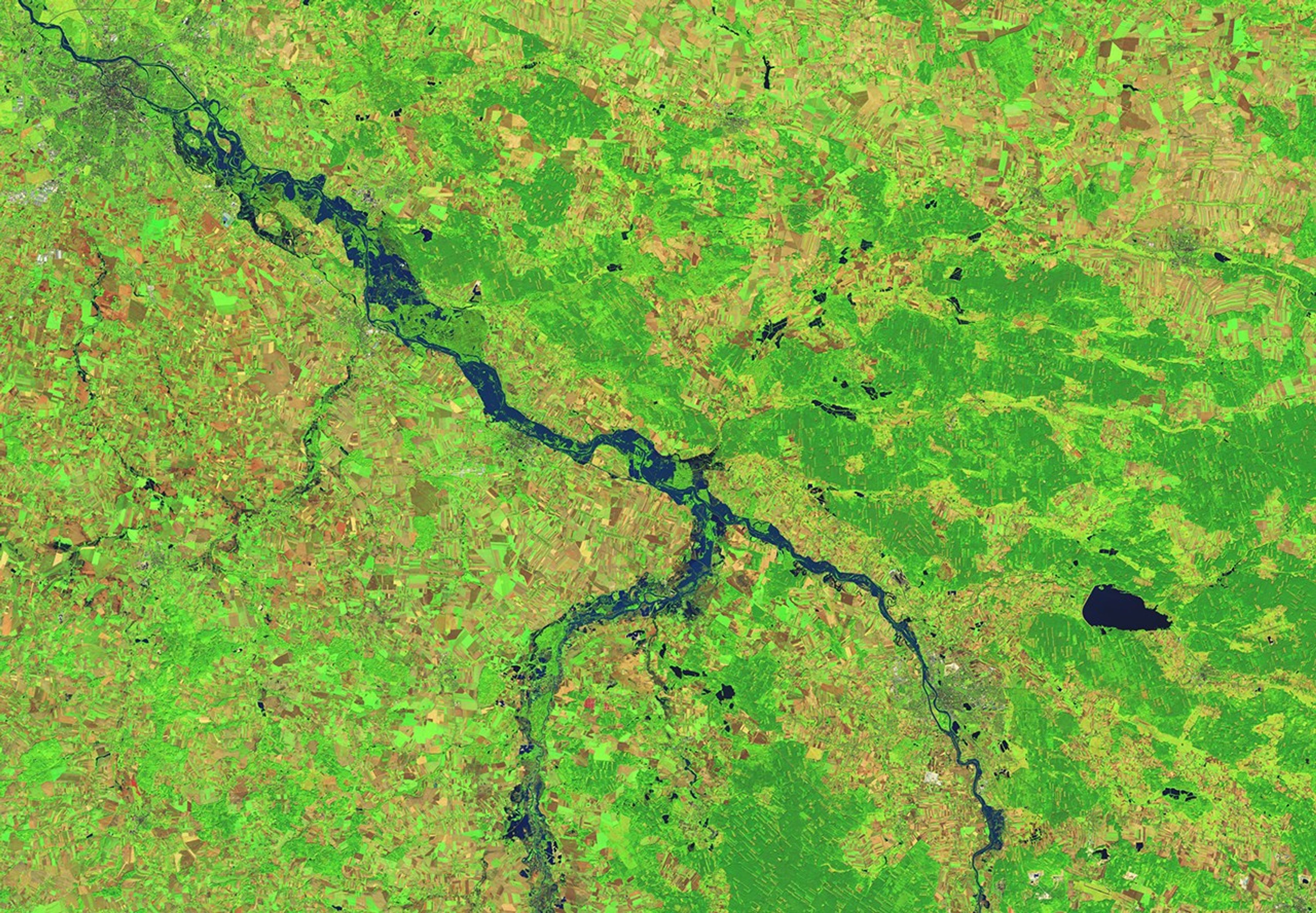
On September 18, water levels along the Oder River in southeastern Poland surpassed the highest alert category set by the country’s institute of meteorology. The river originates in the Oder Mountains in the Czech Republic and runs north through Poland to Germany. Water overtopped the banks of the river near Wrocław and flooded the surrounding farmland, visible in the image above (right), acquired on September 20, 2024. The image on the left shows the same region on September 4, before the storm. Both images were acquired by the OLI (Operational Land Imager) on Landsat 8 and are false color to emphasize the presence of water (dark blue).
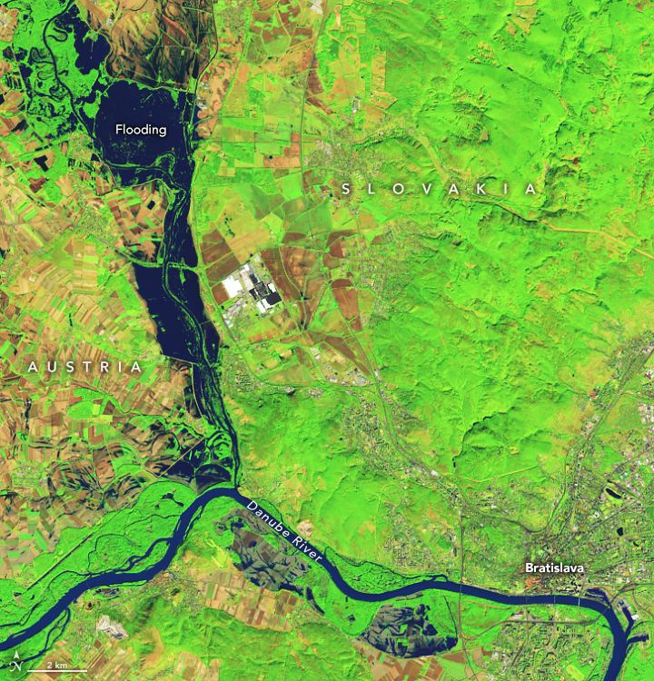
The Danube River overtopped its banks in Slovakia, sending floodwaters into the capital, Bratislava. The false-color image below, acquired by the OLI-2 on Landsat 9, shows inundated areas along the Danube on September 21. According to news reports, the relentless rain forced dozens of people from their homes.
In Poland’s mountain town of Stronie Slaskie, near the border with the Czech Republic, a dam burst and caused deadly flooding. As of September 20, flooding across central and eastern Europe and into Italy has contributed to the displacement of over 25,000 people, according to the European Union.
References & Resources
- BBC (2024, September 22) Polish city urged to evacuate as floods batter central Europe. Accessed September 23, 2024.
- Deutsche Welle (2024, September 18) Slovakia’s capital hit by biggest floods in 30 years. Accessed September 23, 2024.
- Duncan, Scott, via X (2024, September 15) Flooding disaster unfolding right now in Central Europe. Why is it so bad? Accessed September 23, 2024.
- European Union (2024, September 20) Emergency Response Coordination Centre (ERCC) — DG ECHO Daily Map. Accessed September 23, 2024.
- European Union, Copernicus Emergency Management Service (2024, September 23) Flood in South West Poland. EMSR756 — Situational reporting. Accessed September 23, 2024.
- Reuters (2024, September 21) Residents of Polish town hit by flood hope to make homes liveable by winter. Accessed September 23, 2024.
- Yale Climate Connections (2024, September 18) Epic floods are wreaking havoc from Africa to Asia to Europe. Accessed September 23, 2024.
NASA Earth Observatory images by Michala Garrison, using Landsat data from the U.S. Geological Survey . Story by Emily Cassidy .