


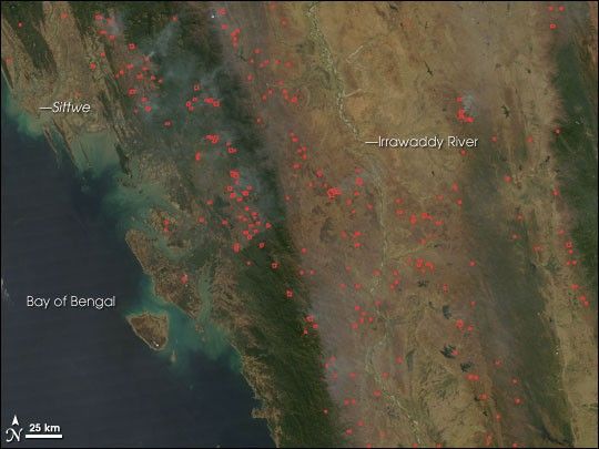
Numerous fires were burning in Myanmar on March 2, 2007, when the Moderate Resolution Imaging Spectroradiometer (MODIS) on NASA’s Aqua satellite passed overhead and captured this image. Locations where the sensor detected active fires are outlined in red. Fires dot the area from the thickly forested Arakan Mountains (along the coast), inland across the Irrawaddy River plain, to the Pegu Mountains in the east (lighter green). Fires, both agricultural and accidental forest fires, are common at this time of year in Myanmar and throughout Southeast Asia.
The large image provided above has a spatial resolution (level of detail) of 250 meters per pixel. The MODIS Rapid Response Team provides twice-daily images of the region in additional resolutions.
References & Resources
NASA image courtesy the MODIS Rapid Response Team, Goddard Space Flight Center


