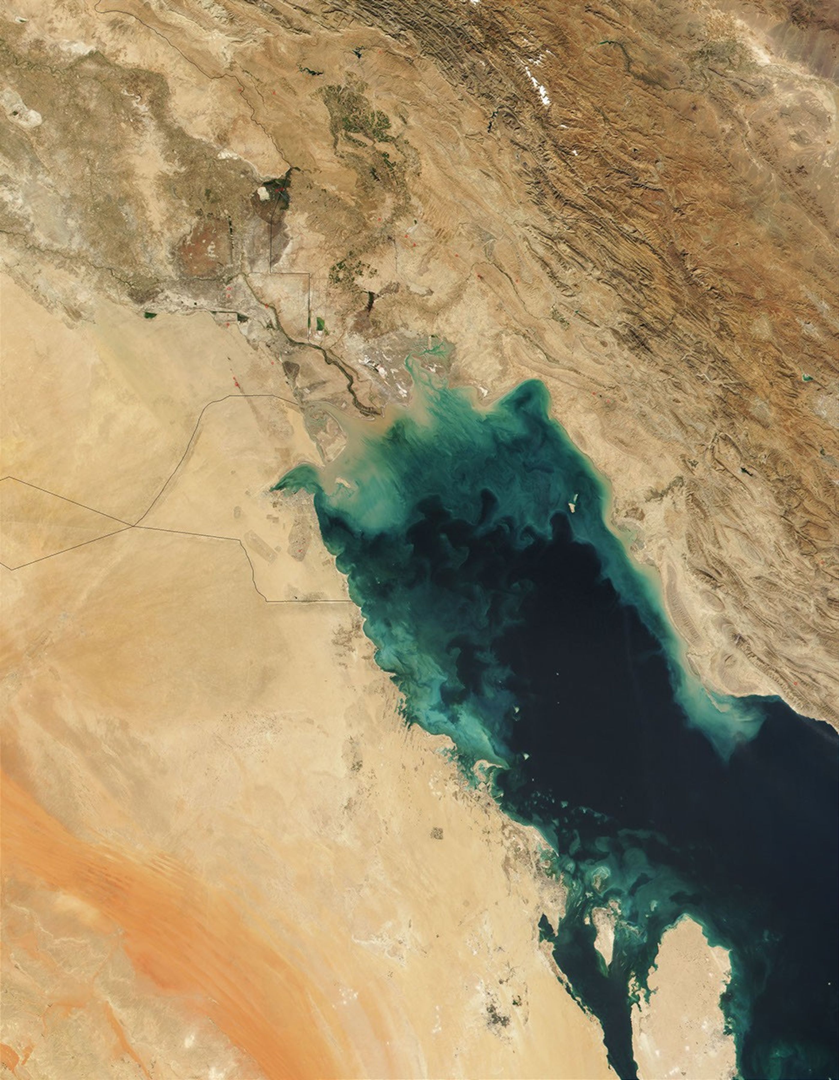
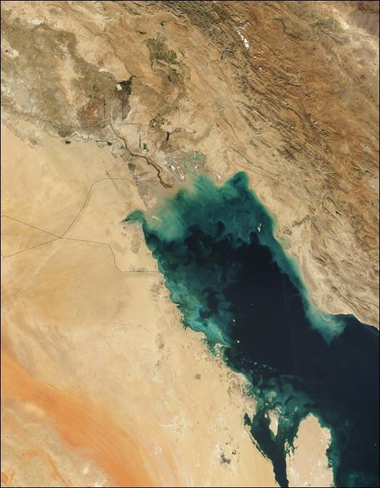
There is a large amount of sediment clearly visible in the true-colorimage of the Persian Gulf, acquired on November 1, 2001, by theModerate-resolution Imaging Spectroradiometer (MODIS). Carried by theconfluence of the Tigris and Euphrates Rivers (at center), thesediment-laden waters appear light brown where they enter the northernend of the Persian Gulf and then gradually dissipate into turquoiseswirls as they drift southward. The nutrients these sediments carry arehelping to support a phytoplankton bloom in the region, which adds somedarker green hues in the rich kaleidoscope of colors on the surface (seethe high resolution image).
The confluence of the Tigris and Euphrates Rivers marks thesouthernmost boundary between Iran (upper right) and Iraq (upper left).South of Iraq are the countries of Kuwait and Saudi Arabia. The red dotsindicate the probable locations of fires burning at oil refineries.Thin black plumes of smoke can be seen streaming away from several ofthese.
References & Resources
Image courtesy Jacques Descloitres, MODIS Land Rapid Response Team at NASA GSFC