large images
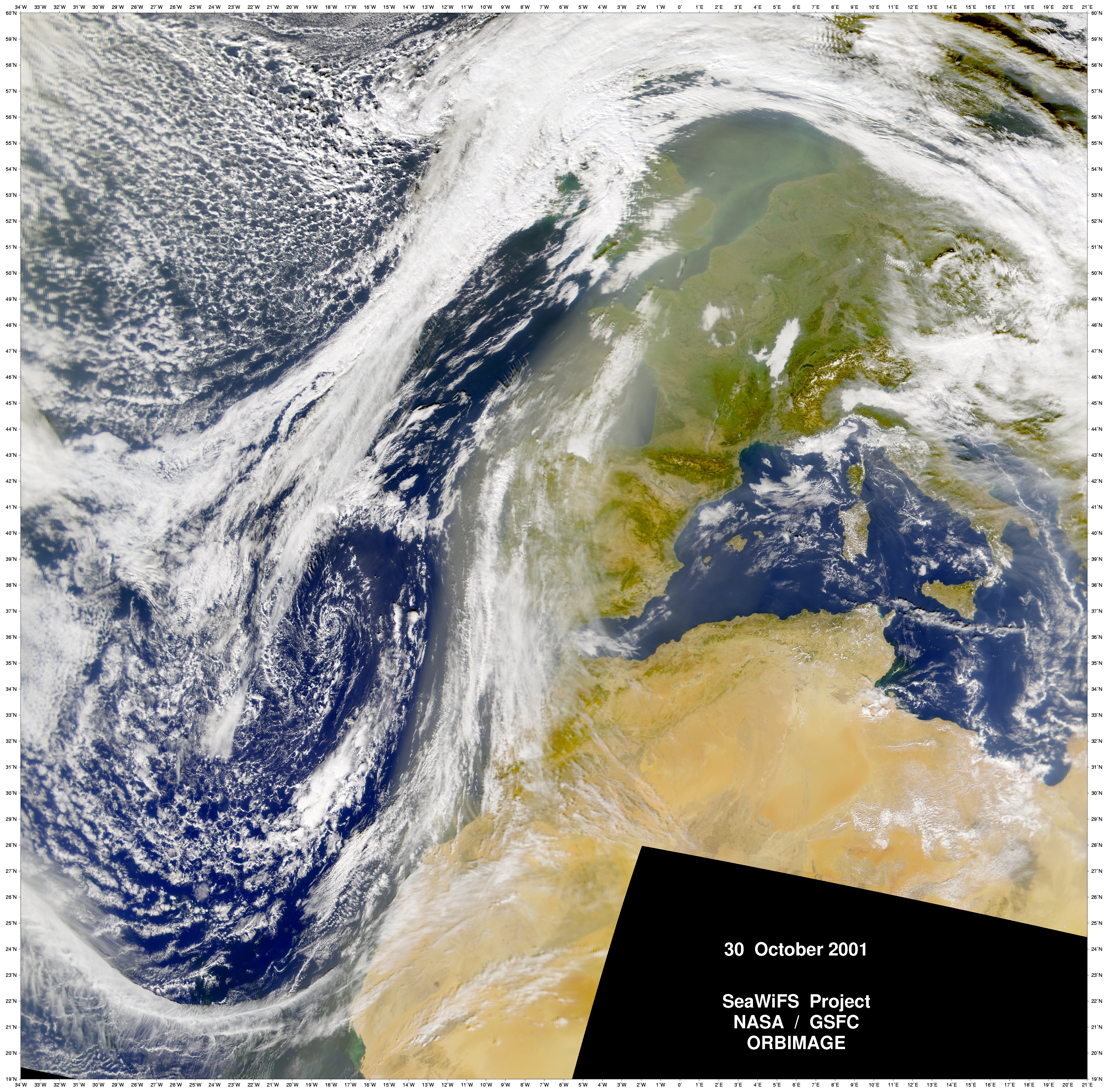
True Color SeaWiFS Image (3.4 MB JPG)
Modelled Dust Transport (36KB PDF)
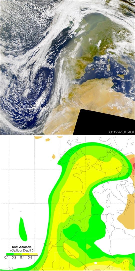
On Tuesday, October 30, 2001, the skies over western Europe were full of dust from Africa, as can be seen in this Sea-viewing Wide Field-of-view Sensor (SeaWiFS) true-color image (top). Persistent strong winds lifted the dust northward from the Sahara Desert, over the countries of Algeria, Mauritania, and Morocco. According to scientists within the U.S. Naval Research Laboratory (NRL), computer models predicted the dust event would continue during the next few days, but with decreasing amounts of the dust being swept northward into Europe.
The bottom image is a map produced by the NRL's computer model showing how the desert dust was predicted to spread over Western Europe. The yellow hues show where there are heavier amounts of dust. Visual comparison between the images indicates there was very good agreement between the conditions observed by SeaWiFS and the model's prediction.
References & Resources
Images courtesy the SeaWiFS Project, NASA/Goddard Space Flight Center, and ORBIMAGE, and Naval Research Laboratory Marine Meteorology Division
None