


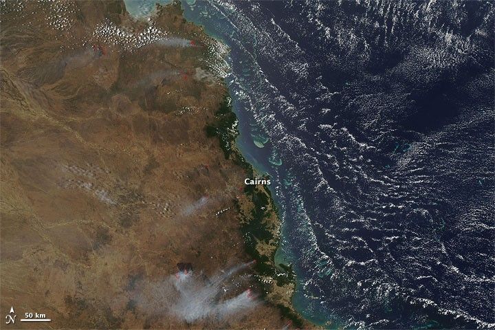
Fires burned along the northeastern coast of Australia in early October 2009. The Moderate Resolution Imaging Spectroradiometer (MODIS) on NASA’s Aqua satellite captured this true-color image on October 6, 2009. Fires burn north, south, and inland from the coastal city of Cairns. Smoke from the fires consistently blows inland, toward the east or east-southeast. Red outlines indicate hotspots associated with high surface temperatures.
On October 7, 2009, an article in The Courier-Mail warned of significant fire dangers for the coming summer. Rains the previous spring had boosted vegetation growth, but hot temperatures and dry conditions had left that vegetation prone to burning. In addition, the monsoon and cyclone season was expected to arrive a month late. A total of 1,700 fires had been contained in just the previous two weeks.
References & Resources
- Williams, B. (2009, October 7). Dry weather sparks serious fire alert for summer. The Courier-Mail. Accessed October 7, 2009.
NASA image courtesy MODIS Rapid Response Team, Goddard Space Flight Center. Caption by Michon Scott.


