
.png?w=1024)


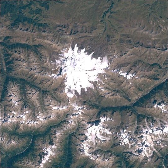
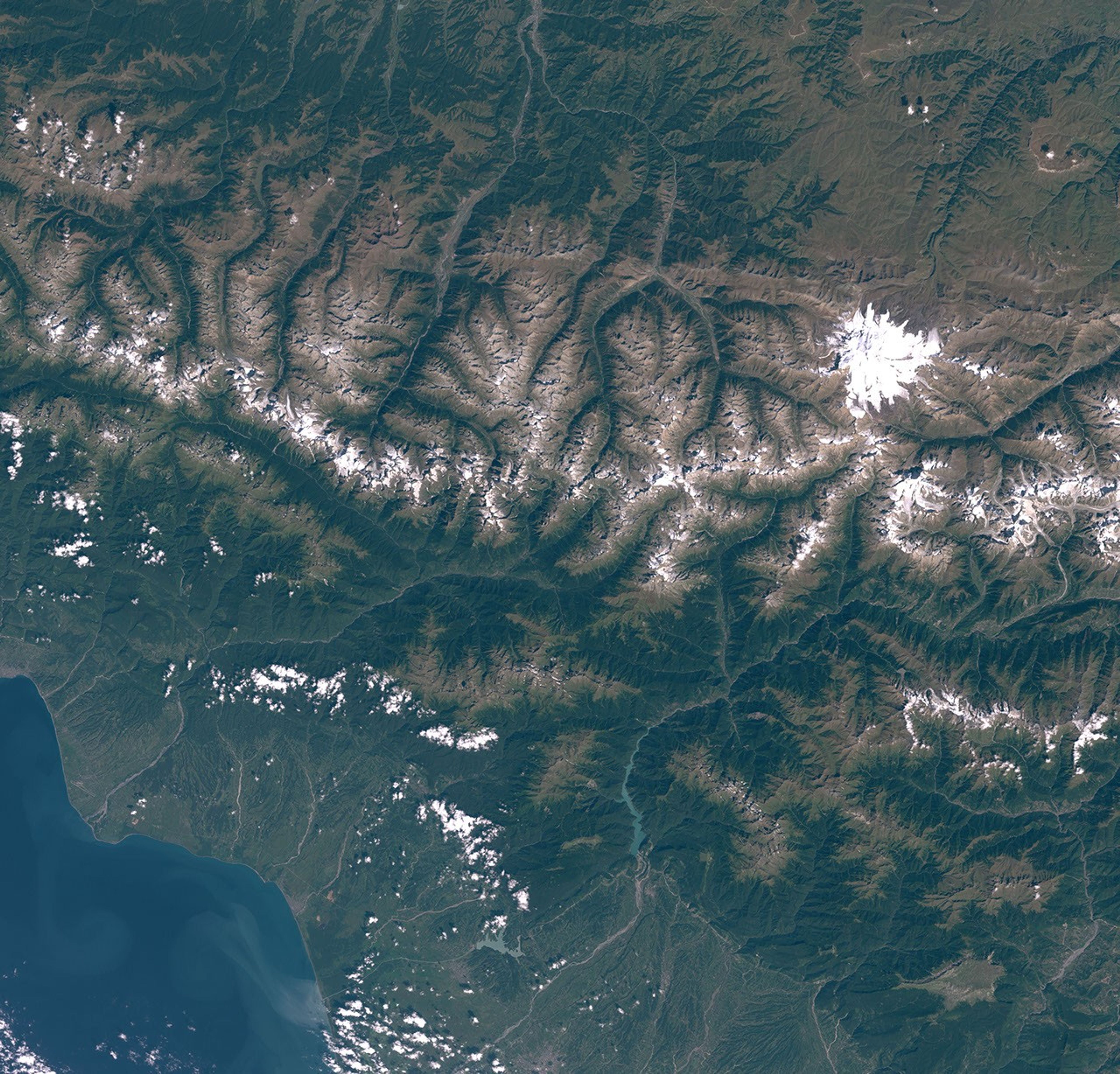
The Seven Summits are the highest peaks on each of the Earth’s seven continents. However, there isdisagreement about where the border between Europe and Asia is located in Russia.One commonly cited boundary for the easternmost edge of Europe is the Ural Mountains, which bringsthe Caucasus Mountains within Europe. The Caucasus’ tallest mountain, Elbrus, is 5,642 meters (18,510 feet)high, higher than Western Europe’s Mt. Blanc in the Alps, the European contender if theCaucaucas are instead considered within Asia. Elbrus has two summits, the east summit being the lowerof the two at 5,621 meters, both of which are dominant volcanic domes.
The first recorded climb of the mountain was in 1829 by Killar Khashirov, who reached the lowereast summit. The higher west summit was reaching in 1874 when the guide Akhia Sottaiev led a team ofBritish and Swiss climbers to the peak. During the early years of the Soviet Union, mountaineeringbecame a popular sport of the masses, and there was tremedous traffic on the mountain. In the winterof 1936, a very large group of inexperienced Komsomol members attempted the mountain, and ended upsuffering many fatalities when they slipped on the ice and fell to their deaths. The Germans brieflyoccupied the mountain during the Second World War; a possibly apocryphal story tells of a Sovietpilot being given a medal for bombing the main mountaineering hut, Pruit 11, while it was occupied.He was then later nominated for a medal for not hitting the hut, but instead the fuel supply, leavingthe hut standing for future generations. From 1959 through 1976, a cable car system was built instages which can take visitors as high as 3,800 meters. There area wide variety of routes up the mountain, but the normal route, which is free of crevasses, continuesmore or less straight up the slope from the end of the cable car system. During the summer, it is notuncommon for 100 people to be attempting the summit via this route each day.
The Caucasus Mountains are the result of a tectonic plate collision between the Arabian plate movingnorthward with respect to the Eurasian plate. They form a continuation of the Himalayas, which are beingpressed upwards by a similar collison zone with the Eurasian and Indian plates. The entire regionis regularly subjected to strong earthquakes from this activity, especially as the fault structureis complex with the Anatolia/Turkey and Iranian Blocks flowing sidewise, which prevents subduction ofthe advancing plate edge and hence the lack of volcanoes (though some minor dome structures, such asElbrus’ peaks, do exist).
This image was acquired byLandsat 7’s Enhanced Thematic Mapper plus(ETM+) sensor on September 12, 2000. This is a true-color image made using red, green, and bluewavelengths (ETM+ bands 3, 2, and 1).
[Editor’s Note: This is one in an ongoing series of Landsat scenes of the Seven Summits. Previouspeaks include Asia’sMt. Everest,North America’sDenali/Mt. McKinley,South America’sCerro Aconcagua,Australia’sMt. Kosciuszko,New Zealand’sAoraki/Mt. Cook,and Africa’sKilimanjaro.]
References & Resources
Image obtained from the University of Maryland Global Land Cover Facility