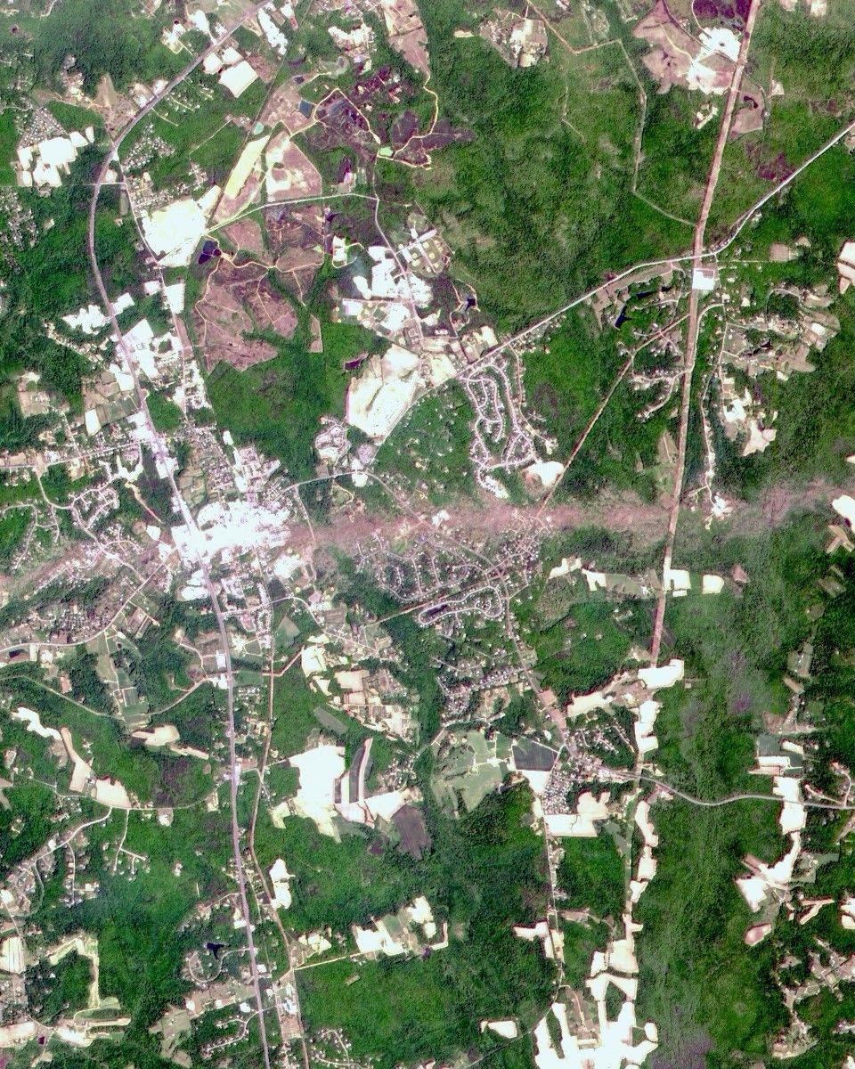


A number of severe thunder storms swept through the mid-Atlantic states on April28, bringing high winds, hailstones, and heavy rains to many areas. The intensestorms spawned at least two tornadoes, one of which was classified as an F4 twister. The powerful tornado touched down in southern Marylandand ripped through the town of La Plata, destroying most of the historicdowntown. The twister—the strongest ever recorded to hit the state andperhaps the strongest ever recorded in the eastern U.S.—flattenedeverything in its path along a 24-mile (39 km) swath running west to eastthrough the state.
The tornado’s path can be seen clearly in this band-sharpened colorimage acquired on May 1 by the Advanced Land Imager (ALI), flying aboardNASA’s EO-1 satellite. La Plata is situated toward the lefthand side ofthis scene and the twister’s swath is the bright stripe passing through thetown and running eastward 6 miles (10 km) toward the Patuxent River beyond therighthand side of the image. This stripe is the result of the vegetationflattened by the storm. The flattened vegetation reflects more light thanuntouched vegetation.
EO-1 is the first Earth observing satellite launched as part of NASA’sNew Millennium Program. This program is designed to spearhead development andtesting of a new generation of satellite remote sensing technologies for futureEarth and space science missions. The ALI is designed to improve upon andextend the measurement heritage begun by the Landsat series of satellites wellinto the 21st Century.
For more images of the tornado’s path, including Landsat,visit Tornado HitsLa Plata, Maryland in the Natural Hazards section of the Earth Observatory.
References & Resources
Image courtesy Lawrence Ong, EO-1 Mission Science Office , NASA GSFC