


large images:
April 25, 2002 (1.8 MB JPEG)
May 18, 2002 (2.3 MB JPEG)
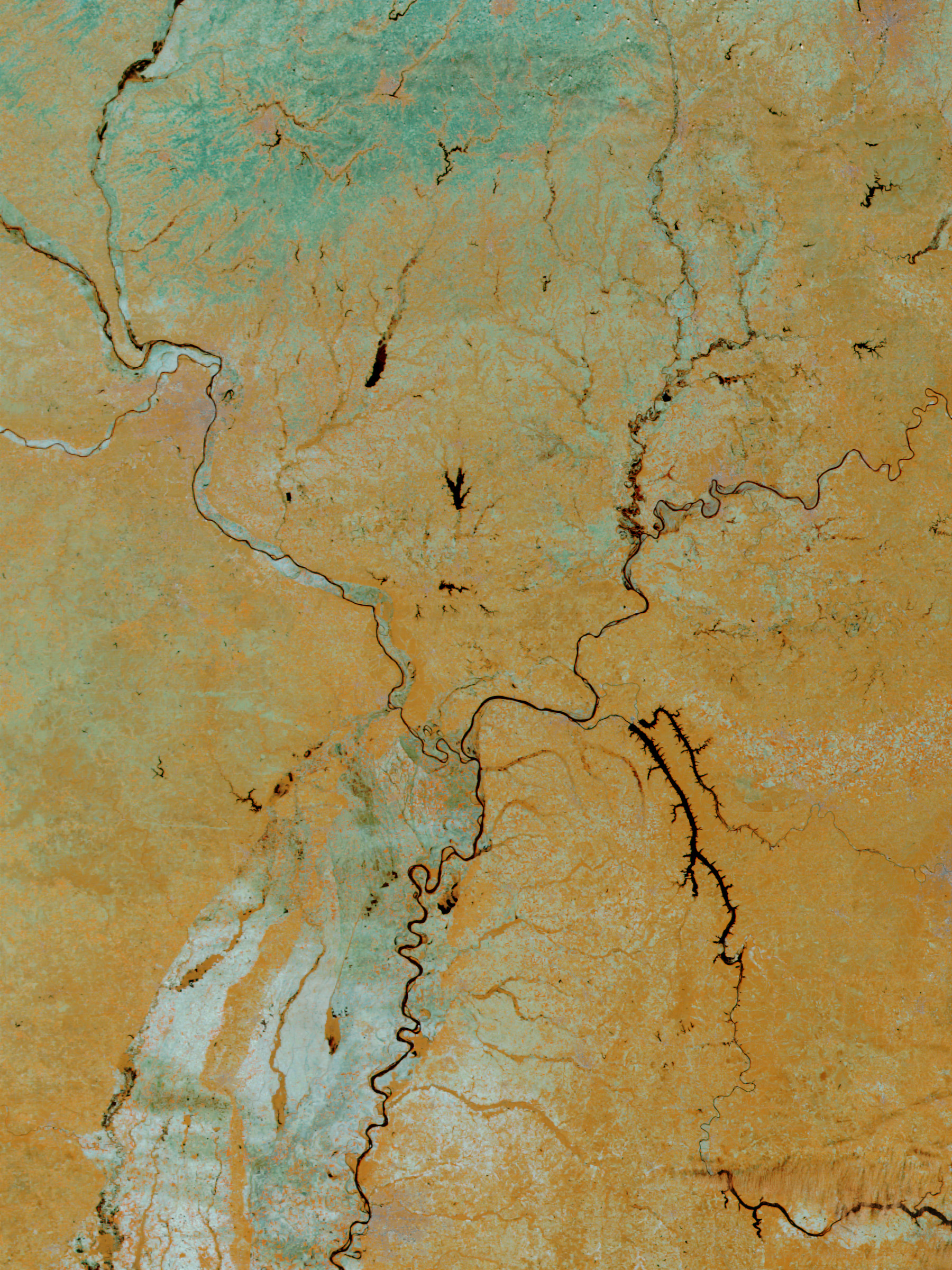
Over the past two weeks, heavy rains gave rise to floods all across themidwestern United States, killing 8 people and forcing many more from theirhomes. These false-color images show the junction of the Ohio River andthe Mississippi River where the flooding was at its worse. The images compareApril 25, 2002, to May 18, 2002, with data from the Moderate-resolution Imaging Spectroradiometer(MODIS), flying aboard NASA’s Terra spacecraft.
The Mississippi River rose up to 12 feet above flood stage in the area shownhere. Southeast Missouri and northern Arkansas, which are west of the greatriver, felt the brunt of the floods. Altogether, more than 50 counties in thestate of Missouri reported flood damage. Farther north in Illinois, Gov. GeorgeRyan declared the entire state a natural disaster area. Severe floods alsooccurred to the east in Kentucky, Ohio, and Indiana. Normally, all the rivers inthis image would resemble thin black lines (left image). Though skies in theregion are clear now, thunderstorms are forecast for later this week, and heavyrains could lead to continued flooding.
In these false-color images, green shows bare land surface and black is water. The orange-brown shades show vegetated areas and thepinkish-white patches are clouds.
References & Resources
Image courtesy Jacques Descloitres, MODIS Land Rapid Response Team at NASA GSFC
None


