


full-size images:
June 3, 2002 (560 KB JPEG)
June 5, 2002 (640 KB JPEG)
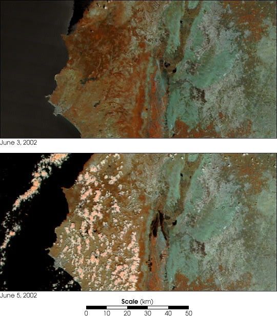
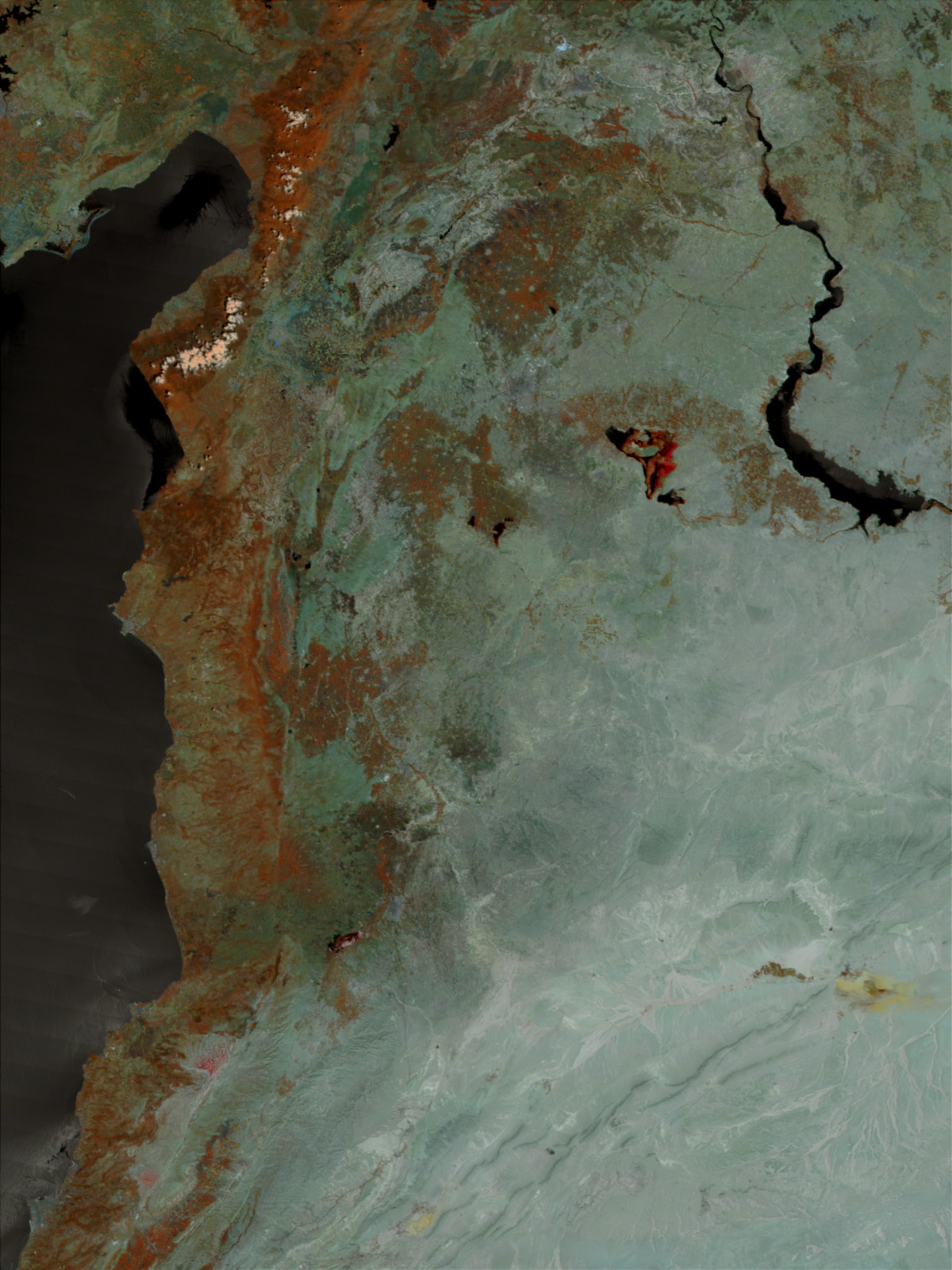
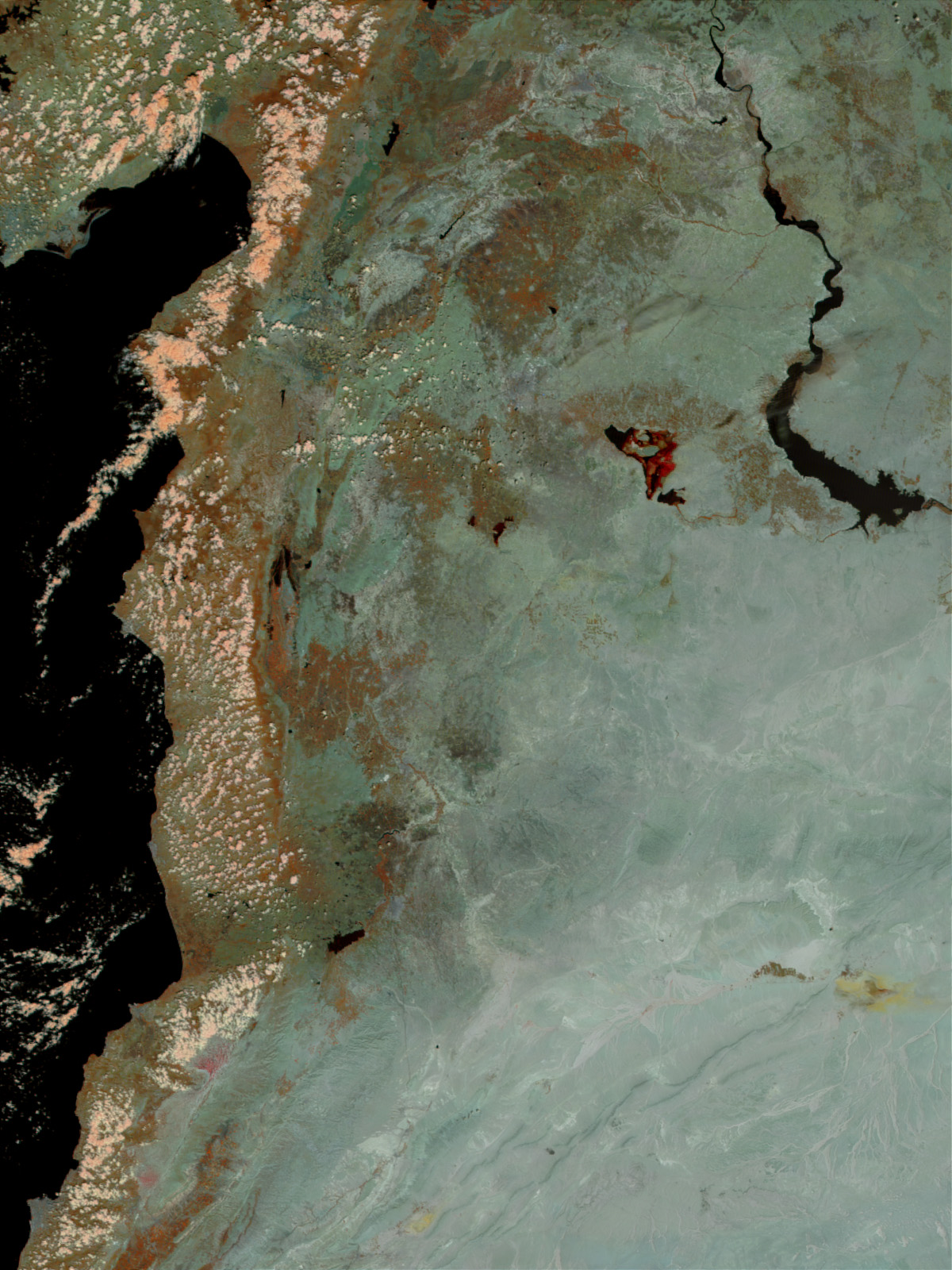
On Tuesday the Zeyzoun dam in northern Syria ruptured and collapsed, killing 20people and leaving thousands more homeless. This false-color image takenon June 5, 2002, (bottom) by the Moderate-resolution Imaging Spectroradiometer (MODIS)instrument aboard NASA’s Terra satellite shows the extent of the flooding.Normally, there would be no water present in the center of the image (top,acquired on June 3, 2002).
After the dam burst, 71 million cubic meters flowed onto the surroundinglandscape and washed over an area of 20,000 acres. Hundreds of homes weredestroyed in and around the villages of Zeyzoun, Qastoun, and Ziara, roughly 220miles (350 kilometers) north of Damascus. Most of the residents fled to higherground with the help of two helicopters. The Syrians originally constructed thedam to contain the Orontes River and provide a steady flow of water to the surrounding farms, many of whichwere lost.
Rescue workers worry that more bodies may be found as the waters of the damrecede. The Japanese government issued more than $40,000 in aid for the victims, andthe Syrian government is petitioning international aid agencies for furtherassistance.
In this false-color image, the ground is sage green and rusty orange, andwater is black. Clouds appear pink.
References & Resources
Image courtesy Jacques Descloitres, MODIS Land Rapid Response Team at NASA GSFC
None


