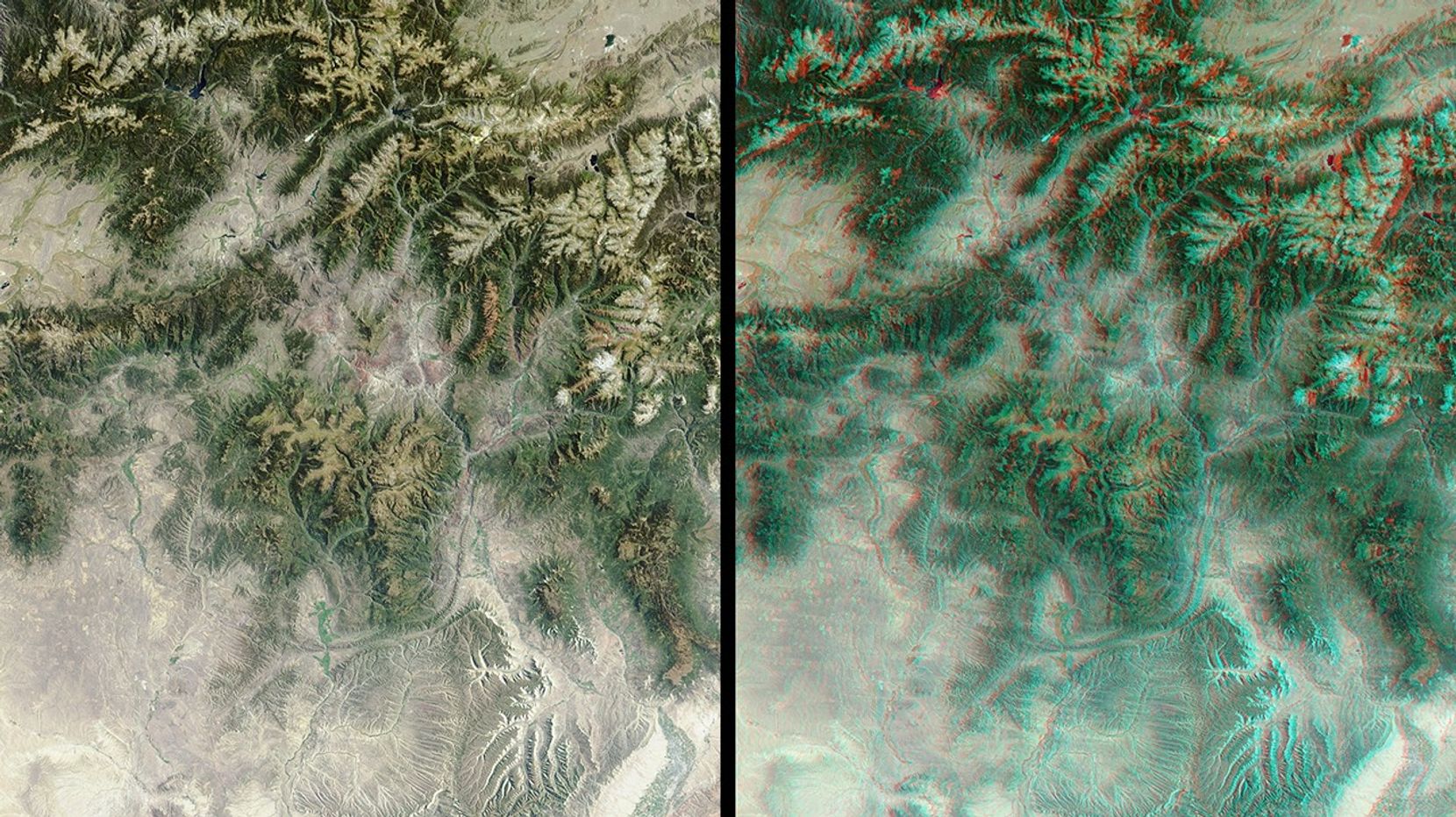


The mountains and desert plateaus of northwest Colorado are contrasted here intwo views from the Multi-angle Imaging SpectroRadiometer (MISR). On the left, anatural-color view acquired by MISR's vertical-viewing (nadir) camera illustratesthese features at a pixel resolution of 275 meters. A striking example of thecapability of multiple view angles to illustrate topography is provided bythe 3D stereo anaglyph view on the right, which was created by combining datafrom MISR's 46-degree forward-viewing and nadir cameras. To facilitate stereoviewing, both images have been oriented with north toward the left. Viewing thestereo image in 3D requires the use of red/blue glasses(http://photojournal.jpl.nasa.gov/Help/VendorList.html#Glasses) with thered filter placed over your left eye.
Undoubtedly the dominant feature of central Colorado are the Rocky Mountains.Running roughly north-south within the eastern portion of the image (across thetop in this orientation) mountain ranges pictured here include the Medicine Bow,Front, Gore and the Sawatch. The Colorado River originates in the RockyMountains National Park near Lake Granby -- a dark blue lake in the upperedge of the image toward the right of center. Other water bodies shown includeAntero Reservoir in the top right corner. The highest peak in the U.S. RockyMountains, Mount Elbert, is situated west of Antero about halfway between theTurquoise and Twin Lakes.
The Colorado River traverses the length of the image, running roughly east andsouth to the lower right-hand corner, where it meets the Gunnison River at thecity of Grand Junction. The striking "L" shaped feature in the lower image centeris a sandstone monocline known as the Grand Hogback. The Yampa River runsfrom its headwaters in the highlands about 65 kilometers north of SteamboatSprings to Dinosaur National Monument in the lower left corner. SteamboatSprings is the site of the Third International Workshop on MultiangularMeasurements and Models(http://cires.colorado.edu/iwmmm-3/) through June 12, 2002.
The images were acquired on September 12, 2000 (during Terra orbit 3923) andcover an area of about 226 kilometers by 257 kilometers. They utilize data fromblocks 58 to 59 within World Reference System-2 path 35.
MISR was built and is managed by NASA's Jet Propulsion Laboratory, Pasadena, CA,for NASA's Office of Earth Science, Washington, DC. The Terra satellite is managedby NASA's Goddard Space Flight Center, Greenbelt, MD. JPL is a division of theCalifornia Institute of Technology.
References & Resources
Image courtesy NASA/GSFC/LaRC/JPL, MISR Team