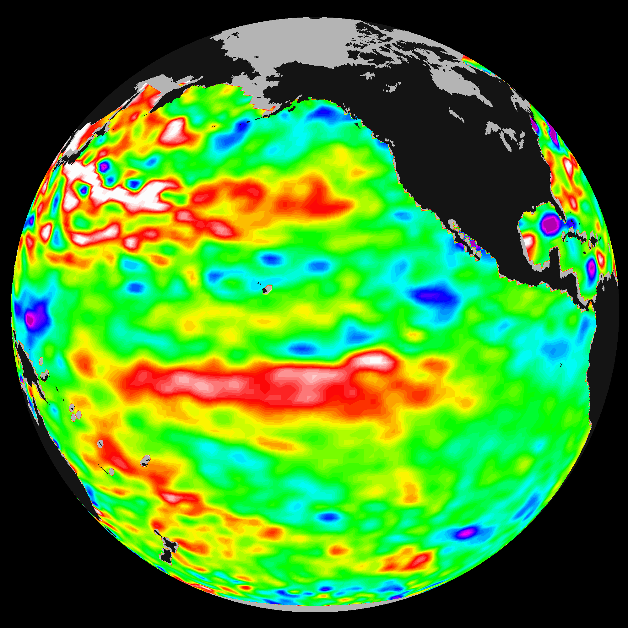
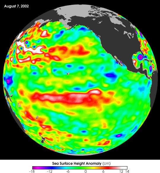
This Topex/Poseidon image of sea-surface heights was taken during a 10-daycollection cycle ending August 7, 2002. Sea-surface heights are a measure of howmuch heat is stored in the ocean depths to influence future planetary climateevents. Since May 2001, there have been a series of warm Kelvinwaves—eastward-moving ocean waves that cross the equatorial Pacific in abouttwo months. A sizable one arrived at the South American coast last February,raising the ocean temperature by 2 degrees Celsius (3.6 degrees Fahrenheit) andtriggering the National Oceanic and Atmospheric Administration’s forecast for amild El Niño in 2002. There was another wave in June, followed by the currentlarge pool of warm water in the tropical Pacific that is now moving toward thecoast of South America at a speed of 215 kilometers (134 miles) a day and willarrive there in three to four weeks, raising ocean temperatures. Scientists willcontinue to monitor the Pacific closely for further signs of El Niño formationand intensity.
Over its ten-year lifespan, TOPEX/Poseidon has acquired continuous data on sea surfaceheight, wind speed, and wave height have given us a new understanding of howocean circulation affects climate. The satellite provides input for long-termclimate forecasting and prediction models. Topex/Poseidon produced the firstglobal views of seasonal current changes. It maps year-to-year changes inupper-ocean heat storage. The satellite has improved our understanding of tides,producing the world’s most precise global tidal maps and demystifying deep-oceantides and their effect on ocean circulation. It monitors global mean sea-levelchanges, an effective indicator of the consequence of global temperature change.Its data are input into atmospheric models for forecasting hurricane seasons andindividual storm severity. And the satellite has improved our knowledge ofEarth’s gravity field.
To learn more, read: After a Decade, NASA’s Topex/Poseidon AdventureSails On.
References & Resources
Image courtesy NASA/JPL Ocean Surface Topography Team