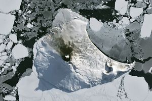
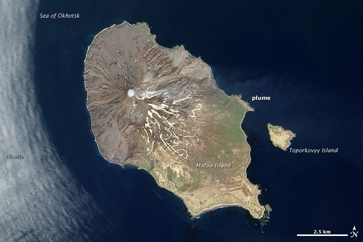
Almost a year after it erupted spectacularly, Sarychev Volcano showed more modest signs of activity. The Advanced Land Imager (ALI) on NASA’s Earth Observing-1 (EO-1) satellite captured this natural-color image on June 11, 2010. Apparent steam fills Sarychev’s summit crater, forming an almost perfect circle of white. A much fainter, barely discernible plume blows away from the summit toward the east.
Sarychev Peak is a stratovolcano. Reachng a height of 1,496 meters (4,908 feet), it forms the highest point on Matua Island. This volcano ranks among the most active in the Kuril Islands, which extend southwestward from the Kamchatka Peninsula.
References & Resources
NASA Earth Observatory image created by Jesse Allen, using EO-1 ALI data provided courtesy of the NASA EO-1 team. Caption by Michon Scott.