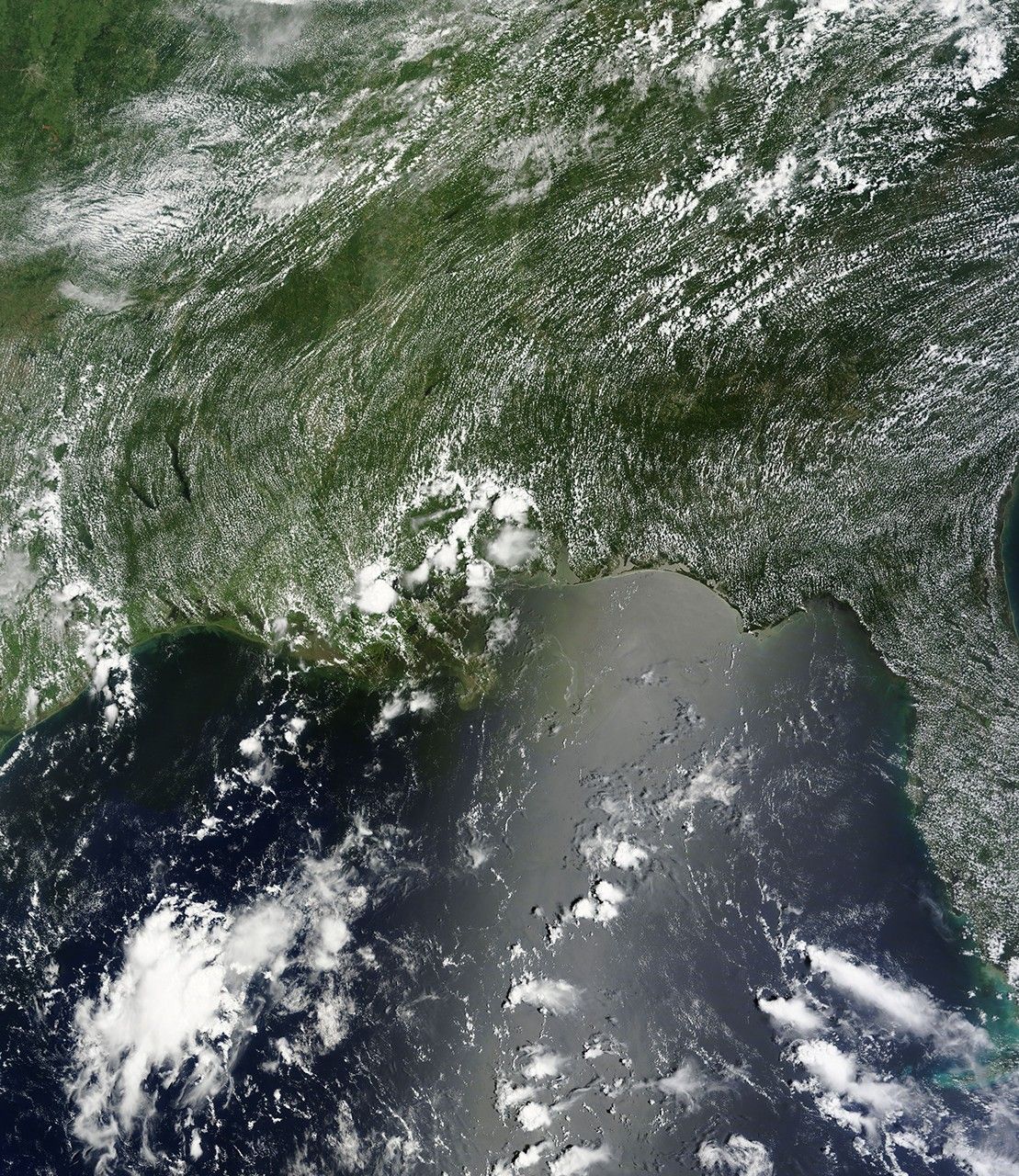
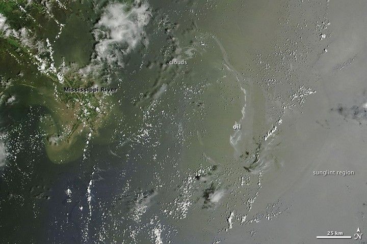
The Gulf of Mexico was speckled and streaked with small clouds on July 20, 2010, when the Moderate Resolution Imaging Spectroradiometer (MODIS) on NASA’s Terra satellite captured this image. Between the clouds, however, a silvery-gray streak of oil remained visible offshore of the Mississippi River Delta. The tan-colored waters around the river delta are full of sediment.
In photo-like images such as this one, oil is most visible when it is located in the sunglint part of the scene—the place where the mirror-like reflection of the Sun off the water gets blurred into a wide bright strip by small waves and ripples.
Our recently published Gulf Oil Slick Images: Frequently Asked Questions explains why oil is most visible in the sunglint part of satellite image and why the Earth Observatory doesn’t post new images of the slick every day.
References & Resources
- Gulf of Mexico Oil Spill Response, the official site of the Deepwater Horizon unified command.
- Current information about the extent of the oil slick is available from the Office of Response and Restoration at the National Oceanic and Atmosphere Administration.
- Information about the impact of the oil slick on wildlife is provided by the U.S. Fish and Wildlife Service.
NASA image courtesy the MODIS Rapid Response Team. Caption by Rebecca Lindsey.