

































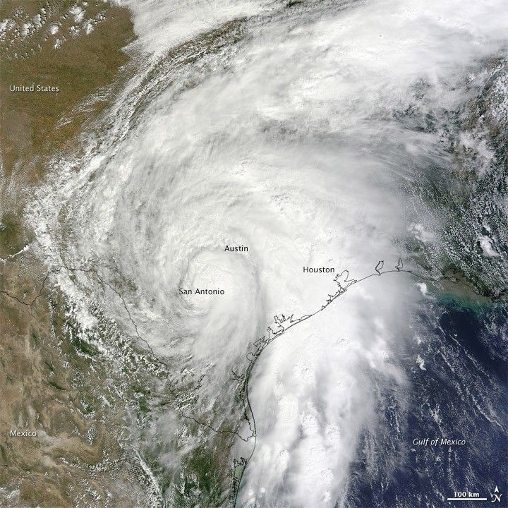
The Moderate Resolution Imaging Spectroradiometer (MODIS) on NASA’s Terra satellite captured this natural-color image of Tropical Storm Hermine at 12:25 p.m. Central Daylight Time (17:25 UTC) on September 7, 2010 as it crossed from the Gulf of Mexico into Texas.
The U.S. National Hurricane Center (NHC) reported at 1:00 p.m. CDT that day that Hermine was centered about 25 kilometers (15 miles) south-southeast of San Antonio. Sustained winds clocked at 65 kilometers (40 miles) per hour, and the storm was moving north at 31 kilometers (20 miles) per hour.
Though not heralded in the news as much as Hurricane Earl from a week before, Tropical Storm Hermine likely did more damage to American communities, spawning tornadoes and torrential rains that led to flooding.
References & Resources
- National Hurricane Center. (2010, September 7). Tropical Storm Hermine Advisory Archive. Accessed September 9, 2010.
NASA image by Jeff Schmaltz, MODIS Rapid Response Team at NASA GSFC. Caption by Mike Carlowicz







