Suggested Searches

1 min read

Fjords of Norway


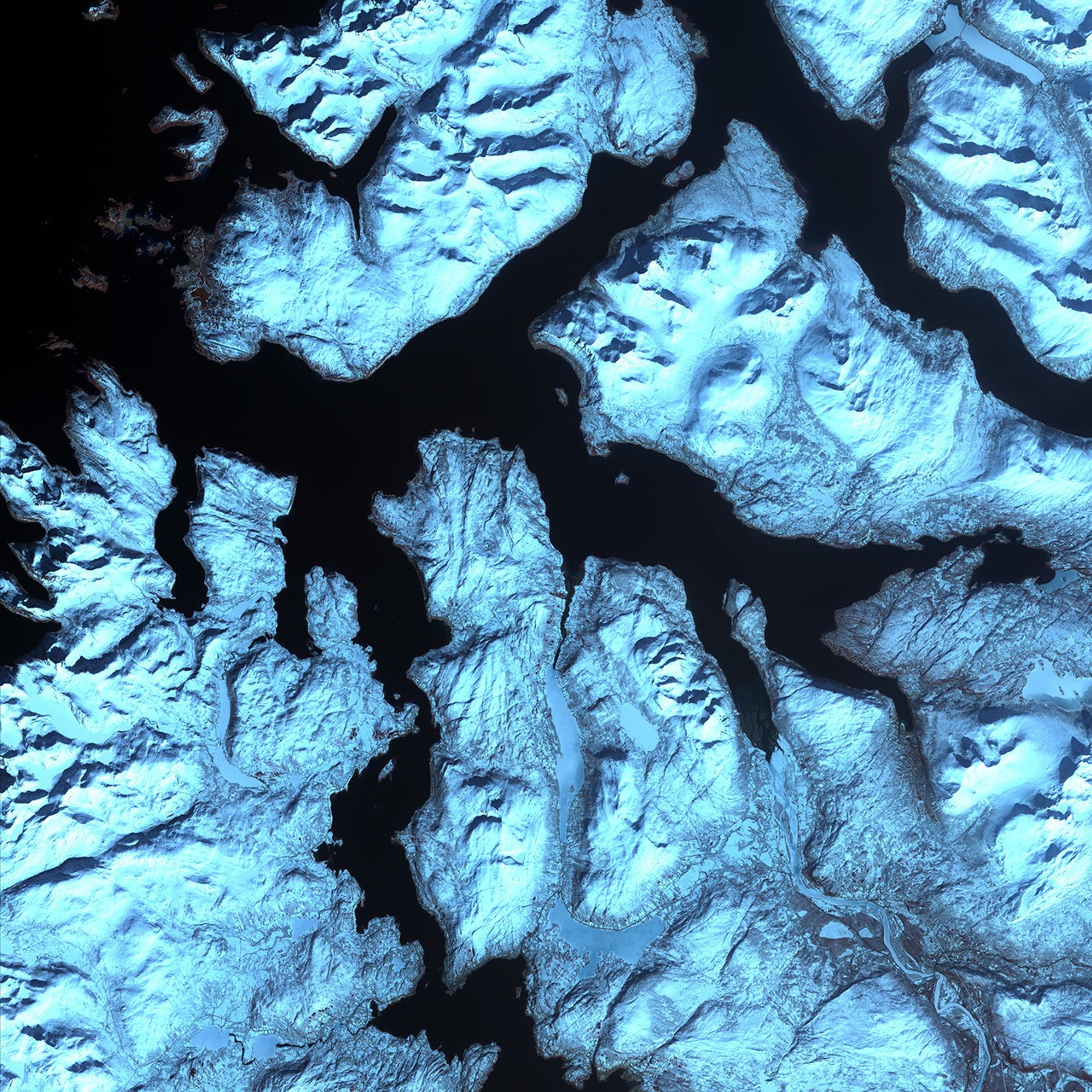
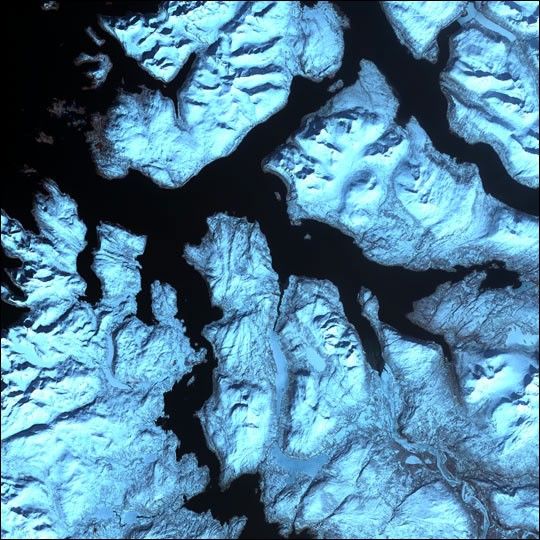
Like dark fingers, cold ocean waters reach deeply into the mountainous coastline ofnorthern Norway, defining the fjords for which the country is famous. Flanked bysnow capped peaks, some of these ice-sculpted fjords are hundreds of meters deep.

This scene was acquired by the ASTER instrument on NASA’s Terra satellite onApril 17, 2002.

References & Resources

Image provided by the USGS EROS Data Center Satellite Systems Branch as part of the Earth as Art II image series

You may also be interested in:

Stay up-to-date with the latest content from NASA as we explore the universe and discover more about our home planet.

Antarctic Sea Ice Saw Its Third-Lowest Maximum
2 min read

Sea ice around the southernmost continent hit one of its lowest seasonal highs since the start of the satellite record.

Article
Arctic Sea Ice Ties for 10th-Lowest on Record
3 min read

Satellite data show that Arctic sea ice likely reached its annual minimum extent on September 10, 2025.

Article
Greenland Ice Sheet Gets a Refresh
3 min read

A moderately intense season of surface melting left part of the ice sheet dirty gray in summer 2025, but snowfall…

Article