


Nicole maintained tropical-storm status for only a matter of hours, but the storm nevertheless poured torrential rains on Jamaica. The heavy rain led to flash floods and landslides, which proved especially deadly in shantytowns along unstable banks.
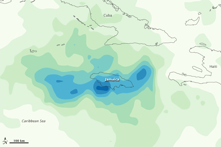
This color-coded image shows rainfall amounts from September 28 to October 4, 2010. The heaviest rainfall—more than 600 millimeters or nearly 24 inches—appears in dark blue. The lightest amounts—less than 75 millimeters or 3 inches—appear in light green.
News accounts recounted extensive damage to buildings, roads, bridges, and water and power utilities; the numbers of casualties differed by report. Squatter settlements experienced some of the worst damage.
This image is based on data from the Multisatellite Precipitation Analysis produced at NASA's Goddard Space Flight Center, which estimates rainfall by combining measurements from many satellites and calibrating them using rainfall measurements from the Tropical Rainfall Measuring Mission (TRMM) satellite.
References & Resources
- Sutton, J. (2010, September 30). Storm kills 12 in Jamaica, threatens U.S. coast. Reuters. ReliefWeb. Accessed October 6, 2010.
- Associated Press. (2010, October 3). Death toll rises to 5 in Jamaican floods, slides. TMCNet. Accessed October 6, 2010.
NASA image by Jesse Allen, using near-real-time data provided courtesy of TRMM Science Data and Information System at Goddard Space Flight Center. Caption by Michon Scott.
None


