In early December 2010, the Panama Canal closed for only the third time in its 96-year history. Two artificial lakes linked to the canal, Gatún and Alajuela, reached their highest-recorded water levels, prompting authorities to close the canal for 17 hours on December 8-9.
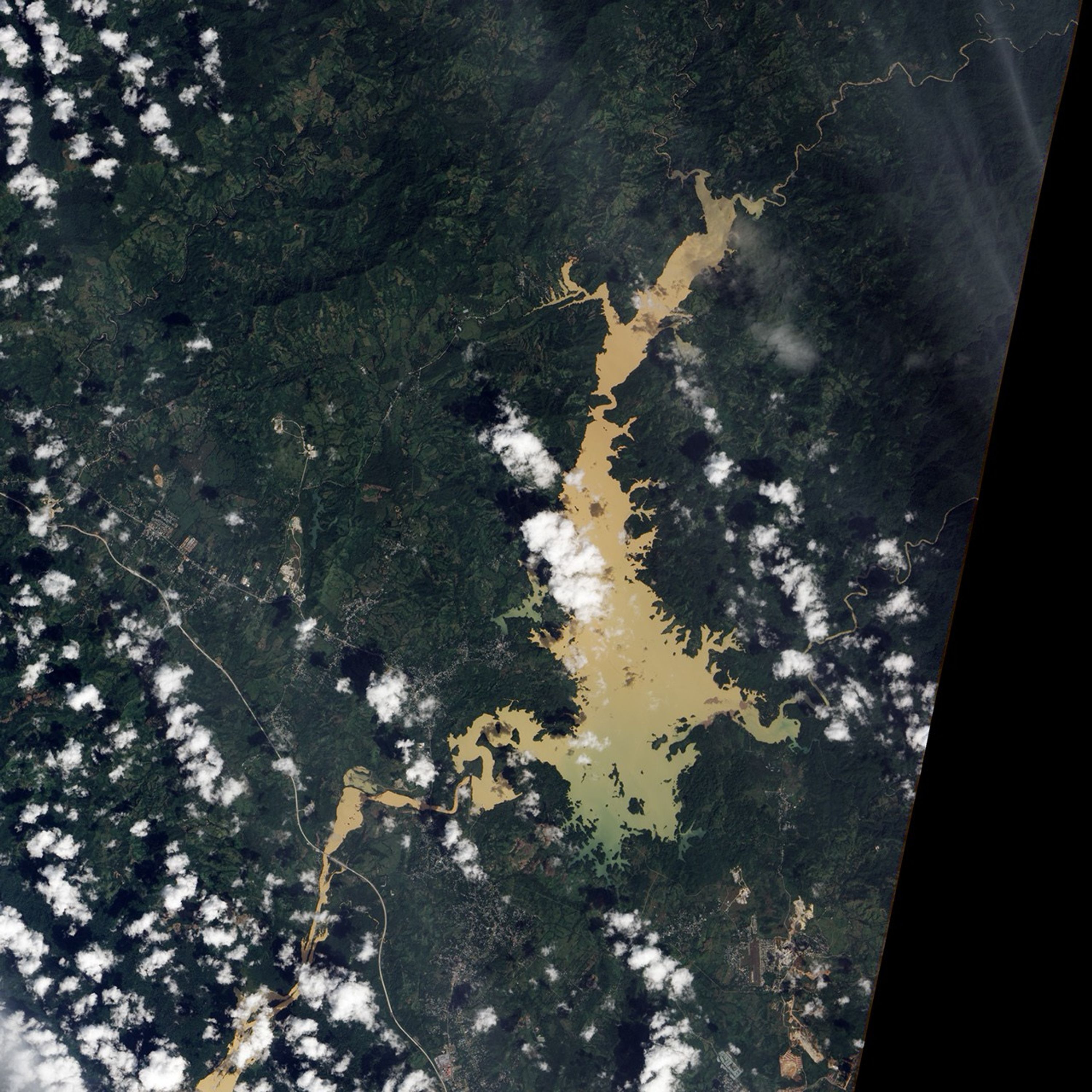
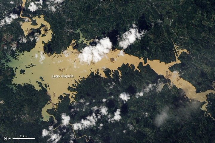
Lago Alajuela serves as a reservoir for the Panama Canal, which lies to the lake’s southwest. On December 17, 2010, the Advanced Land Imager (ALI) on NASA’s Earth Observing-1 (EO-1) satellite captured this natural-color image of Lago Alajuela. This image has been rotated so north is to the right. The canal lies off the top left corner of the image.
Torrential rains can erode soils, delivering heavy sediment loads to streams, rivers, and lakes. Ranging in color from dull green to tan, Lago Alajuela appears choked with sediment, contrasting sharply with the surrounding green forest.
Panama is accustomed to heavy precipitation. The rainy season lasts from May to January. The Panama Canal actually depends on huge quantities of water—each trip through the canal requires some 52 million gallons. Still, heavy rains in early December 2010 overwhelmed the region. The same rains that raised Lago Alajuela’s water level and filled it with sediment also forced thousands of residents to evacuate, washed out roads, and caused deadly landslides.
References & Resources
- CIA World Factbook. (2010, December 7). Panama. Accessed December 20, 2010.
- Dean, C. (2005, May 24). To save its canal, Panama fights for its forests. The New York Times. Accessed December 20, 2010.
- Newsroom Panama. (2010, December 11). Aftermath of Panama flooding hits transport and finances – rain continues. Accessed December 20, 2010.
- UPI. (2010, December 10). Panama Canal, closed due to flood, reopens. Accessed December 20, 2010.
- Wikipedia. (2010, December 17). Panama Canal. Accessed December 20, 2010.
NASA Earth Observatory image created by Jesse Allen and Robert Simmon, using EO-1 ALI data provided courtesy of the NASA EO-1 team. Caption by Michon Scott.