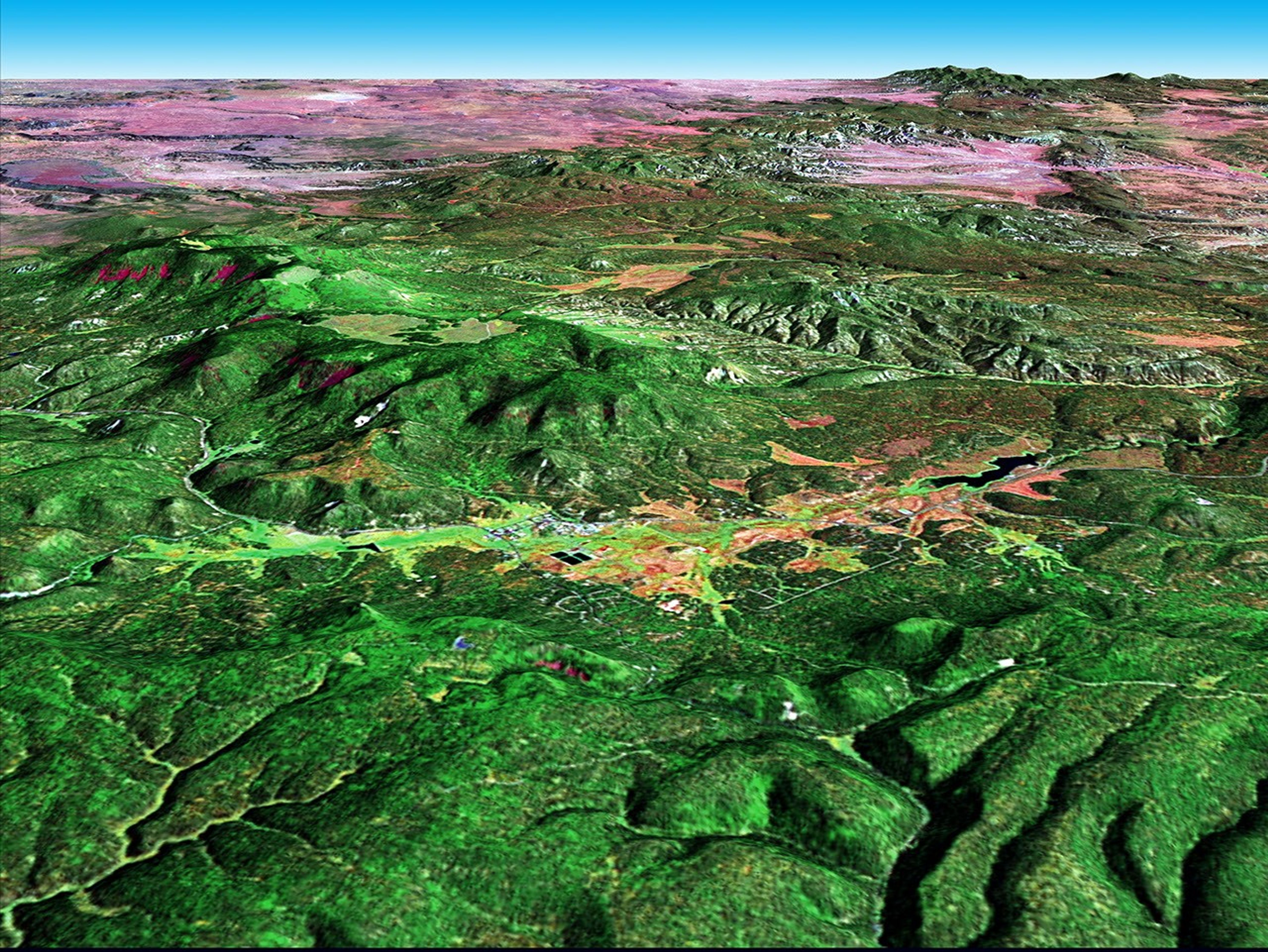
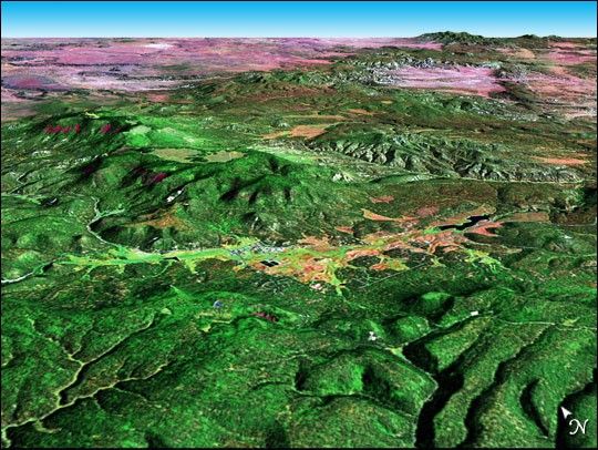
The mountain community of Alpine, Arizona (image center), can be found in the midst of the Apache-Sitgreaves National Forest. Situated at the eastern end of the White Mountains and near the headwaters of the San Francisco River, Alpine is the highest town in Arizona at an elevation of 8,050 feet. The town was settled in 1876. Just east of Alpine, close to the New Mexico border, Luna Lake is visible. The wetlands surrounding the lake house a wildlife refuge for bald and golden eagles.
This perspective image was created by joining Landsat 7 data and Digital Elevation Model (DEM) data. The Landsat 7 image was acquired on September 12, 2000 and combines ETM+ spectral bands 7, 4, and 2 as well as the panchromatic band.
References & Resources
NASA image created by Jesse Allen, Earth Observatory