


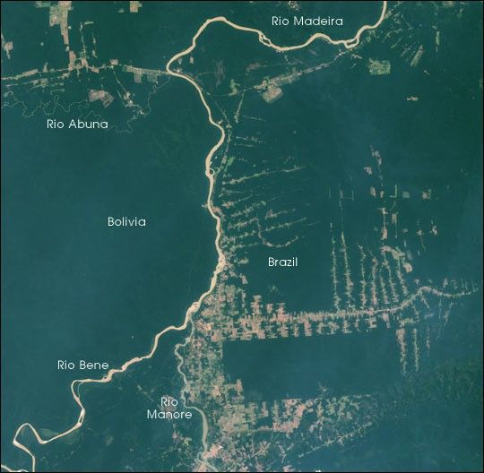
In the northern border regions between Bolivia and Brazil, land use policies differences appear starkly along the border. In this scene, the small Abuna river runs from west to east near the top of the image, defining the northern border of Bolivia with Brazil. It meets the Madeira river to form the northernmost border of Bolivia, while the Manora river comes up from the south at the same river confluence, marking the eastern border of Bolivia here.
Immediately across the river from Bolivia, land clearing patterns change dramatically. The classic “fishbone” clearing pattern in Brazil is very obvious. These clearings are formed when roads are built through a forest and then perpendicular small logging roads reach out and the timber is cut down nearest the roads first.
This image was acquired by the Landsat 7 Enhanced Thematic Mapper Plus (ETM+) instrument on August 22, 2000. This natural-color composite uses red, green, and blue wavelengths (ETM+ bands 3, 2, and 1).
References & Resources
Data provided by the University of Maryland Global Land Cover Facility


