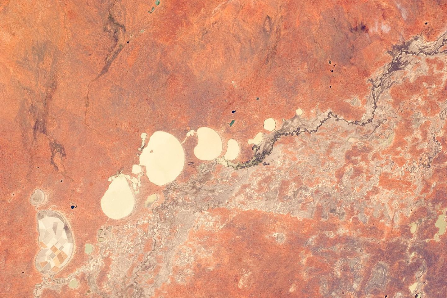
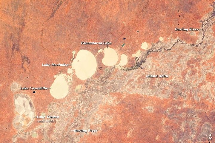
In the far west of New South Wales, Australia, near the town of Menindee, a system of ephemeral, freshwater lakes are fed by the Darling River when it floods. Lake Tandou is the longest, at 18.6 kilometers from north to south. The Darling River itself is flowing in December 2011, as indicated by the dark water and blackened mud along its course (image right), and the lakes appear to have a small amount of water flooding them.
The Darling River flows southwest in tortuous fashion across the flat landscapes of this part of Australia. It has created several inland deltas in its course to the sea, with characteristic diverging channel patterns marked by younger sediments that appear grayer than the ancient red soils and rocks surrounding them. One inland delta appears at image right, where minor channels wind across the countryside. The apex of another inland delta appears at image lower left.
Some of the Menindee Lakes have been incorporated into an artificially regulated overflow system providing for flood control, water storage for domestic use and livestock, and downstream irrigation. The floor of Lake Tandou is used as prime agricultural land, as evidenced by its patchwork of irrigated fields that are protected from flooding. The lakes also serve as important wetlands supporting a rich diversity of birds.
References & Resources
Astronaut photograph ISS030-E-9186 was acquired on December 3, 2011, with a Nikon D2Xs digital camera using an 80 mm lens, and is provided by the ISS Crew Earth Observations experiment and Image Science & Analysis Laboratory, Johnson Space Center. The image was taken by the Expedition 30 crew. The image has been cropped and enhanced to improve contrast, and lens artifacts have been removed. The International Space Station Program supports the laboratory as part of the ISS National Lab to help astronauts take pictures of Earth that will be of the greatest value to scientists and the public, and to make those images freely available on the Internet. Additional images taken by astronauts and cosmonauts can be viewed at the NASA/JSC Gateway to Astronaut Photography of Earth. Caption by M. Justin Wilkinson, Jacobs/ESCG at NASA-JSC.