


April 26, 2012
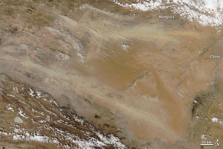
Dust plumes blew out of the Gobi Desert on April 26, 2012. The Moderate Resolution Imaging Spectroradiometer (MODIS) on NASA’s Aqua satellite captured this natural-color image the same day. Arising from source points along the border between southern Mongolia and China, the dust plumes fanned out toward the southeast.
The Gobi Desert straddles the China-Mongolia border, and holds landscapes ranging from sand and bare rock to grassy steppe. The Gobi is one of the world’s most abundant sources of dust. Dust storms tend to be the most frequent in the springtime, especially March and April.
References & Resources
- University Corporation for Atmospheric Research. (2010) Forecasting Dust Storms. (Registration required.) Accessed April 26, 2012.
NASA image by Jeff Schmaltz, LANCE MODIS Rapid Response. Caption by Michon Scott.


