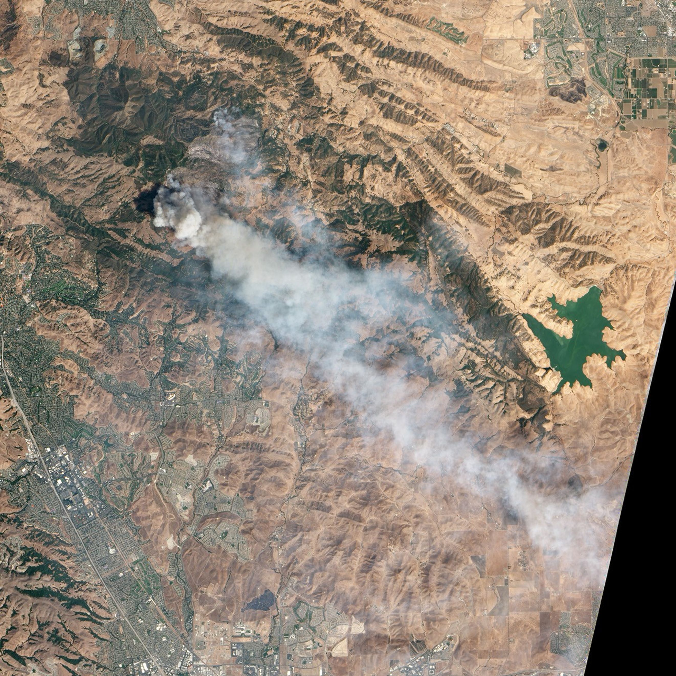
On September 9, 2013, the Advanced Land Imager (ALI) on NASA’s Earth Observing-1 (EO-1) satellite acquired this image of smoke rising from California’s Morgan fire, southeast of Clayton and near Mount Diablo. ALI acquired the image at 11:11 am local time, when winds were pushing smoke to the southeast. The fire started on September 8 and had burned about 3,200 acres (1,300 hectares) by September 10, forcing the evacuation of dozens of homes.
According to the National Interagency Fire Center, a total of 3.9 million acres (1.6 million hectares) had burned during the 2013 wildfire season in the United States as of September 9. Over the past ten years, the average number of U.S. acres burned by early September was 6.4 million (2.6 million hectares).
The Moderate Resolution Imaging Spectroradiometer (MODIS) on NASA’s Aqua satellite—which has a lower spatial resolution than ALI—also detected the fire as it passed over on September 9.
References and Further Reading
- Cal Fire (2013, September 10) Morgan fire. Accessed September 10, 2013.
- Los Angeles Times (2013, September 10) Morgan fire in Mt. Diablo State Park now 45% contained. Accessed September 10, 2013.
- National Interagency Fire Center (2013, September 10) Year-to-date Statistics. Accessed September 10, 2013.
References & Resources
NASA Earth Observatory image by Jesse Allen and Robert Simmon, using EO-1 ALI data from the NASA EO-1 team. Caption by Adam Voiland.