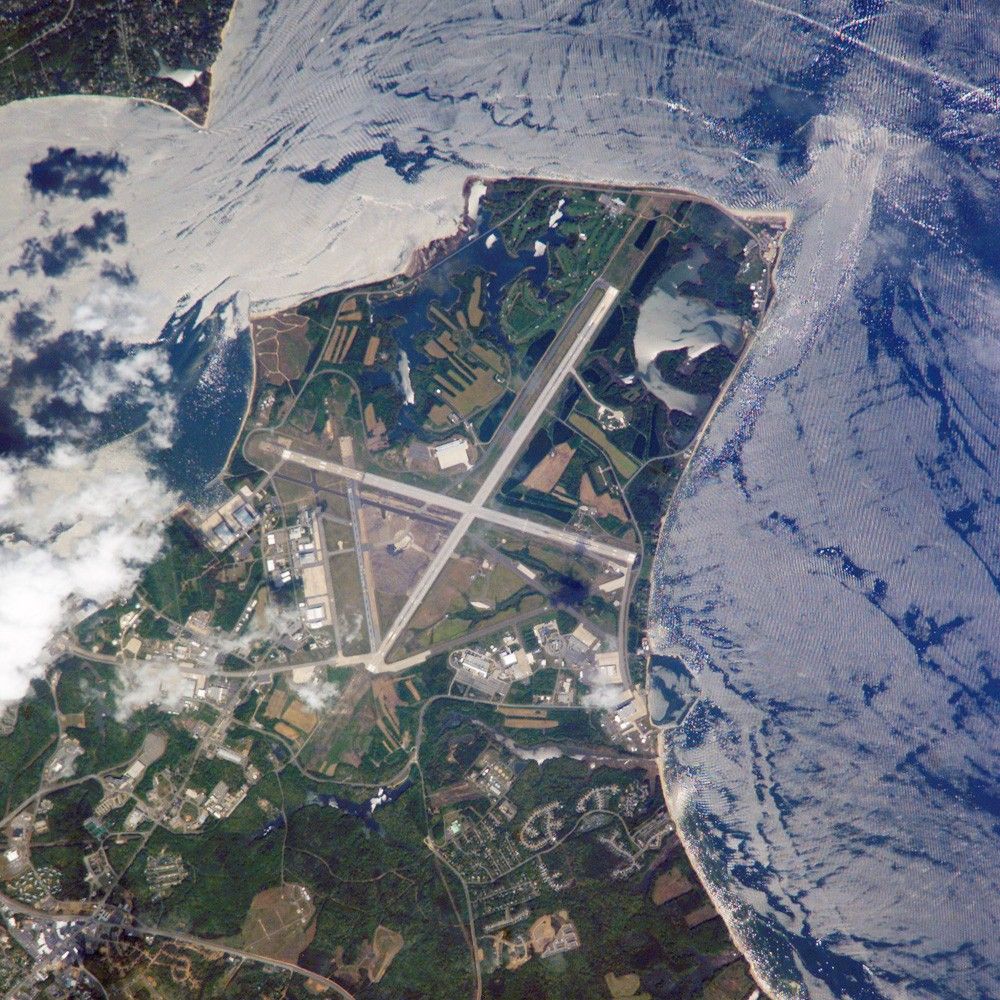
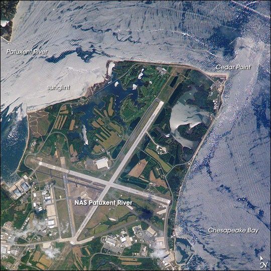
Maryland’s Patuxent River Naval Air Station is located on a small peninsula, bordered by the Patuxent River to the north-northeast and Chesapeake Bay to the east and southeast. The air station was commissioned in 1943, replacing farmlands that had occupied the peninsula less than a year earlier. The primary purpose of “Pax River” (as the site is known by the U.S. Navy) was to consolidate geographically dispersed testing facilities that existed prior to World War II. The Patuxent River station is now the primary center for naval air technology research, development, testing, and support, as well as being the location of the Navy Test Pilot School.
International Space Station crews frequently use the Patuxent River Naval Air Station as a geographic reference point and photographic training target. This astronaut photograph illustrates why—the distinctive pattern of the airfield runways and the station’s location in Chesapeake Bay make it easy to spot from orbit. The sharp boundaries between different kinds of land surfaces are good for camera focusing practice.
This particular image also captures surface water current patterns around the peninsula. Wind- and wave-roughened water surfaces appear silver-gray due to increased reflectance of light back towards the camera (sunglint), whereas dark blue water patches indicate water smoothed by the presence of oils and surfactants (smooth water reflects less light back to the observer) from either natural or human sources. A zone of mixing from converging shoreline currents extends northeast into the bay from Cedar Point.
References & Resources
The featured astronaut photograph ISS015-E-5481 was acquired April 28, 2007, with a Kodak 760C digital camera using an 800 mm lens, and is provided by the ISS Crew Earth Observations experiment and the Image Science & Analysis Laboratory, Johnson Space Center. The image in this article has been cropped and enhanced to improve contrast. The International Space Station Program supports the laboratory to help astronauts take pictures of Earth that will be of the greatest value to scientists and the public, and to make those images freely available on the Internet. Additional images taken by astronauts and cosmonauts can be viewed at the NASA/JSC Gateway to Astronaut Photography of Earth.