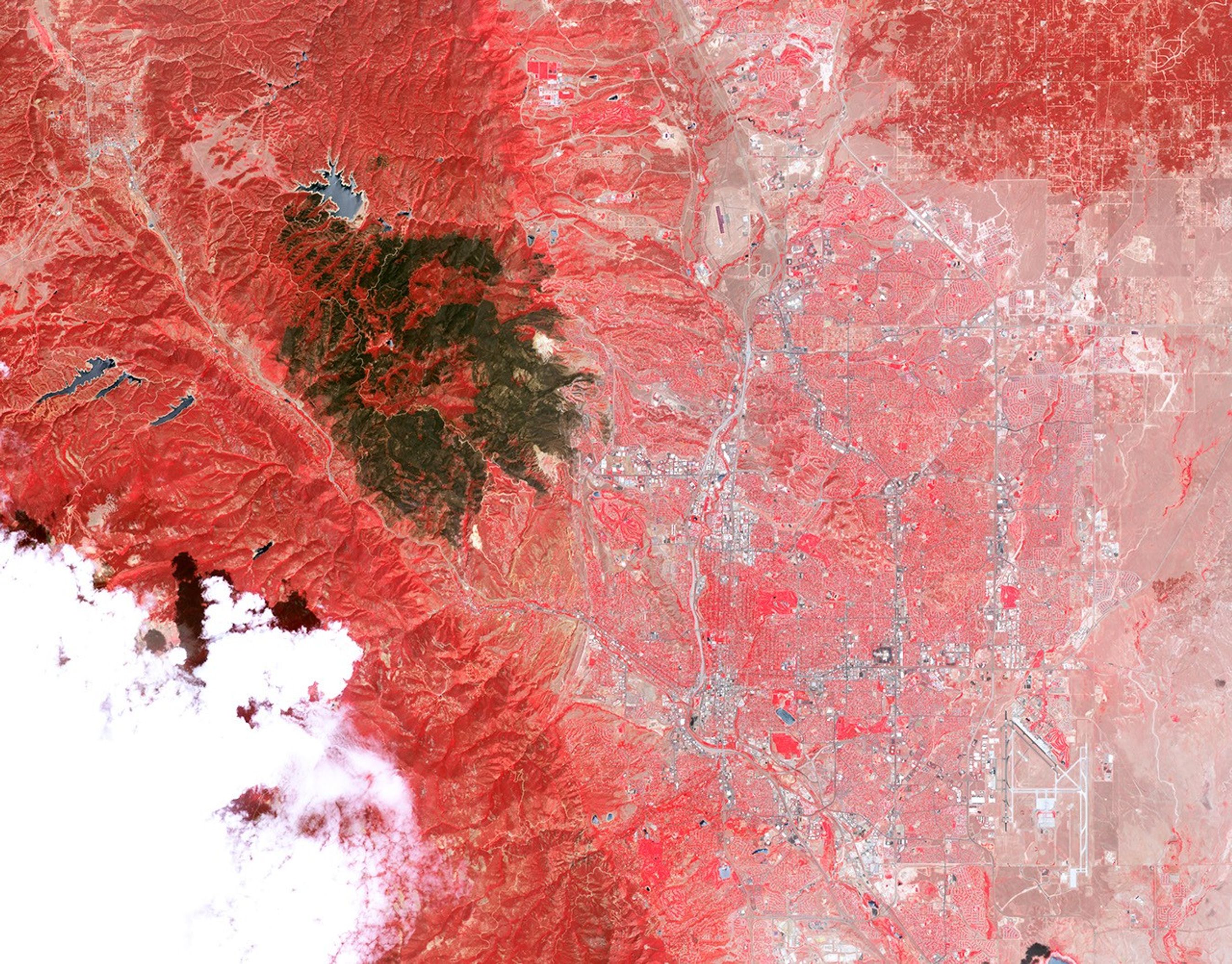

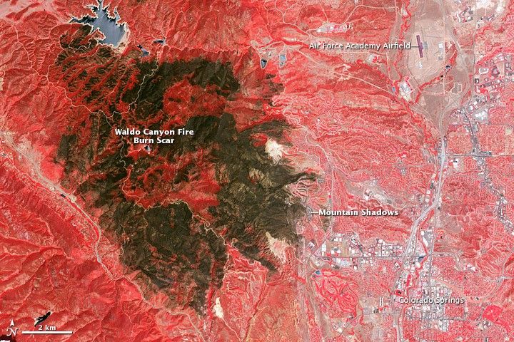
The Waldo Canyon Fire was first reported on June 23, 2012, burning in Pike National Forest, three miles (5 kilometers) west of Colorado Springs. Fueled by extremely dry conditions and strong winds, it had burned 18,247 acres (74 square kilometers) by July 5. The blaze severely damaged or destroyed 346 homes, making it the most destructive fire in Colorado history. Mountain Shadows, a neighborhood northwest of the Colorado Springs city center, experienced some of the most severe damage. According to an analysis conducted by the Denver Post, the combined value of the homes that burned to the ground in the neighborhood was at least $110 million.
The Advanced Spaceborne Thermal Emission and Reflection Radiometer (ASTER) on the Terra satellite acquired this view of the burn scar on July 4, 2012, when the fire was still burning but was 90 percent contained. Vegetation-covered land is red in the false-color image, which includes both visible and infrared light. Patches of unburned forest are bright red, in contrast with areas where flecks of light brown indicate some burning. The darkest brown areas are the most severely burned. Buildings, roads, and other developed areas appear light gray and white. The bright red patches of vegetation near Colorado Springs are golf courses, parks, or other irrigated land.
Further Reading
- Gazette.com. (2012, July 3). Meeting Thursday Night to Address Flood Concerns. Accessed July 5, 2012.
References & Resources
- Inciweb. (2012, July 5). Waldo Canyon Fire. Accessed July 5, 2012.
- Denver Post. (2012, July 4). Colorado Wildfire: Waldo Toll Hits $110 Million for Lost Homes. Accessed July 5, 2012.
- Colorado Springs Fire Department. (2012, July 3). Waldo Canyon Fire. Mountain Shadows (Video). Accessed July 5, 2012.
NASA Earth Observatory image by Jesse Allen and Robert Simmon using data from the NASA/GSFC/METI/ERSDAC/JAROS, and U.S./Japan ASTER Science Team. Caption by Adam Voiland.