


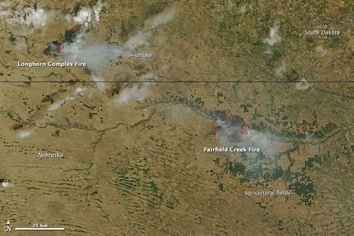
The Moderate Resolution Imaging Spectroradiometer (MODIS) instrument on NASA’s Terra satellite acquired this image of wildfires burning near the border of Nebraska and South Dakota on July 22, 2012. The red outlines indicate hot spots where MODIS detected unusually warm surface temperatures associated with fires. The blaze in South Dakota—the Longhorn Complex fire—began on July 19 and had burned through nearly 30 square miles (78 square kilometers) by the afternoon of July 23. The fire in Nebraska—the Fairfield Creek Fire—was reported on July 20 and had burned over 150 square miles (388 square kilometers). Both fires were fueled in part by the broad drought that has affected the central United States in recent months.
References & Resources
- Inciweb. (2012, July 23). Longhorn Complex. Accessed July 23, 2012.
- Reuters. (2012, July 22). Lightning Sparks Nebraska Wildfire Amid Drought. Accessed July 23, 2012.
NASA image courtesy LANCE MODIS Rapid Response Team, Goddard Space Flight Center. Caption by Adam Voiland.


