


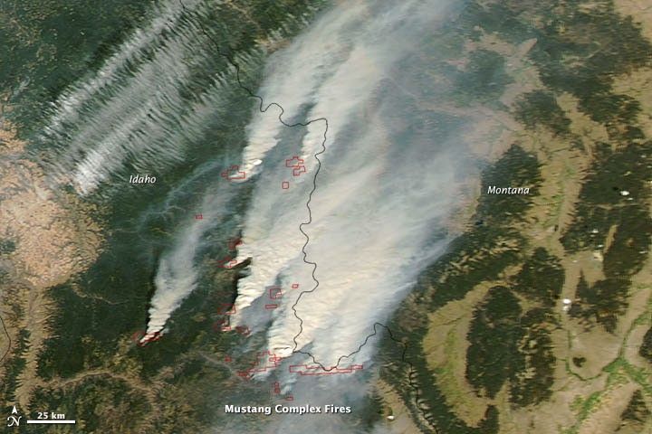
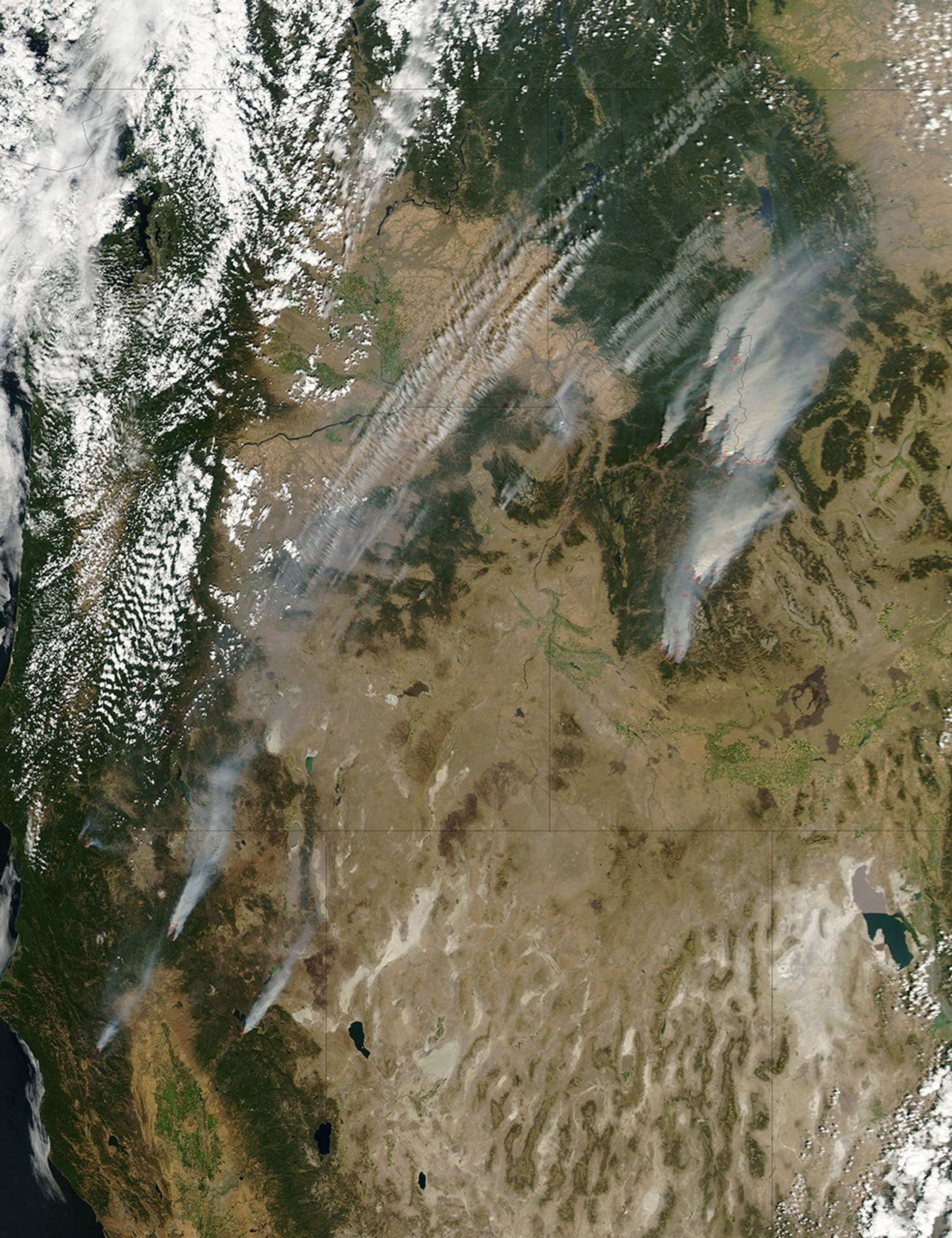
Sparked by lightning in July, the Mustang Complex fire had burned 149,828 acres (60,633 hectares) of rugged terrain near Salmon, Idaho, by August 29, 2012. The fire burned in steep, inaccessible terrain.
This natural-color satellite image shows thick smoke from the fires streaming northeast toward Montana. It was collected by the Moderate Resolution Imaging Spectroradiometer (MODIS) aboard the Aqua satellite on August 28, 2012. Actively burning areas, detected by MODIS’s thermal bands, are outlined in red.
By August 23, more than 1,106,545 acres (447,803 hectares) had burned in Idaho—more than any other state except for Oregon. By August 29, more than 7,277,838 acres (2,945,236 hectares) had burned throughout the United States in what has proven to be one of the most severe wildfire seasons in the last decade.
Further Reading
- Idaho Press-Tribune. (2012, August 29). Black Bear Cub Treated for Burn Injuries. Accessed August 29, 2012.
References & Resources
- Inciweb. (2012, August 29). Mustang Complex Fire. Accessed August 29, 2012.
- National Interagency Fire Center. (2012, August 29). Year-to-Date Statistics. Accessed August 29, 2012.
- National Interagency Fire Center. (2012, August 29). National Year-to-Date Statistics on Fires and Acres Burned by State. Accessed August 29, 2012.
NASA image courtesy Jeff Schmaltz, LANCE MODIS Rapid Response. Caption by Adam Voiland.


