![Request for Information – Potential [Placeholder for Prize]](https://assets.science.nasa.gov/dynamicimage/assets/science/missions/a-step/FFR_Earth_Background_20251120%20.png?w=1024)


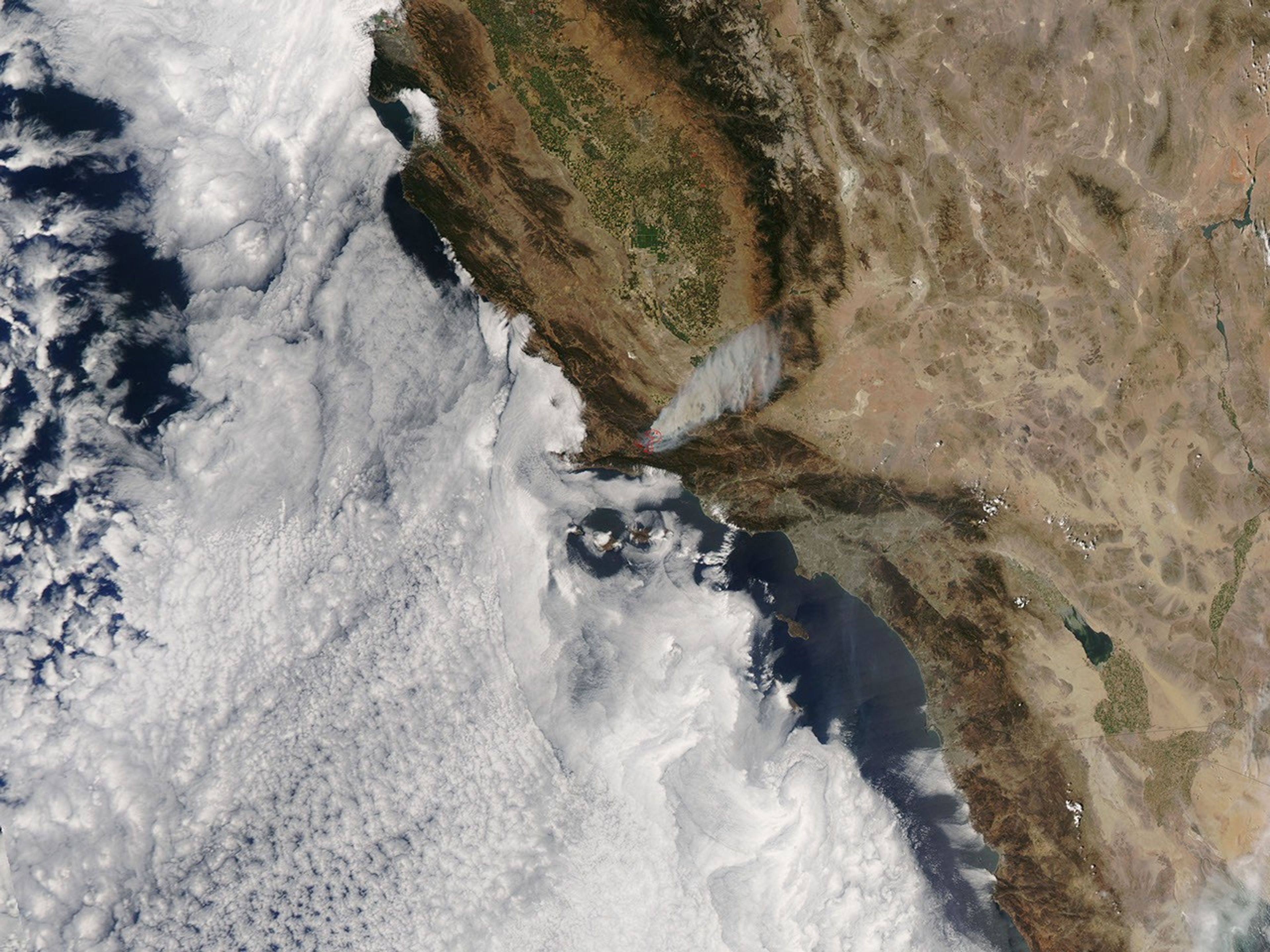
In Santa Barbara County, California, a large wildfire that had burning for a month was continuing to tax firefighters, close roads, and force people to evacuate their homes in the mountains southwest of Los Padres National Forest on August 5, 2007. The Zaca Fire was more than 63,000 acres and about 68 percent contained according to the USDA Forest Service InciWeb report from Sunday, August 5.
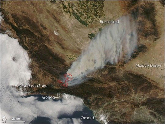
This image from the Moderate Resolution Imaging Spectroradiometer (MODIS) on NASA’s Aqua satellite shows the fire on Sunday afternoon, August 5. The areas where MODIS detected actively burning fires are outlined in red. Thick smoke spreads northeast toward the intensively farmed San Joaquin Valley and the city of Bakersfield. Irrigated fields are lush green, bare or sparsely vegetated land is tan, urban areas are gray, and the natural vegetation on the mountains appears dull greenish-brown.
The fire began accidentally on private land near the forest, and extremely dry conditions allowed the blaze to escape control quickly. Southern California is in the grip of extreme drought according to the U.S. Drought Monitor. According to the group’s drought classification scheme, areas experiencing “extreme drought” are likely to suffer major crop and pasture losses and to face widespread water shortages or restrictions. The costs of wildfires are among the largest economic impacts of droughts in California.
The large image provided above has a spatial resolution (level of detail) of 250 meters per pixel. The MODIS Rapid Response Team provides twice-daily images of the region in additional resolutions.
References & Resources
- California Department of Water Resources Factsheet.
- U.S Drought Monitor. Accessed August 6, 2007.
NASA image courtesy the MODIS Rapid Response Team, Goddard Space Flight Center