![Request for Information – Potential [Placeholder for Prize]](https://assets.science.nasa.gov/dynamicimage/assets/science/psd/solar/2023/09/s/solarsystem_0.jpg?w=1024)


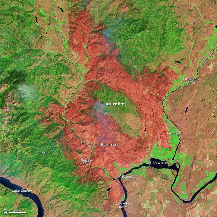
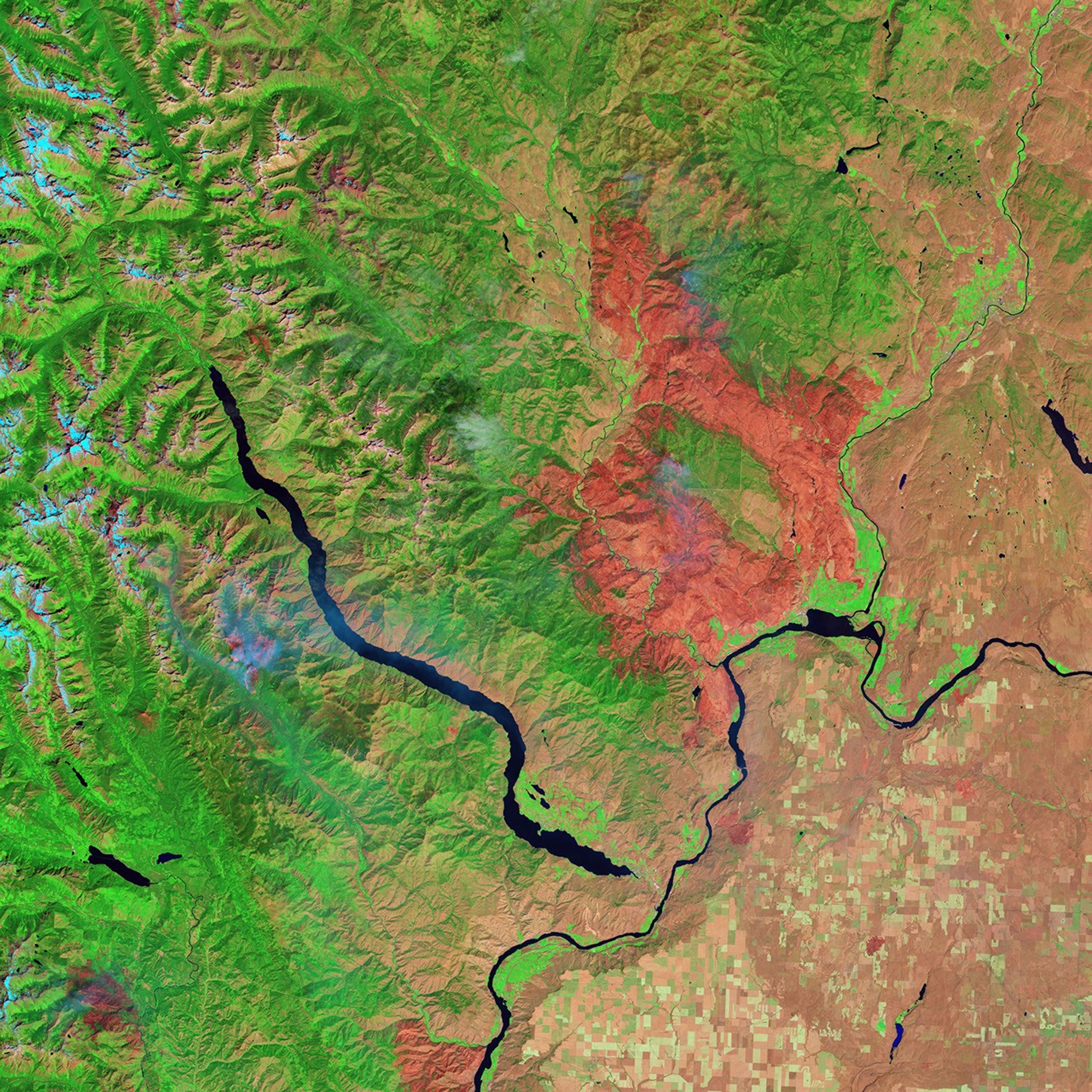
The Carlton Complex fire was first reported on July 14, 2014, burning east of the Methow River near Carlton, Washington. Lightning storms ignited four separate fires in the Methow Valley, and those four blazes converged within a week to form the Carlton Complex. Driven by strong winds, the fire moved rapidly through drought-stressed forests, brushlands, and grasslands in north-central Washington. As of August 11, 2014, it had charred 256,108 acres (103,643 hectares) and was still burning.
Between July 17 and 18, flames pushed toward the towns of Pateros and Brewster, destroying at least 322 homes in the process. On July 22, the Carlton Complex fire became the largest in Washington state’s history when its footprint surpassed that of the 1902 Yacolt fire.
The Operational Land Imager (OLI) on Landsat 8 acquired the top view of the fire on July 31, 2014, when it was still burning but largely contained. In this false-color image, burned vegetation appears red, and the most severely burned areas are generally the darkest. Patches of unburned forests appear dark green. Actively growing farmland is bright green; unburned grasslands and brushlands are tan; and rivers are navy blue.
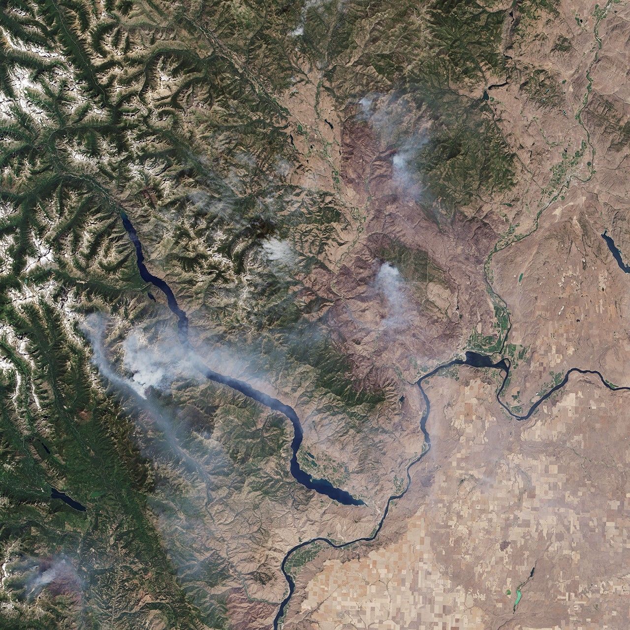
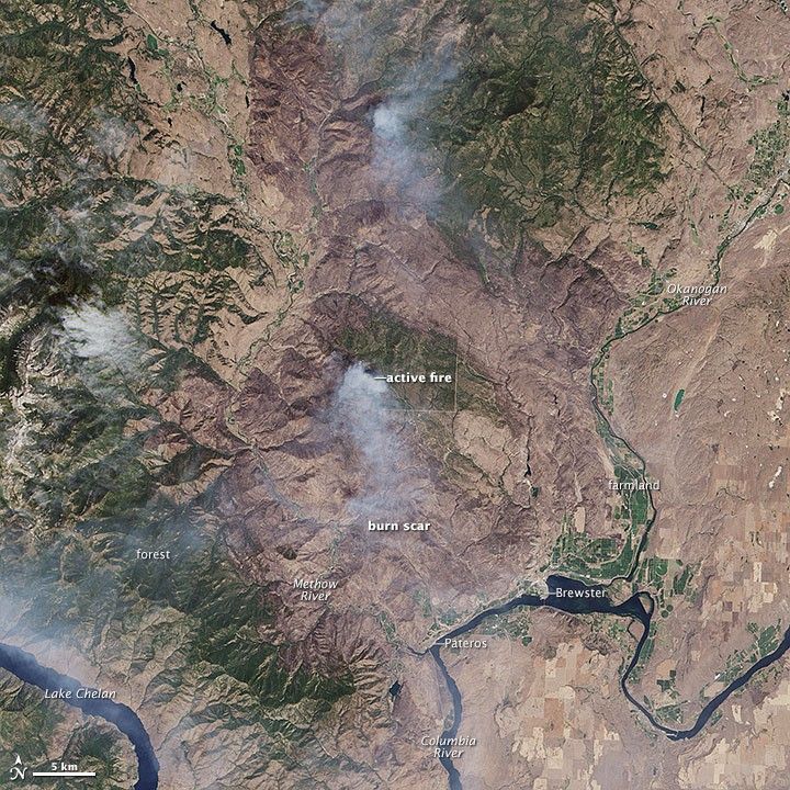
The second image shows the same day but in natural color, similar to what the human eye would see. While it is more difficult to discern in the natural-color image, the burn scar appears darker brown in comparison to the unburned brushlands and grasslands (tan) and forests (green).
References & Resources
- InciWeb (2014, August 11) Carlton Complex. Accessed August 11, 2014.
- The Daily Mail (2014, July 25) Aerial photos show the true scale of the devastation of Washington state’s largest ever wildfire which has burned nearly 400 square miles and destroyed 150 homes. Accessed August 11, 2014.
- HistoryLink (2014, July 22) Yacolt Burn. Accessed August 11, 2014.
- KXLY (2014, July 22) Carlton Complex largest wildfire in state history. Accessed August 11, 2014.
- Seattle Times (2012, July 19) Wildfires whipped by wind in every direction, toll ‘profound’. Accessed August 11, 2014.
- United States Drought Monitor (2014, August 5) Washington. Accessed August 11, 2014.
NASA Earth Observatory image by Jesse Allen, using Landsat data from the U.S. Geological Survey. Caption by Adam Voiland