![Request for Information – Potential [Placeholder for Prize]](https://assets.science.nasa.gov/dynamicimage/assets/science/psd/solar/2023/09/s/solarsystem_0.jpg?w=1024)


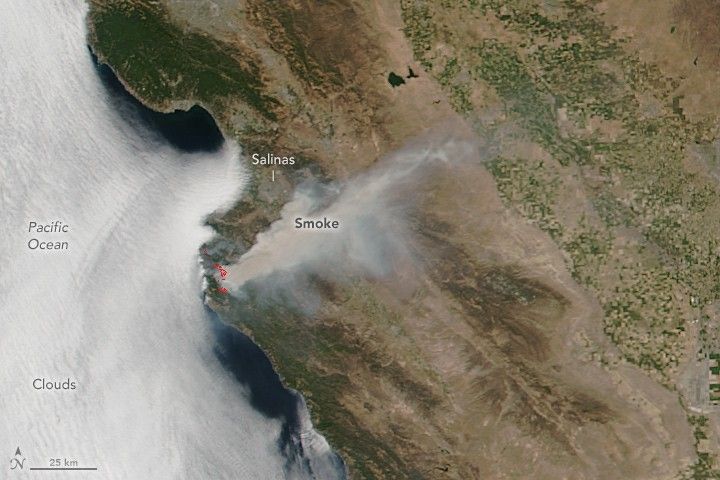
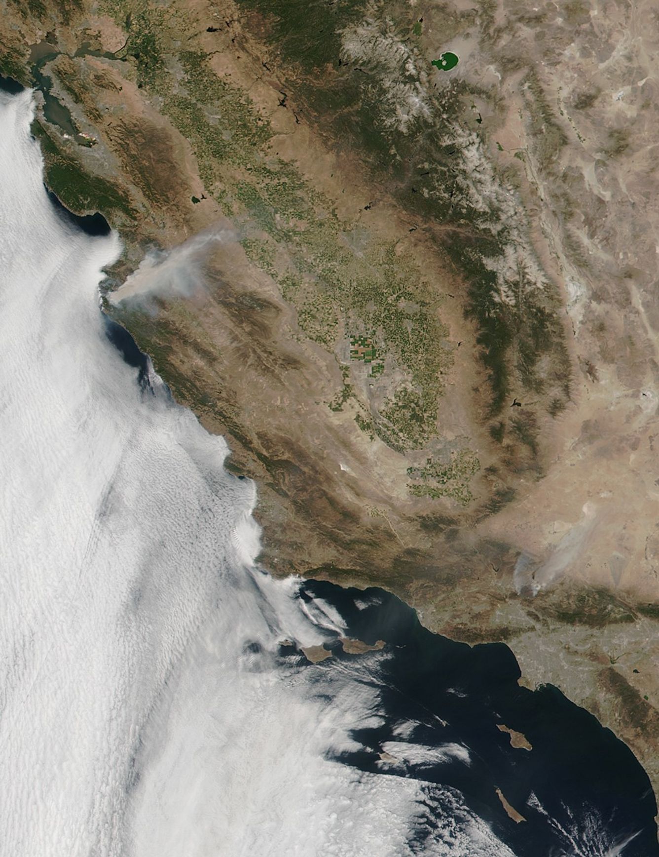
In late July 2016, wildfire burned along Soberanes Creek, Garrapata State Park, and north of Big Sur in Monterey County, California. On July 24, 2016, the Visible Infrared Imaging Radiometer Suite (VIIRS) on the Suomi NPP satellite captured this image of the Soberanes fire.
According to InciWeb, the fire started on July 22. As of July 25, it had burned 14,897 acres and was 5 percent contained by firefighters. Twenty homes and two other buildings have been destroyed. High temperatures and low humidity, coupled with long-term drought, have fueled the blaze.
References & Resources
NASA image by Jeff Schmaltz, LANCE/EOSDIS Rapid Response , using VIIRS data from the Suomi National Polar-orbiting Partnership satellite. Suomi NPP is the result of a partnership between NASA, the National Oceanic and Atmospheric Administration, and the Department of Defense. Caption by Mike Carlowicz.