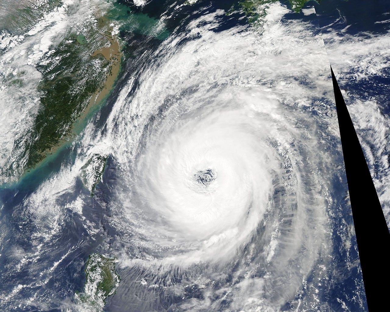

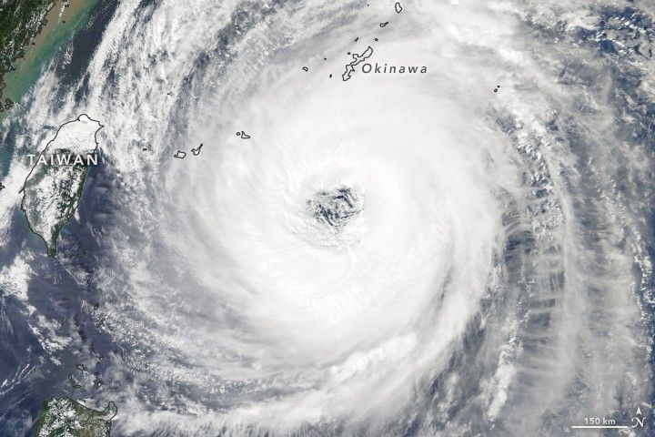
Satellites and astronauts have observed Typhoon Trami on its march across the Western Pacific Ocean this week. As the storm now turns toward Japan, the country’s meteorological agency warned of the potential for heavy winds, rain, landslides, and flooding.
At 2:05 p.m. local time (05:05 Universal Time) on September 28, 2018, the Moderate Resolution Imaging Spectroradiometer (MODIS) on NASA’s Aqua satellite acquired this image of the storm. At the time, Trami was the equivalent of a category 2 cyclone, with sustained winds of 165 kilometers (100 miles) per hour. It was located 380 kilometers (235 miles) south of Okinawa, Japan.
The storm has weakened slightly over the course of the week. When an astronaut on the International Space Station snapped these photos on September 25, Trami was a stronger category 3 storm. Forecasters suggest that the storm could regain strength before reaching Japan’s main islands over the weekend. The forecasted track puts the storm moving northward over Okinawa on September 29, then over the island of Honshu on September 30.
Trami will likely disrupt air traffic. The Naha airport in Okinawa planned to close its domestic and international terminals on September 29.
References & Resources
- Japan Meteorological Agency (2018, September 29) Tropical Cyclone Information. Accessed September 28, 2018.
- Joint Typhoon Warning Center (2018, September 28) Typhoon Trami. Accessed September 28, 2018.
- The Mainichi (2018, September 28) Powerful Typhoon Trami on course to lash Okinawa, Amami Islands on Sept. 29. Accessed September 28, 2018.
- Reuters (2018, September 28) Japan braces as typhoon charts course for main island. Accessed September 28, 2018.
NASA Earth Observatory image by Joshua Stevens, using MODIS data from NASA EOSDIS/LANCE and GIBS/Worldview . Story by Kathryn Hansen.