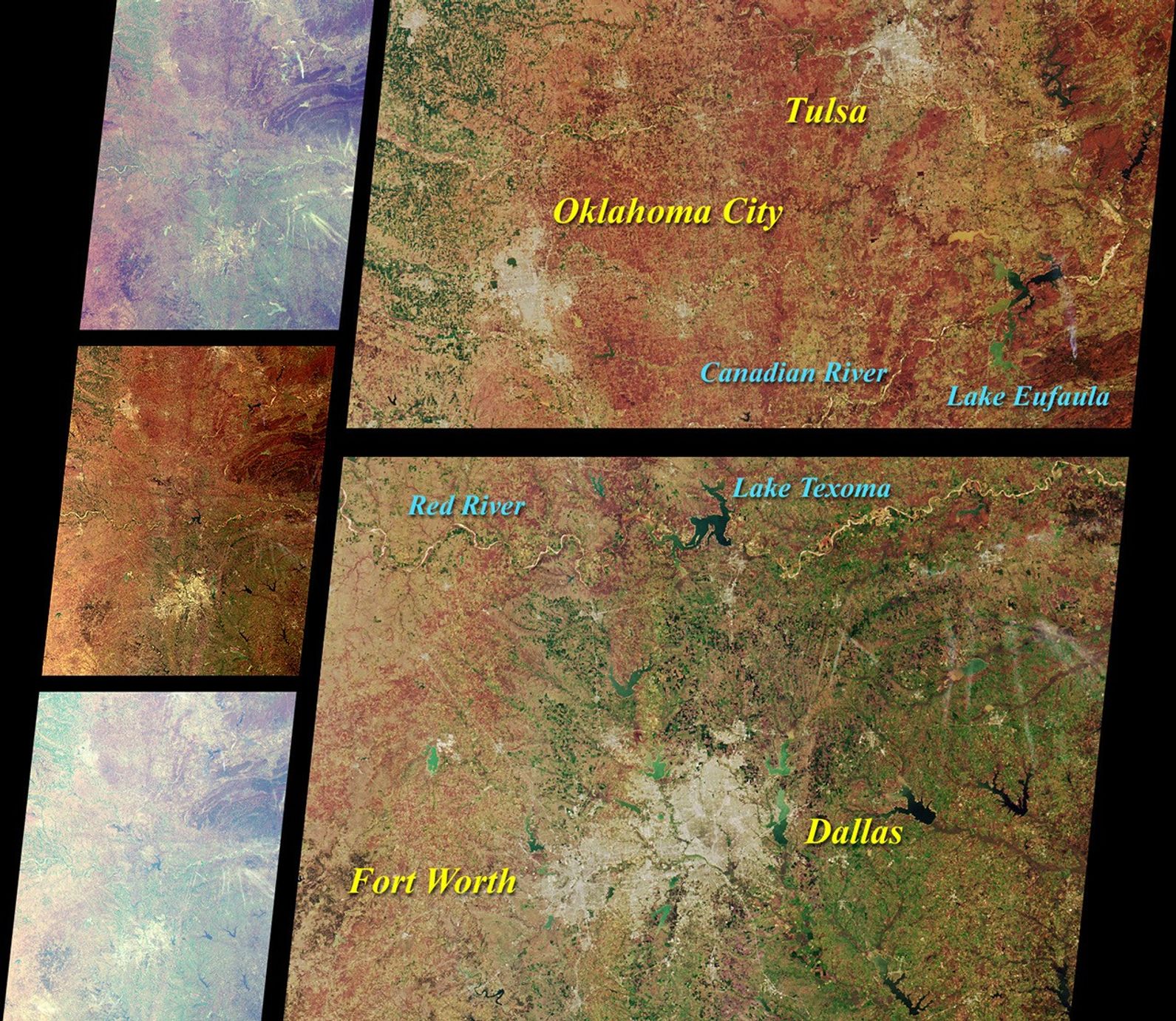

These Multi-angle Imaging Spectroradiometer (MISR) images of Oklahoma and north Texas were acquired on March12, 2000. The three images on the left, from topto bottom, are from the 70-degree forward viewing camera, thevertical-viewing (nadir) camera, and the 70-degree aftward viewingcamera. The higher brightness, bluer tinge, and reduced contrast of theoblique views result primarily from scattering of sunlight in theEarth's atmosphere, though some color and brightness variations are alsodue to differences in surface reflection at the different angles. Thelonger slant path through the atmosphere at the oblique angles alsoaccentuates the appearance of thin, high-altitude cirrus clouds.
On the right, two areas from the nadir camera image are shown in moredetail, along with notations highlighting major geographic features. Thesouth bank of the Red River marks the boundary between Texas andOklahoma. Traversing brush-covered and grassy plains, rolling hills, andprairies, the Red River and the Canadian River are important resourcesfor farming, ranching, public drinking water, hydroelectric power, andrecreation. Both originate in New Mexico and flow eastward, their waterseventually discharging into the Mississippi River.
A smoke plume to the north of the Ouachita Mountains and east of LakeEufaula is visible in the detailed nadir imagery. The plume is also veryobvious at the 70-degree forward view angle, to the right of center andabout one-fourth of the way down from the top of the image.
References & Resources
Image NASA/GSFC/JPL, MISR Team