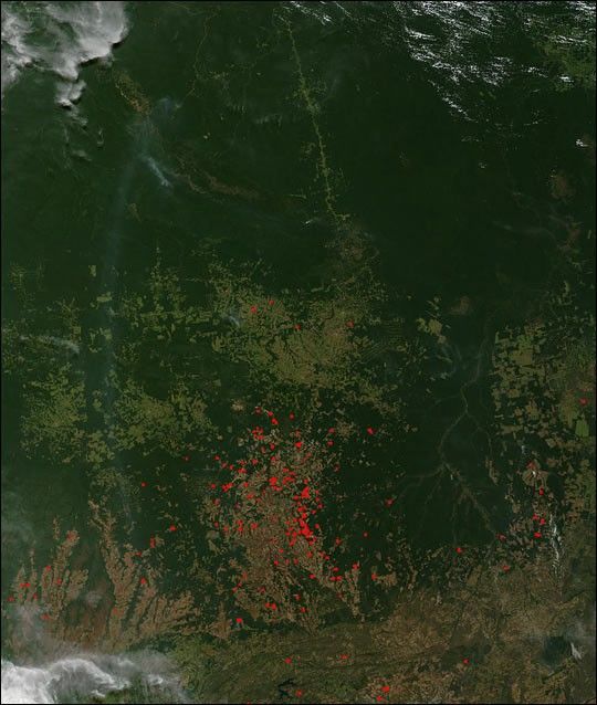
In the Mato Grosso region of Brazil, fire (red dots) is a major cause of deforestation. "Slash and burn" agriculture is used to clear tropical forests for farming and ranching, and this Moderate Resolution Imaging Spectroradiometer (MODIS) image from May 30, 2002, shows the resulting transformation of the landscape. In the southern portions of the image, lines and geometric shapes reveal where plots of land have been coverted to agricultural uses. At top center, a road cuts up through the intact forests in the north.
Please note that the high-resolution scene provided here is 500 meters per pixel. For a copy of the scene at the sensor's fullest resolution, visit the MODIS Rapid Response Image Gallery.
References & Resources
Image courtesy Jacques Descloitres, MODIS Land Rapid Response Team at NASA GSFC