![Request for Information – Potential [Placeholder for Prize]](https://assets.science.nasa.gov/dynamicimage/assets/science/missions/a-step/FFR_Earth_Background_20251120%20.png?w=1024)


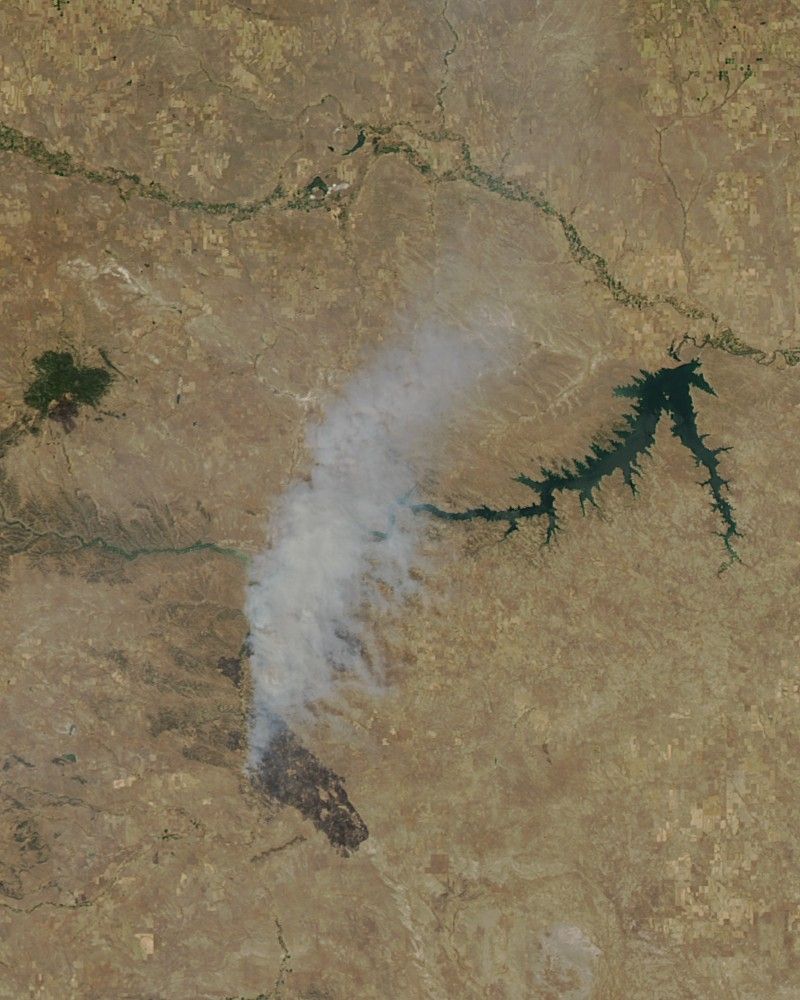
In July 2017, several fast-moving wildfires tore through northeastern Montana, charring hundreds of thousands of acres near Fort Peck Lake.
As of July 25, 2017, the Lodgepole Complex and Crying fire had burned a combined 257,000 acres (400 square miles or 1,000 square kilometers)—an area roughly the size of New York City. Firefighters had gained the upper hand on the Crying fire, which was 60 percent contained; the Lodgepole complex fires were just 20 percent controlled.
The Moderate Resolution Imaging Spectroradiometer (MODIS) on NASA’s Aqua satellite acquired this natural-color image of the fires on July 23, 2017. Actively burning areas, detected by MODIS’s thermal bands, are outlined in red. Charred vegetation appears black.
Montana’s governor has declared a fire emergency, and more than 700 firefighters are on the scene. Drought and a persistent heat wave turned grasslands into a tinderbox. In July 2017, the U.S. Drought Monitor ranked the drought affecting this part of Montana as extreme, one of the most severe ratings on the scale.The fires have burned through sagebrush steppe grasslands, as well as scattered pine forests. Many sagebrush landscapes in the West have been transformed by the arrival of invasive grass species—particularly cheatgrass—that lead to more frequent and severe burns, according to some fire specialists. Severe fires, in turn, make it difficult for sagebrush to regrow, which has contributed to sagebrush steppe becoming of one the most imperiled ecosystems in the United States.
References & Resources
- Billings Gazette (2017, July 24) Bullock declares fire emergency; Red Flag warning continues for Lodgepole Complex area. Accessed July 24, 2017.
- Colorado State University Cheatgrass and Wildfire. Accessed July 24, 2017.
- InciWeb (2017, July 24) Lodgepole Complex. Accessed July 24, 2017.
- InciWeb (2017, July 24) Crying Fire. Accessed July 24, 2017.
- National Wildlife Service Sage-grouse, Sagebrush and the Threat Posed by Invasive Annual Grasses/Increased Fire Frequency. Accessed July 24, 2017.
- U.S. Drought Monitor (2017, July 18) Montana. Accessed July 24, 2017.
NASA image by Jeff Schmaltz, LANCE/EOSDIS Rapid Response. Caption by Pola Lem and Adam Voiland.