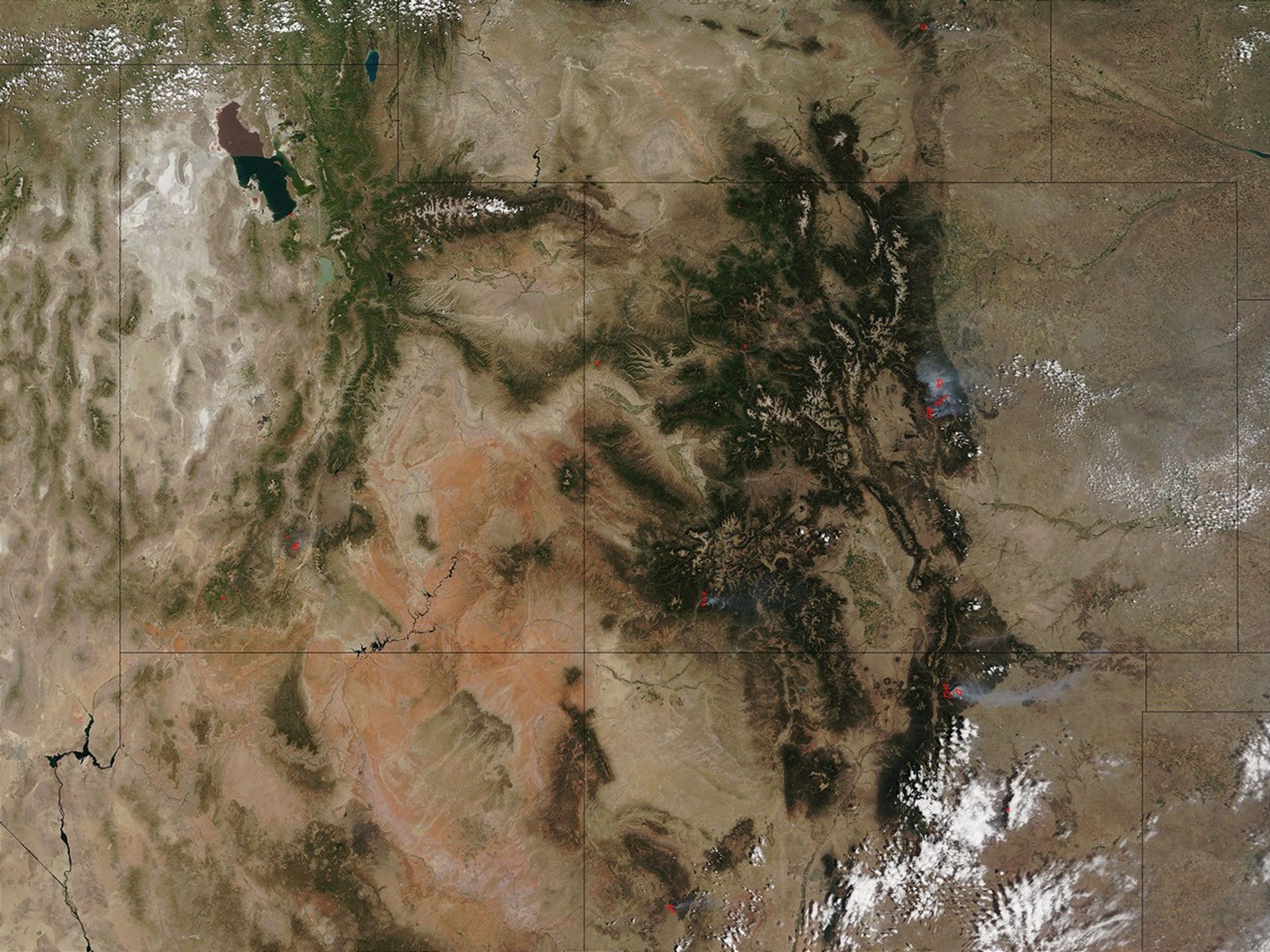

This image from the Moderate Resolution Imaging Spectroradiometer (MODIS) on NASA’s Terra satellite shows the ongoing fire activity in the western United States on Wednesday, June 12, 2002. Several large fires (red dots) are burning in Utah (left of center), Colorado (right of center), and New Mexico (bottom right). In southwest Utah are the Big Wash and Sanford Fires. In Colorado, firefighters are battling (clockwise from top left) the Long Canyon, Coal Seam, Hayman, and Missionary Ridge Fires. In New Mexico are the Ponil (north) and Cherry (west) Fires.
More than 500 firefighters are battling the Hayman Fire southwest of Denver, Colorado, and the Forest Service has requested 1,800 more to try to contain the now more than 90,000-acre fire which has forced over 5,000 people from their homes. At least twenty structures have been lost, but fortunately, there have been no serious injuries to date. The Forest Service has no official estimate of when the fire might be contained, and thousands more people remain on stand-by for possible evacuation. Elsewhere in Colorado, some residents were allowed to return to their homes in Glenwood Springs, as the threat from the Coal Seam Fire lessened, but the Missionary Ridge fire north of Durango is threatening several subdivisions.
In New Mexico, the Ponil Fire is close to 90,000 acres and still growing, but there is currently no immediate threat to any homes or businesses.
Please note that the high-resolution scene provided here is 500 meters per pixel. For a copy of the scene at the sensor's fullest resolution, visit the MODIS Rapid Response Image Gallery.
References & Resources
Image courtesy Jacques Descloitres, MODIS Land Rapid Response Team at NASA GSFC