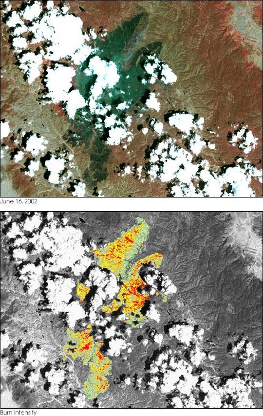
Suggested Searches

1 min read

Rocky Mountain Fires

Instruments:
Topics:
2024-06-16 12:00:00
June 16, 2002

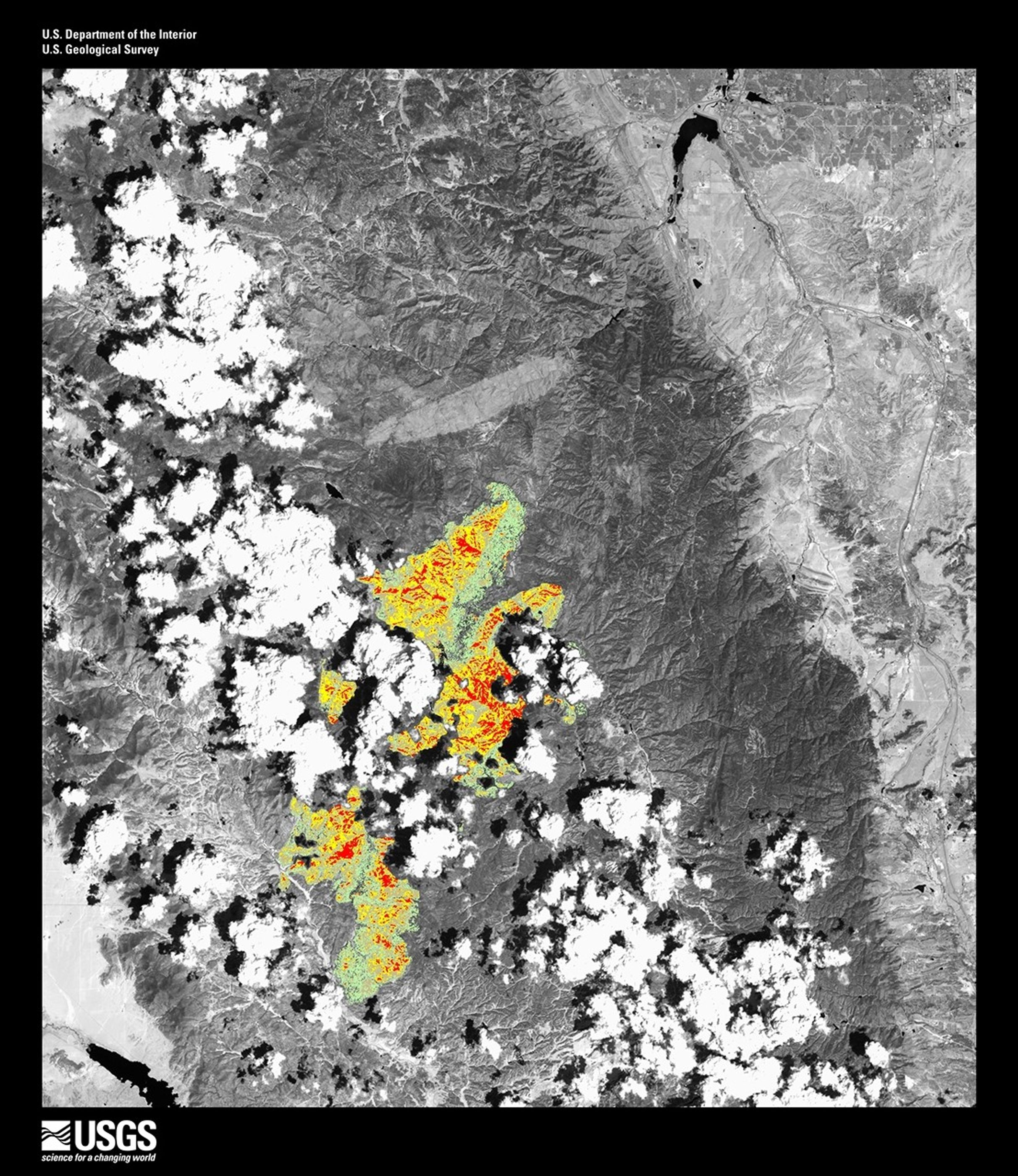
This Landsat image of the area of the Hayman fire in Colorado was taken on July 16, 2002. Vegetation appears red and burn scar appears black in the false-color image (top). The lower image shows burn intensity, with green corresponding to least burned areas and red indicated most burned areas.

References & Resources

Image provided by the USGS EROS Data Center Satellite Systems Branch

You may also be interested in:

Stay up-to-date with the latest content from NASA as we explore the universe and discover more about our home planet.

Fires Tear Through Nebraska Grasslands
3 min read

Dry, warm, and windy conditions across the U.S. Great Plains led to extreme fire activity in March 2026.

Article
Seasons Change in Southwest Virginia
3 min read

From autumn color to a winter-white finish, forested areas around Blacksburg trade foliage for snow over the span of two…

Article
Winds Whip Up Fires and Dust on the Southern Plains
3 min read

Dry, gusty conditions spurred fast-growing fires in Oklahoma and Kansas, along with dangerous dust storms across the region.

Article