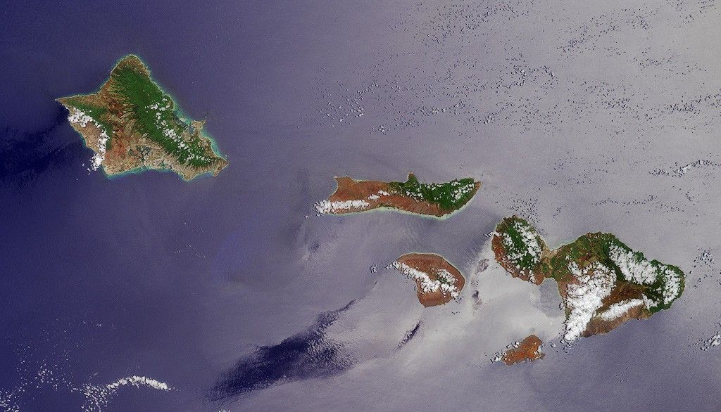

This Multiangle Imaging Spectro-Radiometer (MISR) image of fiveHawaiian Islands was acquired by the instrument's vertical-viewing (nadir) camera on June 3, 2000.
The image shows the islands of Oahu, Molokai, Lanai, Maui, andKahoolawe. The prevailing Pacific trade winds bring higher levelsof rainfall to the eastern slopes of the islands, leading to agreater abundance of vegetation on the windward coasts. The smallchange in observation angle across the nadir camera’s field-of-view causes the right-hand portion of the image to be moreaffected by Sun glint, making the ocean surface appear brighter.
Oahu is the westernmost of the islands seen in this image.Waikiki Beach and the city of Honolulu are located on thesouthern shore, to the west of Diamond Head caldera.
MISR is one of several Earth-observing instruments on the Terrasatellite, launched in December 1999. The Terra spacecraft, theflagship of a fleet of satellites dedicated to understanding ourglobal environment, is part of NASA's Earth Sciences Enterprise,a long-term research program dedicated to understanding howhuman-induced and natural changes affect our world.
References & Resources
Image courtesy NASA/GSFC/JPL, MISR Team