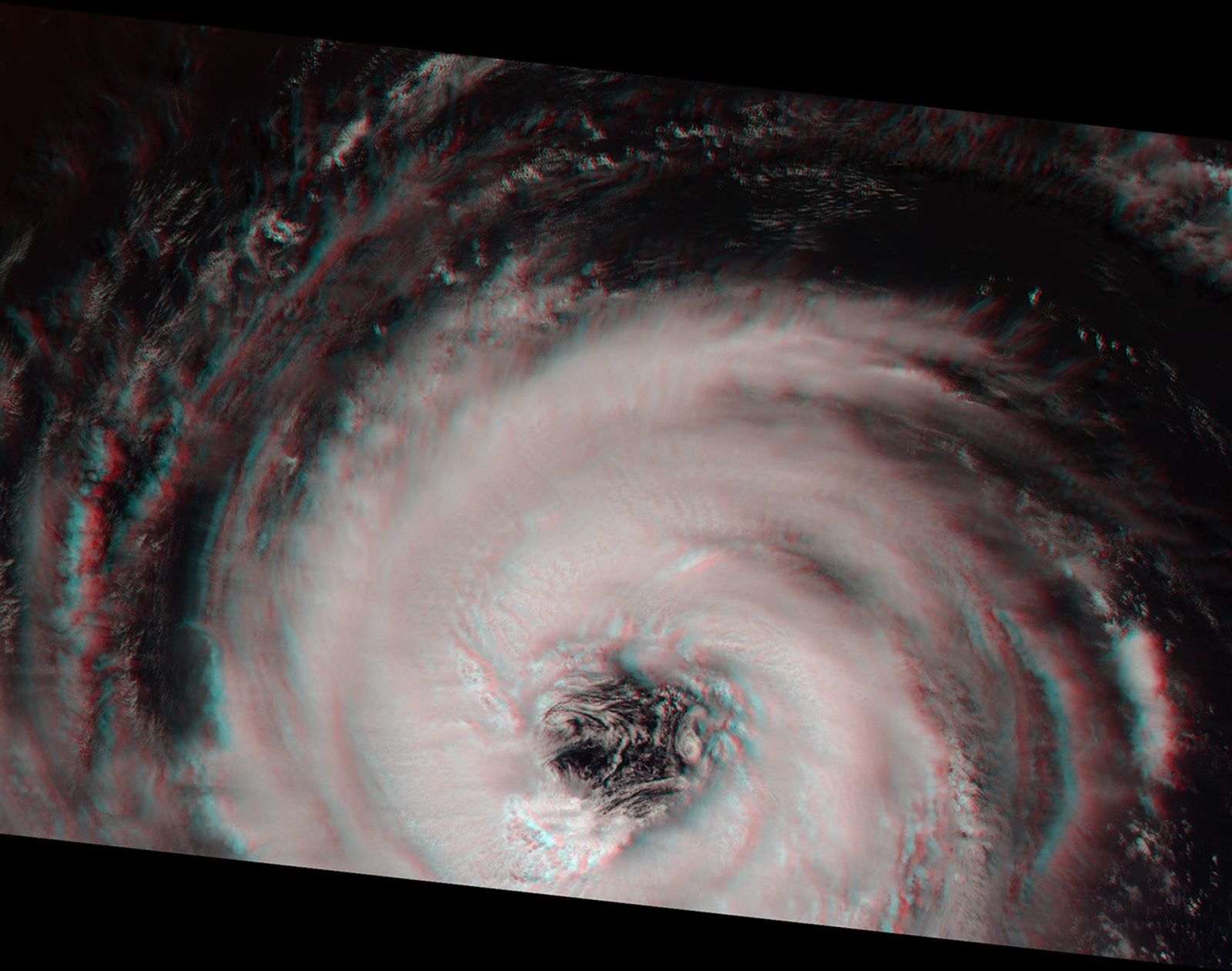
The Multi-angle Imaging Spectroradiometer (MISR) acquired this stereoimage of Hurricane Alberto on August 19, 2000. At this time, the storm was located in the NorthAtlantic Ocean, about 1700 kilometers west of the Azores. According tothe National Weather Service, Alberto was increasing in intensity andexhibiting maximum sustained winds of about 165 kilometers per hour.
This stereo "anaglyph" image was generated using MISR's vertical (nadir)camera plus the 26-degree forward-viewing camera. It is oriented so thatthe spacecraft's flight path is from left to right. North is at the left.To view the image in 3-D, use red/blue glasses with the red filter overyour left eye.
Near the center of the storm, the "eye" measures about 60 kilometersin diameter. The steep eye wall, where surface winds reach their peakintensity, is very apparent. Convective thunderclouds are present inthe storm's spiral arms, and their three-dimensional structure isvisible in this stereo view.
References & Resources
Image courtesy NASA/GSFC/JPL, MISR Team. (JPL Photojournal #PIA02636)