![Request for Information – Potential [Placeholder for Prize]](https://assets.science.nasa.gov/dynamicimage/assets/science/missions/a-step/FFR_Earth_Background_20251120%20.png?w=1024)


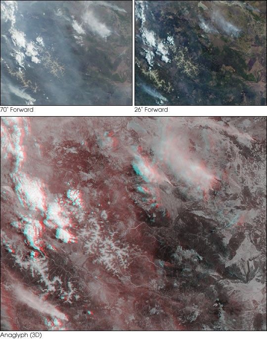
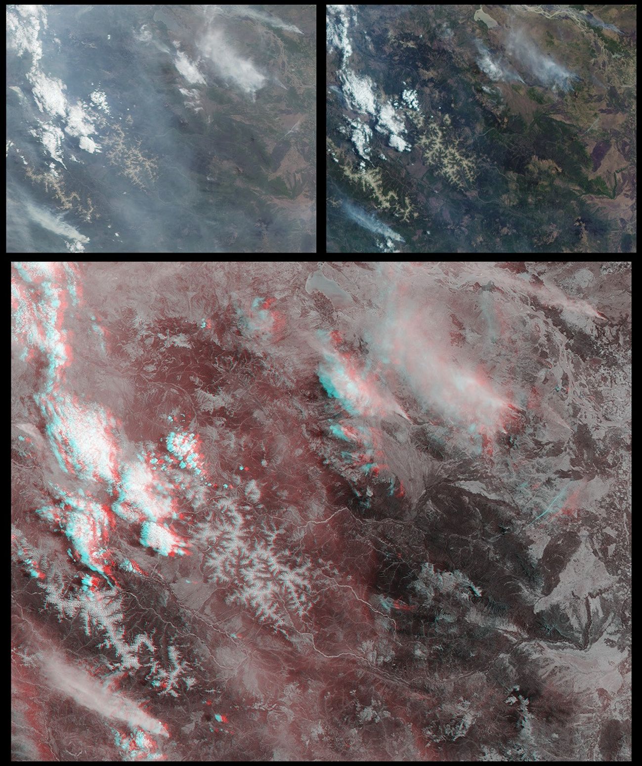
Several mountain ranges and a portion of the Amur River are visible inthis set of MISR images of Russia's far east Khabarovsk region. Theimages were acquired on May 13, 2001. The viewfrom MISR's 70-degree forward-looking camera is at the top left; the26-degree forward-looking view is at the top right. The larger image atthe bottom is a stereo "anaglyph" created using the cameras at twointermediate angles. To view the stereo image in 3-D you need red/blueglasses with the red filter placed over your left eye. All of the imagesare oriented with north to the left to facilitate stereo viewing. Eachimage covers an area about 345 kilometers x 278 kilometers.
The Amur River, in the upper right, and Lake Bolon, at the top center,are most prominent in the 26-degree view due to sunglint (mirror-likereflection of the Sun's rays by the water). The Amur River valley is aprimary breeding ground for storks and cranes and a stopover for largenumbers of migratory birds. About 20% of the Amur wetlands are protectedby official conservation measures, but human development has convertedlarge portions to agricultural uses. Other notable features in theseimages are several mountain chains, including the Badzhal'skiy to theleft of center and the Bureiskiy in the lower left.
Smoke plumes from several forest fires can be seen. They are especiallyapparent in the 70-degree view where the smoke's visibility isaccentuated, in part, by the long slant path through the atmosphere. Thelargest plumes are in the lower left and upper right, with some smallerplumes above and to the right of the image centers. In the upper imagesthe hazy region in the vicinity of these smaller plumes has theappearance of low-altitude smoke, but depth perception provided by thestereo anaglyph shows that it is actually a distinct layer ofhigh-altitude cirrus clouds. Whether the cirrus is related to the firesis uncertain. It is possible, however, for the fires to have heatedthe lower atmosphere enough to create bubbles of hot air. As suchbubbles rise, they can force the stable air above, nearly saturated withwater vapor, to move even higher. As the air rises it cools, possibly triggeringthe formation of ice clouds. Visualization of other three-dimensional characteristics of the scene, such as theintermediate-altitude layer of cumulus clouds along the left side, ismade possible by the stereo imagery.
References & Resources
Image courtesy NASA/GSFC/LaRC/JPL, MISR Team.